Marker Logo HMdb.org THE HISTORICAL
MARKER DATABASE
“Bite-Size Bits of Local, National, and Global History”
Elizabethtown in Hardin County, Kentucky — The American South (East South Central)
 

Helm Cemetery


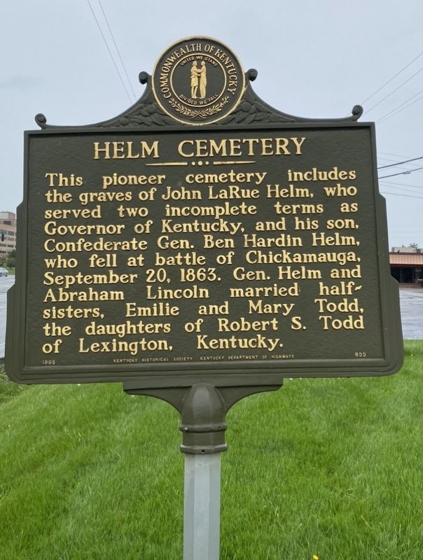
Helm Cemetery Marker image. Click for full size.
Photographed By Darren Jefferson Clay, April 10, 2021
1. Helm Cemetery Marker
Inscription. This pioneer cemetery includes the graves of John LaRue Helm, who served two incomplete terms as Governor of Kentucky, and his son, Confederate Gen. Ben Hardin Helm, who fell at battle of Chickamauga, September 20, 1863. Gen. Helm and Abraham Lincoln married half-sisters, Emilie and Mary Todd, the daughters of Robert S. Todd of Lexington, Kentucky.
 
Erected 1965 by Kentucky Historical Society and Kentucky Department of Highways. (Marker Number 833.)
 
Topics and series. This historical marker is listed in these topic lists: Cemeteries & Burial SitesWar, US Civil. In addition, it is included in the Kentucky Historical Society series list. A significant historical date for this entry is September 20, 1863.
 
Location. 37° 42.487′ N, 85° 52.403′ W. Marker is in Elizabethtown, Kentucky, in Hardin County. Marker is on North Dixie Highway (U.S. 31W) north of Craddock Court, on the right when traveling north. Touch for map. Marker is at or near this postal address: 804 N Dixie Hwy, Elizabethtown KY 42701, United States of America. Touch for directions.
 
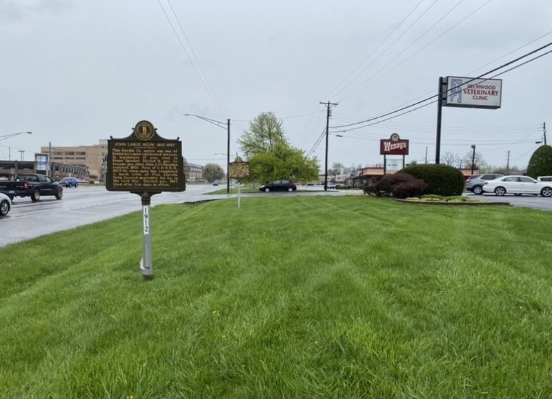
Other nearby markers. At least 8 other markers are within 2 miles of this marker, measured as the crow flies. John Larue Helm, 1802-1867 (a few steps from this marker); John Young Brown (1835-1904) (approx. 0.4 miles away); Lincoln Heritage House (approx. 0.8 miles away); Sarah Bush Johnston Lincoln
Paid Advertisement
Click on the ad for more information.
Please report objectionable advertising to the Editor.
Click or scan to see
this page online
(approx. 0.8 miles away); Severns Valley Baptist Church (approx. 1.3 miles away); The Cannonball (approx. 1.3 miles away); Battle of Elizabethtown (approx. 1.3 miles away); Brown-Pusey House (approx. 1.3 miles away). Touch for a list and map of all markers in Elizabethtown.
 
Helm Cemetery Marker image. Click for full size.
Photographed By Darren Jefferson Clay, April 10, 2021
2. Helm Cemetery Marker
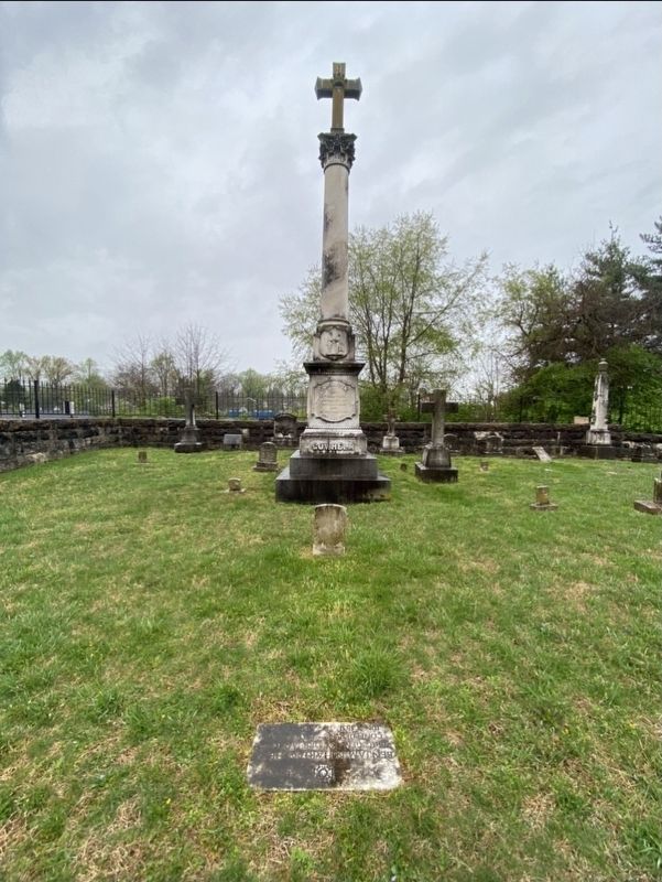
Grave markers of Governor John Larue Helm and Brigadier General Benjamin Hardin Helm image. Click for full size.
Photographed By Darren Jefferson Clay, April 10, 2021
3. Grave markers of Governor John Larue Helm and Brigadier General Benjamin Hardin Helm
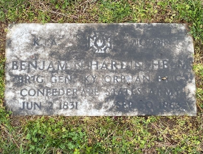
Brigadier General Benjamin Hardin Helm’s headstone image. Click for full size.
Photographed By Darren Jefferson Clay, April 10, 2021
4. Brigadier General Benjamin Hardin Helm’s headstone
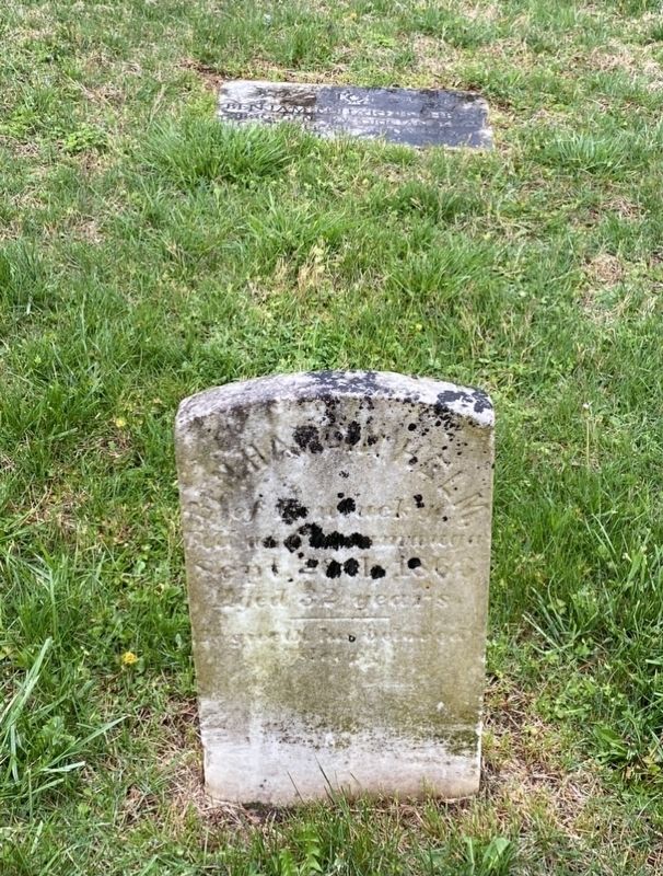
Brigadier General Benjamin Hardin Helm’s original and government issued headstones image. Click for full size.
Photographed By Darren Jefferson Clay, April 10, 2021
5. Brigadier General Benjamin Hardin Helm’s original and government issued headstones
 
 
Credits. This page was last revised on April 20, 2021. It was originally submitted on April 19, 2021, by Darren Jefferson Clay of Duluth, Georgia. This page has been viewed 261 times since then and 25 times this year. Photos:   1, 2, 3, 4, 5. submitted on April 19, 2021, by Darren Jefferson Clay of Duluth, Georgia. • Bernard Fisher was the editor who published this page.
Share this page.  
Share on Tumblr
m=171344

CeraNet Cloud Computing sponsors the Historical Marker Database.
This website earns income from purchases you make after using our links to Amazon.com. We appreciate your support.
Paid Advertisement
Apr. 25, 2024