Near Williamsburg in James City County, Virginia — The American South (Mid-Atlantic)
The Jamestown Riverfront 1630-1690
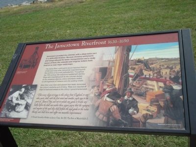
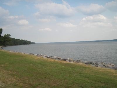
The James River continued to be an important feature of the town even after Jamestown expanded beyond the confines of its small, palisaded fort. Throughout the 17th century, the waterfront bustled with activity. Ships with imported goods for the colonists docked at the numerous wharves, where stevedores waited to roll hogsheads of tobacco onto the waiting vessels.
More than once, laws were passed that made Jamestown the colony’s exclusive port of entry. These acts required all ships to load and unload at the colony’s governmental seat.
That every ship arivinge in this colony from England, or any other parts, shall, with the first wind and weather, sayle upp to the porte of James Citty, and not to unlade any goods or breake any bulke before she shall cast anchor there, upon payne that the captayne and mayster of the sayd ship shall forfeite the sayd goods or the value thereof, and shall have and suffer one mounthes imprisonment.
A Grand Assembly Holden at James Citty, Act XX, The First of March 1631-2
Erected by Colonial National Historic Park.
Topics. This historical marker is listed in this topic list: Colonial Era. A significant historical month for this entry is March 1631.
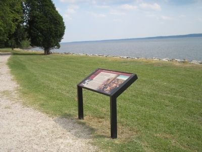
Location. 37° 12.42′ N, 76° 46.531′ W. Marker is near Williamsburg, Virginia, in James City County. Marker can be reached from Colonial Parkway, on the right when traveling west. Marker is in the "New Towne" section of the Historic Jamestown unit of Colonial National Historic Park. Touch for map. Marker is in this post office area: Williamsburg VA 23185, United States of America. Touch for directions.
Other nearby markers. At least 8 other markers are within walking distance of this marker. Row Houses (a few steps from this marker); A Campsite pre-1607 (a few steps from this marker); Fences and Livestock (within shouting distance of this marker); Jackson Home 1620s (within shouting distance of this marker); Ditch and Mound (about 300 feet away, measured in a direct line); Water and Well (about 300 feet away); Efforts of a Virginia Tradesman 1670s (about 300 feet away); The Ambler House (about 300 feet away). Touch for a list and map of all markers in Williamsburg.
More about this marker. The right side of the marker features a picture of “Waterfront activity at Jamestown.” The bottom left contains a photograph of the “13,000-pound pile driver excavated at Jamestown in the 1950s.” Above this is a drawing of “A pile driver in use on the Jamestown waterfront.”
Also see . . .
1. The Jamestown Riverfront 1630 - 1690. Colonial National Historic Park from National Park Service website. (Submitted on March 19, 2009, by Bill Coughlin of Woodland Park, New Jersey.)
2. Historic Jamestowne. Historic Jamestowne is the site of the first permanent English settlement in America. The site is jointly administered by APVA Preservation Virginia and the National Park Service. (Submitted on March 19, 2009, by Bill Coughlin of Woodland Park, New Jersey.)
Credits. This page was last revised on June 16, 2016. It was originally submitted on March 19, 2009, by Bill Coughlin of Woodland Park, New Jersey. This page has been viewed 962 times since then and 21 times this year. Photos: 1, 2, 3. submitted on March 19, 2009, by Bill Coughlin of Woodland Park, New Jersey.


