Near Williamsburg in James City County, Virginia — The American South (Mid-Atlantic)
Interpreting Jamestown
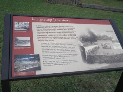
To prepare for the 350th anniversary in 1957, archaeologist J. C. Harrington suggested that “the present foundations, which have been excavated and covered back over, be capped with a layer of concrete and then built up to a point above ground level by old brick obtained during the Jamestown excavation.” “The whole town site,” he proposed, “should be landscaped to give the feeling of openness under trees.”
Originally painted white to signify that they were replications of footings below ground, these reconstructed foundations caused confusion as the paint faded.
Today’s landscape, like those in the past, will no doubt be replaced by new efforts to help visitors gain a greater understanding of 17th-century Jamestown.
Erected by Colonial National Historic Park.
Topics. This historical marker is listed in this topic list: Colonial Era. A significant historical year for this entry is 1934.
Location. 37° 12.457′ N, 76° 46.611′ W. Marker is near Williamsburg, Virginia, in James City County. Marker can be reached from Colonial Parkway, on the right when traveling west. Marker is in the "New Towne" section of the Historic Jamestown unit of Colonial National Historic Park. Touch for map. Marker is in this post office area: Williamsburg VA 23185, United States of America. Touch for directions.
Other nearby markers. At least 8 other markers are within walking distance of this marker. Colonial Highway (within shouting distance of this marker); Efforts of a Virginia Tradesman 1670s (within shouting distance of this marker); Water and Well (within shouting distance of this marker); A Jamestown Warehouse 1630s-1699 (within shouting distance of this marker); Backstreet – Jamestown’s Main Street 1620-1699 (about 300 feet away, measured in a direct line); A Campsite pre-1607 (about 400 feet away); The Greate Road – An Early Highway pre-1607-1700s (about 400 feet away); Ditch and Mound (about 400 feet away). Touch for a list and map of all markers in Williamsburg.
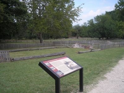
More about this marker. The right of the marker contains a photograph of the “Reconstructed Marable house foundation in white brick and landscape in New Towne, ca. 1957.” The left of the marker features several photographs of various excavations in Jamestown. These include, “Merchant row house excavated in the 1930s,” “Reconstructed foundation and landscape in New Towne, ca. 1957” and an “Aerial view of New Towne, ca. 1950s, showing over six miles of excavation trenches dug in 50-foot grids across the site.”
Also see . . .
1. Interpreting Jamestown. Colonial National Historic Park from National Park Service website. (Submitted on March 20, 2009, by Bill Coughlin of Woodland Park, New Jersey.)
2. Historic Jamestowne. Historic Jamestowne is the site of the first permanent English settlement in America. The site is jointly administered by APVA Preservation Virginia and the National Park Service. (Submitted on March 20, 2009, by Bill Coughlin of Woodland Park, New Jersey.)
Credits. This page was last revised on June 16, 2016. It was originally submitted on March 20, 2009, by Bill Coughlin of Woodland Park, New Jersey. This page has been viewed 876 times since then and 11 times this year. Photos: 1, 2, 3. submitted on March 20, 2009, by Bill Coughlin of Woodland Park, New Jersey.


