Perryville in Perry County, Missouri — The American Midwest (Upper Plains)
El Camino Real
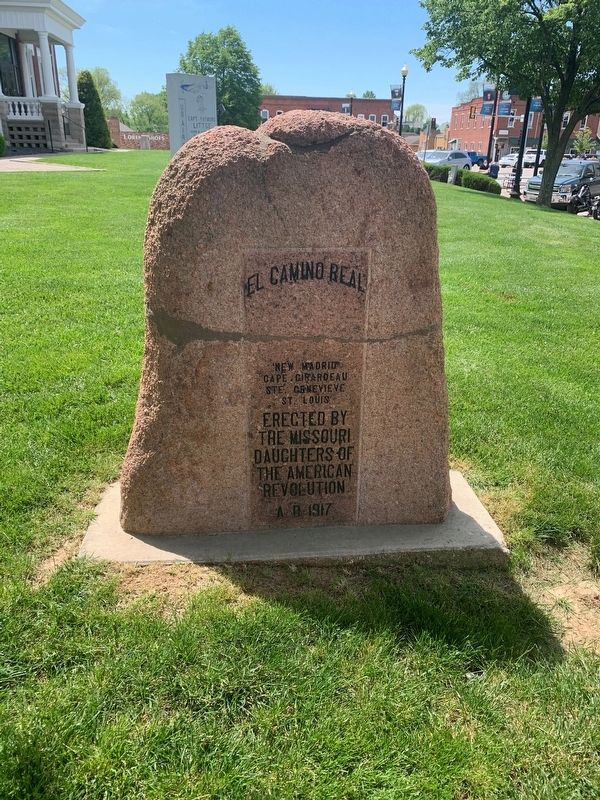
Photographed by Thomas Smith, May 1, 2021
1. El Camino Real Marker
Cape Girardeau
Ste. Genevieve
St. Louis
Erected 1917 by The Missouri Daughters of the American Revolution.
Topics and series. This historical marker is listed in these topic lists: Colonial Era • Roads & Vehicles • Settlements & Settlers. In addition, it is included in the Daughters of the American Revolution (DAR) series list. A significant historical year for this entry is 1917.
Location. 37° 43.535′ N, 89° 51.803′ W. Marker is in Perryville, Missouri, in Perry County. It is at the intersection of West St. Maries Street and North Jackson Street, on the right when traveling east on West St. Maries Street. Touch for map. Marker is at or near this postal address: 28 N Jackson St, Perryville MO 63775, United States of America. Touch for directions.

Regionally, this marker is in Southeast Missouri. It is also in the American Lewis & Clark Corridor, in the Corn Belt, and in the Great River Road Region. Globally, it is in North America, the Western Hemisphere, the Western World, and the Anglosphere. Historically, it finds itself in what was once the Viceroyalty of New France, the territory
this page online
Other nearby markers. At least 8 other markers are within walking distance of this marker: Capt. Raymond Littge (a few steps from this marker); In Honor of those who served in the Military Forces of America (a few steps from this marker); Phillips Building (within shouting distance of this marker); Kiesler Building (within shouting distance of this marker); Mercier Building (within shouting distance of this marker); Perry County Union Soldiers Monument (within shouting distance of this marker); Morton Building (within shouting distance of this marker); Great American Eclipse of 2017 (within shouting distance of this marker). Touch for a list and map of all markers in Perryville.
Additional commentary.
1. Name Translation
El Camino Real literally translates to English from Spanish as The Royal Road, although Kingshighway is a more common translation.
— Submitted May 3, 2021, by Devry Becker Jones of Washington, District of Columbia.
Credits. This page was last revised on May 3, 2021. It was originally submitted on May 3, 2021, by Thomas Smith of Waterloo, Ill. This page has been viewed 467 times since then and 18 times this year. Photo 1. submitted on May 3, 2021, by Thomas Smith of Waterloo, Ill. • Devry Becker Jones was the editor who published this page.
