Near Springville in Tulare County, California — The American West (Pacific Coastal)
Battle Mountain
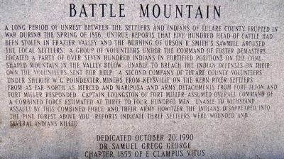
Photographed by Lester J Letson, August 20, 2005
1. Battle Mountain Marker
this page online
Erected 1990 by Dr. Samuel Gregg George Chapter 1855, E Clampus Vitus.
Topics and series. This historical marker is listed in these topic lists: Indigenous Peoples and Communities • Wars, US Indian. In addition, it is included in the E Clampus Vitus series list. A significant historical date for this entry is October 20, 1865.
Location. 36° 15.71′ N, 118° 45.483′ W. Marker is near Springville, California, in Tulare County. It is on Balch Park Road 12 miles east of CA-190 (California Highway 190), on the right when traveling east. From the junction of CA Hwy 190 and Balch Park (Springville-Milo) Road: Head north on Balch Park Road 6.1 miles to the junction with Mountain 296 (Yokuhl Valley Dr). Bear right to stay on Balch Park Road 4.5 miles (pass Battle Mountain Dr. on the left) to the junction with Mountain Rd 276 (Blue Ridge Drive). Stay straight on Balch Park Road 1.6 miles to find the Battle Mountain marker on the right shoulder heading east. Touch for map. Marker is at or near this postal address: 45200 Balch Park Road, Springville CA 93265, United States of America. Touch for directions.

Regionally,
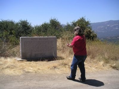
Photographed by Lester J Letson, August 20, 2005
2. Battle Mountain Marker
Other nearby markers. At least 7 other markers are within 17 miles of this marker, measured as the crow flies: Elster Building (approx. 9.7 miles away); Daunt (approx. 10.3 miles away); The Citrus School Bell (approx. 10.3 miles away); Camp Nelson (approx. 11.7 miles away); Treaty of 1851 (approx. 13.6 miles away); Citrus South Tule School (approx. 14.4 miles away); Success Dam and Lake (approx. 16.1 miles away).
More about this marker. [T]he cone shaped mountain in the valley below" is no longer visible from the site of the marker itself due to vegetation growth in the years since it was placed. For a good view of Battle Mountain (36.252338, -118.789597) proceed back down Balch Park Road about 0.2 miles to a point where the downhill
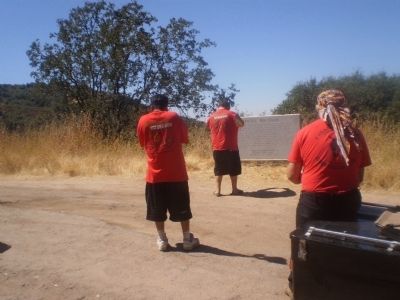
Photographed by Lester J Letson, August 14, 2010
3. Battle Mountain Marker
Picture taken from across the road. Three members of E Clampus Vitus walking up to view the marker.
Regarding Battle Mountain. [T]he cone shaped mountain in the valley below" is no longer visible from the site of the marker itself due to vegetation growth in the years since the marker was placed. For a good view of Battle Mountain, proceed back down Balch Park Road about 0.2 miles to a point where the brush is much lighter on the downhill shoulder.
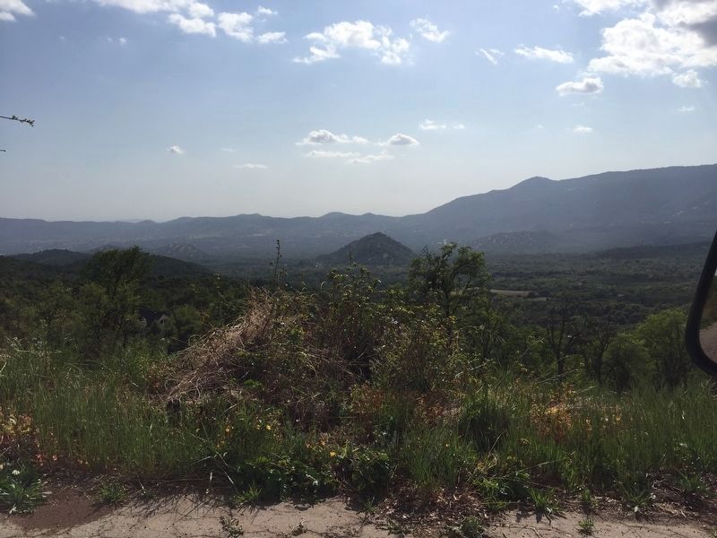
Photographed by Blair Smith, April 21, 2021
4. Battle Mountain Marker
Battle Mountain, "the cone shaped mountain in the valley below", as seen from the downhill shoulder about 0.2 miles back on Balch Park Road from the Marker.
Credits. This page was last revised on May 12, 2021. It was originally submitted on August 15, 2010, by Lester J Letson of Fresno, California. This page has been viewed 6,168 times since then and 282 times this year. Last updated on May 11, 2021, by Blair Smith of Riverside, California. Photos: 1, 2, 3. submitted on August 15, 2010, by Lester J Letson of Fresno, California. 4. submitted on May 11, 2021, by Blair Smith of Riverside, California. • J. Makali Bruton was the editor who published this page.
