Piqua in Miami County, Ohio — The American Midwest (Great Lakes)
Main Street
Photographed by William Fischer, Jr., March 6, 2009
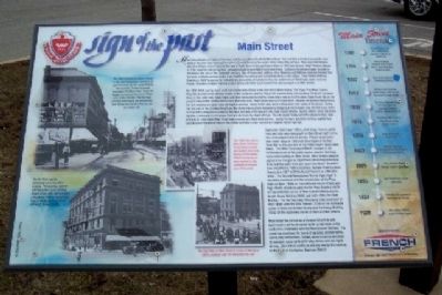
1. Main Street Marker
By 1808-1909, county roads were connecting Main Street to the rest of the Miami Valley. The Piqua-Troy Road (County Road 25-A) dead ended at Main Street on the
this page online
During the 1820's and 1830's, retail shops, taverns, public halls and mills were build on Main Street right next to the community's
Photographed by William Fischer, Jr., March 6, 2009
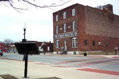
2. Main Street Marker
The Piqua Milling Company is across Main Street in the background.
Main Street has served
Photographed by William Fischer, Jr., March 6, 2009
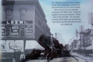
3. The 1860 Commercial Block
is shown in this 1897 photograph, covered with advertisements for the Loewi Clothing Store and the German language newspaper Die Miami Post. It was the largest commercial structure in Piqua prior to the Civil War. The first floor provided retail space, the second floor held offices and the third floor served as a lodge hall.
Erected 2008 by Flesh Public Library and French Oil Mill Machinery Company.
Topics. This historical marker is listed in these topic lists: Government & Politics • Indigenous Peoples and Communities • Industry & Commerce • Roads & Vehicles • Settlements & Settlers • Wars, US Indian. A significant historical year for this entry is 1782.
Location. 40° 8.8′ N, 84° 14.362′ W. Marker is in Piqua, Ohio, in Miami County. It is on Main Street, on the right when traveling south. Marker is across Main Street from the former railroad (now pedestrian) bridge over the Great Miami River, between Water and Wood Streets. Touch for map. Marker is in this post office area: Piqua OH 45356, United
Photographed by William Fischer, Jr., March 6, 2009
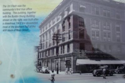
4. The Orr-Flesh
was the community's first true office building. This building, together with the Buntin-Young Building shown on the right, was built after a disastrous 1902 fire devastated most of the southern half of the 400 block of Main Street.

Regionally, this marker is in the Dayton Metro, in the Miami Valley, and in the Till Plains. It is also in the American Midwest and in the Corn Belt. Globally, it is in North America, the Western Hemisphere, the Western World, and the Anglosphere. Historically, it finds itself in what was once the Haudenosaunee (Iroquois) Confederacy, the territory of the Mississippian Culture, and the Northwest Territory.
Other nearby markers. At least 8 other markers are within walking distance of this marker: Shawnee Bridge (within shouting distance of this marker); Public Square (within shouting distance of this marker); Lock Nine Riverfront Park (about 400 feet away); a different marker also named Shawnee Bridge (about 500 feet away); a different marker also named Shawnee Bridge (about 600 feet away); The Mills Brothers (about 700 feet away); Piqua Veterans Memorial (about 700 feet away); McCulloch (about 700 feet away). Touch for a list and map of all markers in Piqua.
Other markers no longer nearby. The 1913 Flood (was within shouting distance of this marker but has been permanently
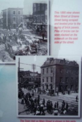
Photographed by William Fischer, Jr., March 6, 2009
5. This 1895 view shows Main Street at Greene Street
being scraped and leveled prior to the laying of brick pavers. Piles of bricks can be seen stacked on the sidewalk on the east side of the street.
Credits. This page was last revised on June 16, 2016. It was originally submitted on March 24, 2009, by William Fischer, Jr. of Reynoldsburg, Ohio. This page has been viewed 2,434 times since then and 68 times this year. Photos: 1, 2, 3, 4, 5. submitted on March 24, 2009, by William Fischer, Jr. of Reynoldsburg, Ohio. • Craig Swain was the editor who published this page.
