Maumee in Lucas County, Ohio — The American Midwest (Great Lakes)
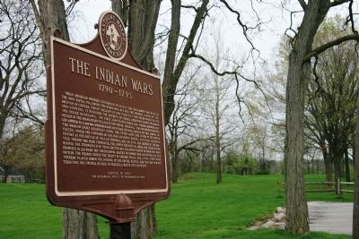
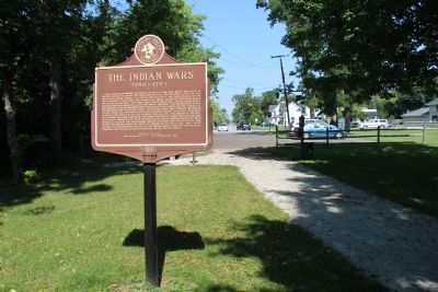
The Indian Wars
1790 - 1795
| — | Anthony Wayne Parkway | — |

Photographed by Dale K. Benington, April 28, 2009
1. The Indian Wars Marker
this page online
Erected 1955 by The Historical Society of Northwestern Ohio.
Topics. This historical marker is listed in these topic lists: Indigenous Peoples and Communities • Military • Wars, US Indian. A significant historical date for this entry is August 20, 1794.
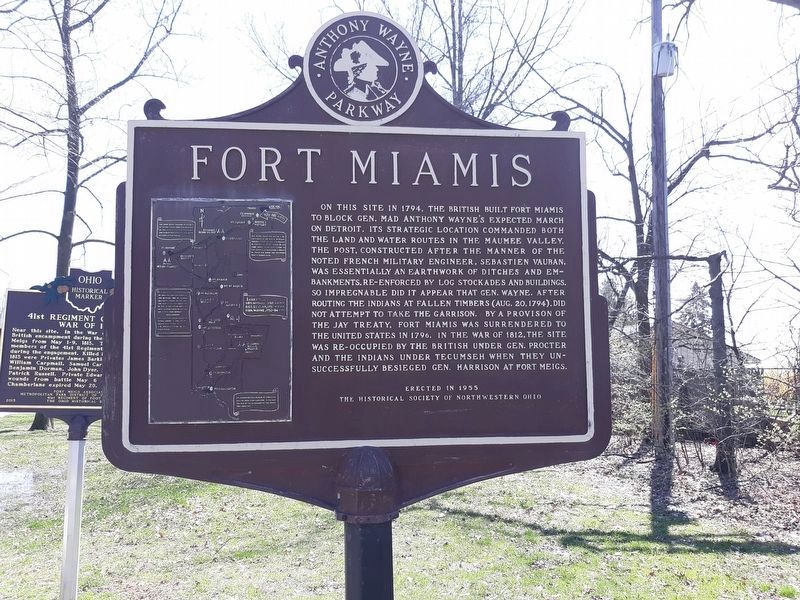
Location. Marker has been reported permanently removed. It was located near 41° 34.411′ N, 83° 37.626′ W. Marker was in Maumee, Ohio, in Lucas County. It was at the intersection of River Road and Michigan Avenue on River Road. This marker is located in Maumee, Ohio's "Fort Miamis Park," and it is on the reverse side of the "Fort Miamis" historical marker. Touch for map. Marker was at or near this postal address: 1900 River Road, Maumee OH 43537, United States of America.
We have been informed that this marker is no longer there and will not be replaced. This page is an archival view of what was.
Regionally, this marker was on the Lake Erie Shore and in the Toledo Metropolitan Area. It was also in the American Midwest and in the Corn Belt. Globally, it was in North America, on the Great Lakes, in the Western Hemisphere, in the

Photographed by Dale K. Benington, April 28, 2009
2. The Indian Wars Marker
"The Indian Wars" historical marker is viewed in the left foreground, and the Fort Miamis defensive earthworks is viewed in the center/right background.
Other nearby markers. At least 7 other markers are within walking distance of this location: Letters From 1794 / A Strategic Location (within shouting distance of this marker); 41st Regiment of Foot - War of 1812 / Private Patrick Russell (within shouting distance of this marker); The Formidable Fort Miamis (within shouting distance of this marker); A Shattered Truce (about 500 feet away); Running A Gauntlet (about 600 feet away); Old Fort, New Battle (about 600 feet away); The Great Trail (approx. ¼ mile away). Touch for a list and map of all markers in Maumee.
Other markers no longer nearby. Fallen Timbers Battlefield and Fort Miamis National Historic Site (was within shouting distance of this marker but has been replaced with another marker now near it); Fort Miamis (was within shouting distance of this marker but has been permanently removed); a different marker also named Fort Miamis
Photographed by Dale K. Benington, September 5, 2014
3. The Indian Wars Marker
A 2014 view of the historical marker in a location several hundred feet east of the 2009 location seen in picture #1.
Photographed by Craig Doda, April 8, 2020
4. The Indian Wars Marker
side 2
Credits. This page was last revised on May 14, 2021. It was originally submitted on May 10, 2009, by Dale K. Benington of Toledo, Ohio. This page has been viewed 1,668 times since then and 47 times this year. Last updated on May 14, 2021, by Craig Doda of Napoleon, Ohio. Photos: 1, 2. submitted on May 11, 2009, by Dale K. Benington of Toledo, Ohio. 3. submitted on September 5, 2014, by Dale K. Benington of Toledo, Ohio. 4. submitted on January 29, 2021, by Craig Doda of Napoleon, Ohio. • Devry Becker Jones was the editor who published this page.
