Maumee in Lucas County, Ohio — The American Midwest (Great Lakes)
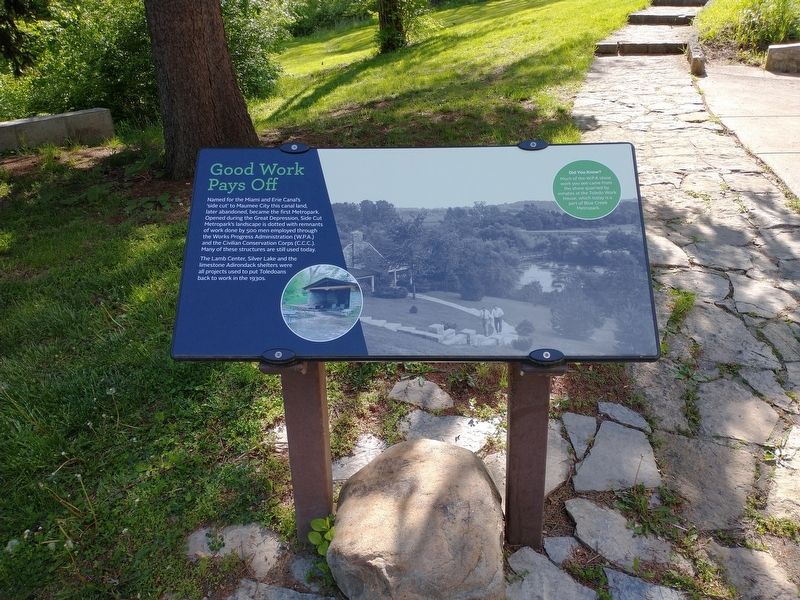
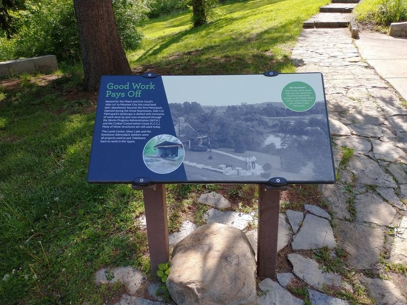
Good Work Pays Off
Photographed by Craig Doda, May 12, 2021
1. Good Work Pays Off Marker
Named for the Miami and Erie Canal's 'side cut' to Maumee City this canal land, later abandoned, became the first Metropark. Opened during the Great Depression, Side Cut Metropark's landscape is dotted with remnants of work done by 500 men employed through the Works Progress Administration (W.P.A.) and the Civilian Conservation Corps (C.C.C.). Many of these structures are still used today.
The Lamb Center, Silver Lake and the limestone Adirondack shelters were all projects used to put Toledoans back to work in the 1930s.
[Sidebar:]
Did You Know?
Much of the W.P.A stone
work you see came from
the stone quarried by
inmates at the Toledo Work
House, which today is a
part of Blue Creek
Metropark.
Topics and series. This historical marker is listed in these topic lists: Charity & Public Work • Parks & Recreational Areas • Waterways & Vessels. In addition, it is included in the Civilian Conservation Corps (CCC), the The Miami & Erie Canal, and the Works Progress Administration (WPA) projects series lists.
Location. 41° 33.396′ N, 83° 40.322′ W.
this page online

Regionally, this marker is on the Lake Erie Shore and in the Toledo Metropolitan Area. It is also in the American Midwest and in the Corn Belt. Globally, it is in North America, on the Great Lakes, in the Western Hemisphere, in the Western World, and in the Anglosphere. Historically, it finds itself in what was once the Viceroyalty of New France, the Haudenosaunee (Iroquois) Confederacy, the territory of the Mississippian Culture, and the Northwest Territory.
Other nearby markers. At least 8 other markers are within walking distance of this marker: Locking in Commerce (within shouting distance of this marker); Side Cut's Left Over Locks (about 600 feet away); Maumee City (about 600 feet away); Rotary International (1905-2005) / Maumee Rotary Centennial Pavilion Dedicated July 2, 2005 (approx. 0.2 miles away); Ohio Historical Flood Marker (approx.
Photographed by Craig Doda, May 12, 2021
2. Good Work Pays Off Marker
Other markers no longer nearby. The Great Depression (was here, next to this marker but has been permanently removed); Side Cut Locks (was about 300 feet away, measured in a direct line but has been permanently removed); Clay's Landing (was approx. 0.8 miles away but has been confirmed missing).
Credits. This page was last revised on May 17, 2021. It was originally submitted on May 14, 2021, by Craig Doda of Napoleon, Ohio. This page has been viewed 292 times since then and 30 times this year. Photos: 1, 2. submitted on May 14, 2021, by Craig Doda of Napoleon, Ohio. • Devry Becker Jones was the editor who published this page.
