Near Williamsburg in James City County, Virginia — The American South (Mid-Atlantic)
An Upper-Class Neighborhood 1630s-1699
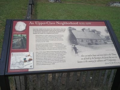
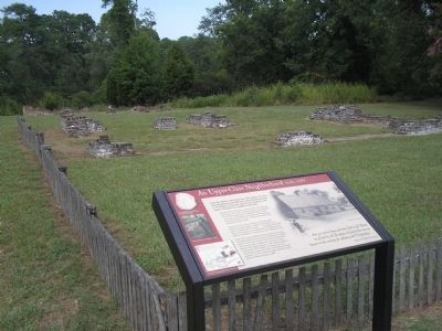
Richard Kemp, an ardent supporter of Governor Harvey, secretary to the colony, and councilman, built Virginia’s first all-brick house here in 1638-39. Walter Chiles, a merchant and burgess, purchased the “Brick house formerly Mr Secry Kemps” in 1649 and lived here with his family into the 1670s.
Instructions from King Charles I in 1639 directed Governor Francis Wyatt to build a “convenient house for the meetings of the council . . . .” This structure, called the “country house,” was used both for official business and as a residence. It stood to the east of Kemp’s house.
After 1676, lawyer William Sherwood built two houses to replace these earlier structures. Sherwood most likely lived in a fine brick house to the east. The high-status home to the west included one room with ornate plasterwork, highly unusual in 17th-century Virginia. Lord Howard of Effingham, a Virginia governor, apparently lodged here, and he and later governors regularly met here with the council until the capital moved to Williamsburg in 1699.
. . . there are twelve houses and stores built in the Towne, one of brick by the Secretayre, the fairest that was ever knowen in this countrye for substance and Uniformitye . . .
Erected by Colonial National Historic Park.
Topics. This historical marker is listed in this topic list: Colonial Era. A significant historical year for this entry is 1649.
Location. 37° 12.456′ N, 76° 46.468′ W. Marker is near Williamsburg, Virginia, in James City County. Marker can be reached from Colonial Parkway, on the right when traveling west. Marker is in the "New Towne" section of the Historic Jamestown unit of Colonial National Historic Park. Touch for map. Marker is in this post office area: Williamsburg VA 23185, United States of America. Touch for directions.
Other nearby markers. At least 8 other markers are within walking distance of this marker. A Diverse Jamestown Household 1620-1640 (a few steps from this marker); The Ambler House (within shouting distance of this marker); May-Hartwell Site 1660-1699 (within shouting distance of this marker); A Remarkable Collection 1670-1700 (within shouting distance of this marker); Ditch and Mound (about 300 feet away, measured in a direct line); Oyster Shells to Mortar (about 300 feet away); Gardens and Crops (about 300 feet away); Jackson Home 1620s (about 300 feet away). Touch for a list and map of all markers in Williamsburg.
More about this marker. The right side of the marker features a picture of Francis Wyatt’s “country house.” The left side of the marker contains a map showing “Detail from archaeological map of Jamestown.” The country house of Francis Wyatt is indicated on the map, along with Richard Kemp’s house, and two houses of William Sherwood. Above this is a photograph of the “Richard Kemp house excavation, ca. 1990s,” and of a “Decorative plaster cherub from the home William Sherwood rented to the Virginia governor.”
Also see . . .
1. An Upper-Class Neighborhood 1630s - 1699. Colonial National Historic Park from National Park Service website. (Submitted on March 26, 2009, by Bill Coughlin of Woodland Park, New Jersey.)
2. Historic Jamestowne. Historic Jamestowne is the site of the first permanent English settlement in America. The site is jointly administered by APVA Preservation Virginia and the National Park Service. (Submitted on March 26, 2009, by Bill Coughlin of Woodland Park, New Jersey.)
Credits. This page was last revised on June 16, 2016. It was originally submitted on March 26, 2009, by Bill Coughlin of Woodland Park, New Jersey. This page has been viewed 1,190 times since then and 39 times this year. Photos: 1, 2, 3. submitted on March 26, 2009, by Bill Coughlin of Woodland Park, New Jersey.


