Near Gering in Scotts Bluff County, Nebraska — The American Midwest (Upper Plains)
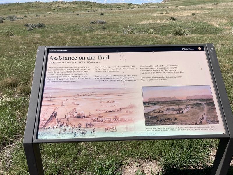
Assistance on the Trail
Soldiers were not always available to help travelers.
While emigrants were mostly self-sufficient, there were times when they needed extra help. Since there were few forts in the early years, aid often came from the feared "savages.” Instead of attacking the wagon trains as the eastern newspapers predicted, tribes often provided directions, offered ferry service, carried mail and traded for a variety of items among other aid.
By the 1860's, though, the tribes became frustrated with the loss of their way of life and the breaking of treaties. The result was more frequent conflict.
The army established Fort Mitchell, among others, in 1864 to help protect wagon trains from the growing unrest among the Native Americans. The 11th Ohio's Company F manned the adobe fort, located west of Mitchell Pass. Soldiers endured poor living conditions during the summers they occupied the fort. Their orders were to protect the pioneers. The fort was abandoned by mid-1866.
Consider the challenges you face during a long journey. Where do you look for assistance?
Captions:
During the 1840s and 1850s most encounters with the plains tribes were peaceful.
Hurriedly built of adobe, Fort Mitchell was one of several forts established to guard the trail in the 1860's.
Erected by National Park Service, U.S. Department of the Interior.
Topics. This historical marker is listed in these topic lists: Forts and Castles • Native Americans • Roads & Vehicles • Settlements & Settlers. A significant historical year for this entry is 1864.
Location. 41° 49.944′ N, 103° 42.734′ W. Marker is near Gering, Nebraska, in Scotts Bluff County. Marker can be reached from Old Oregon Trail Road (State Highway 92). Located on the old Oregon Trail. Touch for map. Marker is at or near this postal address: 190276 Old Oregon Trail Road, Gering NE 69341, United States of America. Touch for directions.
Other nearby markers. At least 8 other markers are within walking distance of this marker. History Lives on in Art (here, next to this marker); Oregon Trail (about 400 feet away, measured in a direct line); A Transportation Corridor (approx. 0.2 miles away); Choices (approx. 0.3 miles away); Scott's Bluff Pony Express Station (approx. 0.4 miles away); A Landscape Changed Forever (approx. 0.7 miles away); Before the Wagons (approx. 0.7 miles away); The Many Faces of the Trail (approx. 0.7 miles away). Touch for a list and map of all markers in Gering.
Credits. This page was last revised on September 7, 2021. It was originally submitted on June 2, 2021, by Connor Olson of Kewaskum, Wisconsin. This page has been viewed 142 times since then and 10 times this year. Photo 1. submitted on June 2, 2021, by Connor Olson of Kewaskum, Wisconsin. • Bill Pfingsten was the editor who published this page.
