Maryland: Confederate or Union State?

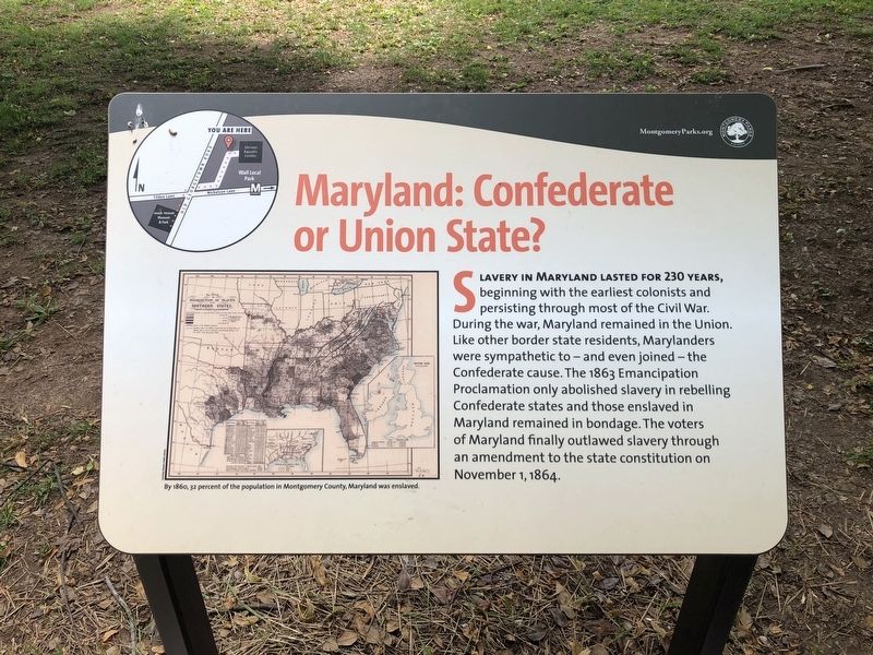
Slavery in Maryland lasted for 230 years, beginning with the earliest colonists and persisting through most of the Civil War. During the war, Maryland remained in the Union. Like other border state residents, Marylanders were sympathetic to — and even joined — the Confederate cause. The 1863 Emancipation Proclamation only abolished slavery in rebelling Confederate states and those enslaved in Maryland remained in bondage. The voters of Maryland finally outlawed slavery through an amendment to the state constitution on November 1, 1864.
[Caption:]
By 1860, 32 percent of the population in Montgomery County, Maryland was enslaved.
Erected 2021 by Montgomery Parks.
Topics. This historical marker is listed in these topic lists: Abolition & Underground RR • African Americans • War, US Civil. A significant historical date for this entry is November 1, 1864.
Location. 39° 2.745′ N, 77° 7.14′ W. Marker is in North Bethesda, Maryland, in Montgomery County. Marker can be reached from the intersection of Nicholson Lane and Old Georgetown Road (Maryland Route 187), on the right when traveling west. Touch for map. Marker is at or near this postal address: 5900 Executive Blvd, Rockville MD 20852, United States of America. Touch for directions.
Other nearby markers. At least 8 other markers are within walking distance of this marker.

Credits. This page was last revised on June 4, 2021. It was originally submitted on June 4, 2021, by Devry Becker Jones of Washington, District of Columbia. This page has been viewed 547 times since then and 29 times this year. Photos: 1, 2. submitted on June 4, 2021, by Devry Becker Jones of Washington, District of Columbia.