Near Alexandria in Campbell County, Kentucky — The American South (East South Central)
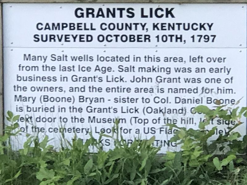
Grants Lick
Campbell County, Kentucky
| — | Surveyed October 10, 1797 | — |
Photographed by Duane and Tracy Marsteller, May 30, 2021
1. Grants Lick Marker
Topics. This historical marker is listed in these topic lists: Cemeteries & Burial Sites • Industry & Commerce • Settlements & Settlers • Waterways & Vessels. A significant historical date for this entry is October 10, 1797.
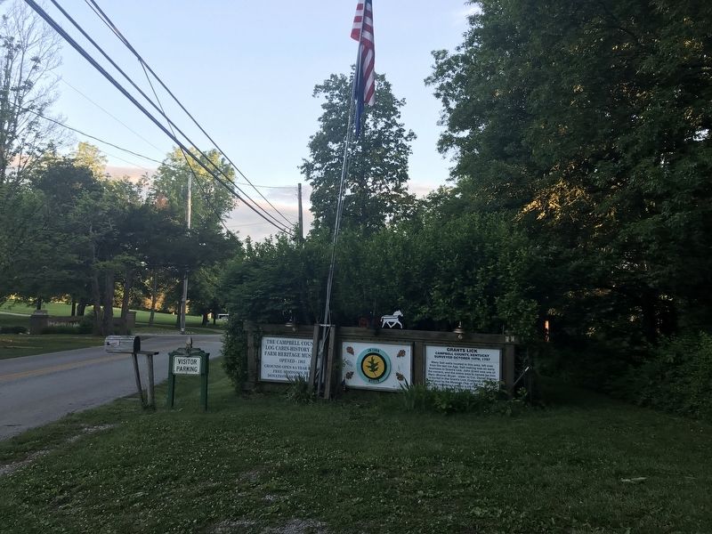
Location. 38° 51.391′ N, 84° 23.999′ W. Marker is near Alexandria, Kentucky, in Campbell County. It is on Clayridge Road south of Smith-Hiteman Road, on the right when traveling south. Marker is in front of the Campbell County Log Cabin Museum. Touch for map. Marker is at or near this postal address: 890 Clayridge Road, Alexandria KY 41001, United States of America. Touch for directions.

Regionally, this marker is in the Outer Bluegrass. It is also in the American South, specifically in the Upper South, and in the
this page online
Other nearby markers. At least 8 other markers are within 9 miles of this marker, measured as the crow flies: A different marker also named Grant's Lick (approx. 0.7 miles away); Mary Boone Bryan (approx. 0.7 miles away); British Indian Raid (approx. 7 miles away); Kentucky's Nineteenth (approx. 7.2 miles away); Capt. Ernest Wagner Park (approx. 9 miles away in Ohio); Thomas Ashburn (approx. 9 miles away in Ohio); New Richmond Pearl Harbor Memorial (approx. 9 miles away in Ohio); The United States Merchant Marine (approx. 9 miles away in Ohio). Touch for a list and map of all markers in Alexandria.
Photographed by Duane and Tracy Marsteller, May 30, 2021
2. Grants Lick Marker
Marker is the panel on the right.
Credits. This page was last revised on July 6, 2022. It was originally submitted on June 11, 2021, by Duane and Tracy Marsteller of Murfreesboro, Tennessee. This page has been viewed 963 times since then and 84 times this year. Photos: 1, 2. submitted on June 11, 2021, by Duane and Tracy Marsteller of Murfreesboro, Tennessee.
