Near Medway in Clark County, Ohio — The American Midwest (Great Lakes)
Medway in the 20th Century
Lower Valley Pike Scenic Byway
Courtesy of Thomas P. Martin, June 8, 2021
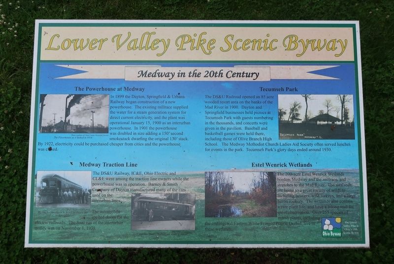
1. Medway in the 20th Century Marker
Inscription.
The Powerhouse at Medway
In 1899 the Dayton, Springfield & Urbana Railway began construction of a new powerhouse. The existing millrace supplied the water for a steam generation system for direct current electricity, and the plant was operational January 15, 1900 as an interurban powerhouse. In 1901 the powerhouse was doubled in size adding a 150' second smokestack dwarfing the original 130' stack. By 1922, electricity could be purchased cheaper from cities and the powerhouse was closed.
Medway Traction Line
The DS&U Railway, IC&E, Ohio Electric and CL&E were among the traction line owners while the powerhouse was in operation. Barney & Smith Company of Dayton manufactured many of the cars used on the interurban lines. The automobile spelled doom for the electric railroads. The final run of the interurban trolley was on November 1, 1938.
Tecumseh Park
The DS&U Railroad opened an 85 acre wooded resort area on the banks of the Mad River in 1900. Dayton and Springfield businesses held picnics at Tecumseh Park with guests numbering in the thousands, and concerts were given in the pavilion. Baseball and basketball games
Click or scan to see this page online
were held there, including those of Olive Branch High School. The Medway Methodist Church Ladies Aid Society often served lunches for events in the park. Tecumseh Park's glory days ended around 1930.
Estel Wenrick Wetlands
The 200-acre Estel Wenrick Wetlands borders Medway and the millrace, and stretches to the Mad River. The wetlands are home to a great variety of wildlife including beavers, wild turkeys, and a large heron rookery. The wetlands also contain a rare plant life, and have a hiking trail for quiet observation. Over 255 species of marsh plants, including the endangered Eastern White Fringed Prairie Orchid, live in these wetlands.
Captions Top left: The Powerhouse as it looked in 1914. Photo courtesy of Clark County Historical Society Bottom left: Waiting for passengers to board on electric car to Springfield. Photo courtesy of Jerry Porter Bottom center: An Ohio Electric Railway car ready to depart. Photo courtesy of Jerry Porter
84° 0.551′ W. Marker is near Medway, Ohio, in Clark County. It is at the intersection of Spangler Road and East Main Street, on the right when traveling north on Spangler Road. Touch for map. Marker is at or near this postal address: 101 East Main Street, Medway OH 45341, United States of America. Touch for directions.
Regionally, this marker is in the Dayton Metro and in the Miami Valley. It is also in the American Midwest and in the Corn Belt. Globally, it is in North America, the Western Hemisphere, the Western World, and the Anglosphere. Historically, it finds itself in what was once the Haudenosaunee (Iroquois) Confederacy, the territory of the Mississippian Culture, and the Northwest Territory.
Credits. This page was last revised on June 16, 2021. It was originally submitted on June 16, 2021, by Duane and Tracy Marsteller of Murfreesboro, Tennessee. This page has been viewed 1,430 times since then and 113 times this year. Photos:1, 2. submitted on June 16, 2021, by Duane and Tracy Marsteller of Murfreesboro, Tennessee.