Indian Mound Estates in Enon in Clark County, Ohio — The American Midwest (Great Lakes)
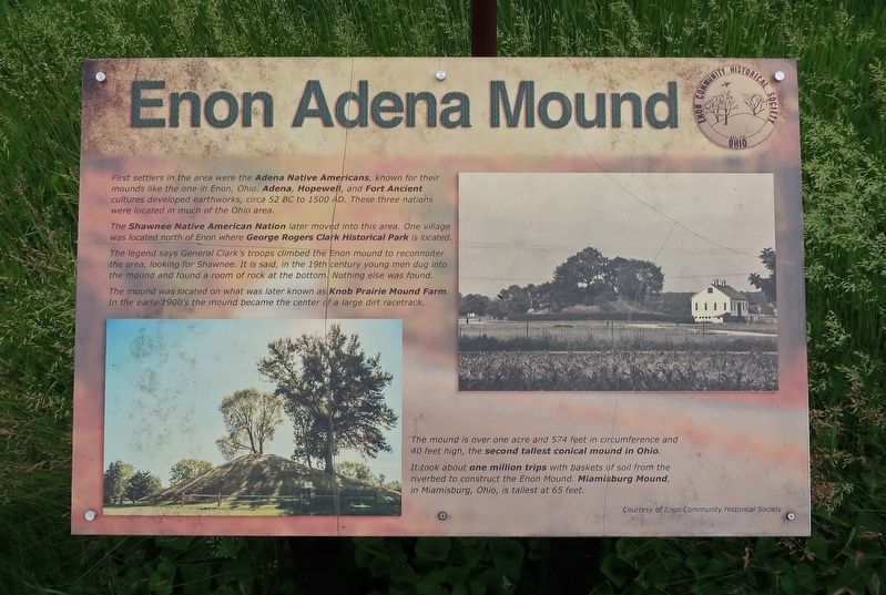
Enon Adena Mound
Courtesy of Thomas P. Martin, June 8, 2021
1. Enon Adena Mound Marker
The Shawnee Native American Nation later moved into this area. One village was located north of Enon where George Rogers Clark Historical Park is located.
The legend says General Clark's troops climbed the Enon mound to reconnoiter the area, looking for Shawnee. It is said, in the 19th century young men dug into the mound and found a room of rock at the bottom. Nothing else was found.
The mound was located on what was later known as Knob Prairie Mound Farm. In the early 1900's the mound became the center of a large dirt racetrack.
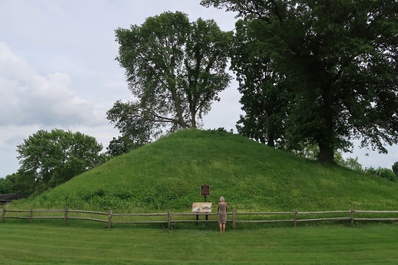
The mound is over one acre and 574 feet in circumference and 40 feet high, the second tallest conical mound in Ohio.
It took about one million trips with baskets of soil from the riverbed to construct the Enon Mound. Miamisburg Mound, in Miamisburg, Ohio, is tallest at 65 feet.
Erected by Enon Community Historical Society.
Topics.
this page online
Location. 39° 52.778′ N, 83° 55.904′ W. Marker is in Enon, Ohio, in Clark County. It is in Indian Mound Estates. It is at the intersection of Mound Circle and Indian Drive, in the median on Mound Circle. Touch for map. Marker is at or near this postal address: 400 Mound Circle, Enon OH 45323, United States of America. Touch for directions.

Regionally, this marker is in the Dayton Metro and in the Miami Valley. It is also in the American Midwest and in the Corn Belt. Globally, it is in North America, the Western Hemisphere, the Western World, and the Anglosphere. Historically, it finds itself in what was once the Haudenosaunee (Iroquois) Confederacy, the territory of the Mississippian Culture, and the Northwest Territory.
Other nearby markers. At least 8 other markers are within 3 miles of this marker, measured as the crow flies: Adena Mound Enon Ohio (here, next to this marker); Mad River Township Civil War Memorial (approx. 0.4 miles away); Enon Civil War Memorial
Courtesy of Thomas P. Martin, June 8, 2021
2. Enon Adena Mound Marker
Credits. This page was last revised on February 7, 2023. It was originally submitted on June 16, 2021, by Duane and Tracy Marsteller of Murfreesboro, Tennessee. This page has been viewed 2,931 times since then and 319 times this year. Photos: 1, 2. submitted on June 16, 2021, by Duane and Tracy Marsteller of Murfreesboro, Tennessee.
