Great Red River Flood of 1945
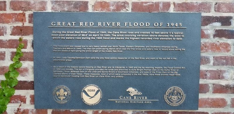
During the Great Red River Flood of 1945, the Cane River rose and crested 16 feet above it's typical mean pool elevation of 98.0 on April 10,1945. The brick coursing variation above denotes the level to which the waters rose during the 1945 flood and marks the highest recorded river elevation to date.
This flood event was caused due to very heavy rainfall over North Texas, Eastern Oklahoma, and Southwest Arkansas during February and March of 1945. The final rain event during March 29-31 was the final straw, and waters rose to record levels during the first two weeks of April along the entire length of the middle Red River.
In 1945, Lake Texoma/Dennison Dam were the only flood control measures on the Red River, and much of the rain fell in the uncontrolled areas.
As a result of the historic record flooding on Red River and its tributaries in 1945 and the far-reaching impacts, the Flood Control Act of 1946 was passed. This Act of Congress provided the funds and directives to build Wright Patman Dam on the Sulfur River of Northeast Texas, Millwood Dam on the Little and Saline Rivers of Southwest Arkansas, and Lake O the Pines Dam on the Big Cypress Bayou of East Texas. These measures, most of which were completed in the mid 1950s, have made another major flood (due to backwater flooding from Red River) on Cane River
very unlikely.Erected by City of Natchitoches, NOAA, Cane River National Heritage Area, State of Louisiana Cane River Waterway Commission.
Topics. This historical marker is listed in these topic lists: Disasters • Notable Events • Waterways & Vessels.
Location. 31° 45.692′ N, 93° 5.15′ W. Marker is in Natchitoches, Louisiana, in Natchitoches Parish. Marker can be reached from Front Street north of Church Street, on the right. Touch for map. Marker is in this post office area: Natchitoches LA 71457, United States of America. Touch for directions.
Other nearby markers. At least 8 other markers are within walking distance of this marker. The Louisiana Purchase/El Camino Real De Los Tejas (here, next to this marker); Saint Denis Tomb (within shouting distance of this marker); Ducournau Building (about 300 feet away, measured in a direct line); The Historic Cane River (about 400 feet away); Roque House (about 500 feet away); a different marker also named Roque House (about 500 feet away); The Red River Campaign (about 600 feet away); First Mass in Natchitoches (about 600 feet away). Touch for a list and map of all markers in Natchitoches.
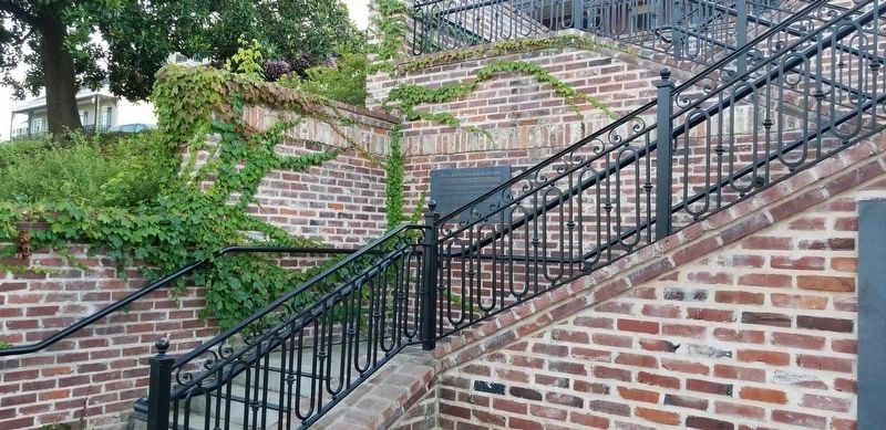
More about this marker. Marker is located on the walkway between the Cane River and Front Street in a park area.
Credits. This page was last revised on June 19, 2021. It was originally submitted on June 19, 2021, by Cajun Scrambler of Assumption, Louisiana. This page has been viewed 468 times since then and 65 times this year. Photos: 1, 2. submitted on June 19, 2021, by Cajun Scrambler of Assumption, Louisiana.

