Federal Triangle in Northwest Washington in Washington, District of Columbia — The American Northeast (Mid-Atlantic)
Permanence and Grandeur: Building the Federal Triangle
Photographed by Craig Swain, May 22, 2008
1. Permanence and Grandeur: Building the Federal Triangle Marker
this page online
Topics. This historical marker is listed in these topic lists: Parks & Recreational Areas • Roads & Vehicles • Settlements & Settlers. A significant historical year for this entry is 1791.
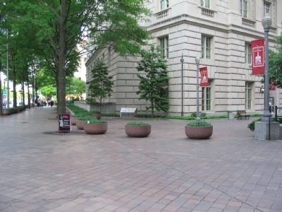
Location. 38° 53.664′ N, 77° 1.619′ W. Marker is in Northwest Washington in Washington, District of Columbia. It is in Federal Triangle. It is at the intersection of Pennsylvania Avenue Northwest and 11th Street Northwest, on the right when traveling east on Pennsylvania Avenue Northwest. Located in front of the
Photographed by Craig Swain, May 22, 2008
2. Permanence and Grandeur: Building the Federal Triangle Marker

Regionally, this marker is in the Washington Metropolitan Area. It is also in the American Northeast, in the Upper South, in the Mid-Atlantic, in the Tidewater, and in the Chesapeake Bay Region. Globally, it is in North America, the Western Hemisphere, the Western World, and the Anglosphere.
Other nearby markers. At least 8 other markers are within walking distance of this marker: Statue of Benjamin Franklin (within shouting distance of this marker); Preserving the Past (about 300 feet away, measured in a direct line); a different marker also named Pennsylvania Avenue (about 300 feet away); G-Men and G-Women (about 300 feet away); This memorial tree (about 400 feet away); Appointed Rounds (about 500 feet away); U. S. Post Office Department (about 700 feet away); Arts and Artists (about 700 feet away). Touch for a list and map of all markers in Northwest Washington.
Another marker is no longer nearby. Pennsylvania Avenue
Photographed by Kevin W., January 10, 2010
3. The Old Post Office Building
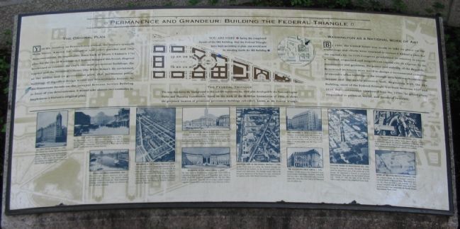
More about this marker. The background of the marker is a map of the area around Federal Triangle under the original plan, with the Triangle highlighted. An inset map shows the area as built, indicating the position of the marker on both with colored dots.
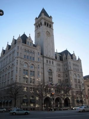
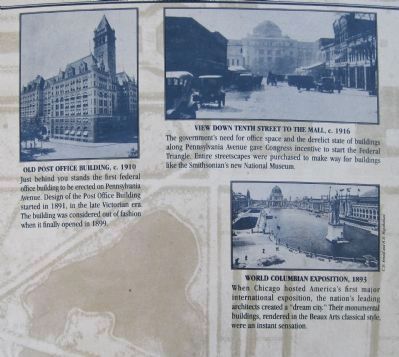
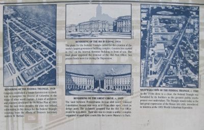
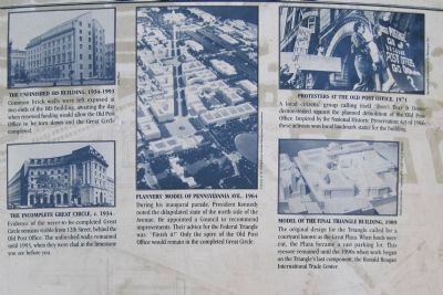
In the lower portion of the are a set of photos showing the triangle as it appeared in the past and today. These photos include: The Old Post Office Building, View down Tenth Street and the Mall c. 1916, World Colombian Exposition 1893, several renderings of the Federal Triangle from 1928, a west looking view of Federal Triangle from the 1940s, The IRS buiding in 1934, The incomplete Great Circle in 1934, a planners model of Pennsylvania Avenue from 1964, protesters at the old Post Office in 1971, and a model of the final Triangle building plan in the 1980s.
Photographed by Craig Swain, May 22, 2008
4. The Great Circle
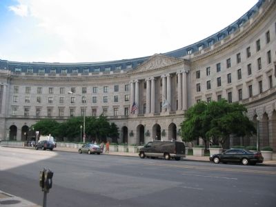
Within Federal Triangle is the "Great Circle", formed as a courtyard. The building seen here houses the Interstate Commerce Commission. Below the building is a metro-rail stop.
Photographed by Kevin W., January 10, 2010
5. Permanence and Grandeur: Building the Federal Triangle Marker

Photographed by Kevin W., January 10, 2010
6. Permanence and Grandeur: Building the Federal Triangle Marker
Map of the Federal Triangle, from the marker.
Photographed by Kevin W., January 10, 2010
7. Permanence and Grandeur: Building the Federal Triangle Marker
Photographed by Kevin W., January 10, 2010
8. Permanence and Grandeur: Building the Federal Triangle Marker
Credits. This page was last revised on January 29, 2026. It was originally submitted on April 3, 2009, by Craig Swain of Leesburg, Virginia. This page has been viewed 1,676 times since then and 47 times this year. Photos: 1, 2. submitted on April 3, 2009, by Craig Swain of Leesburg, Virginia. 3. submitted on January 10, 2010, by Kevin W. of Stafford, Virginia. 4. submitted on April 3, 2009, by Craig Swain of Leesburg, Virginia. 5, 6, 7, 8. submitted on January 10, 2010, by Kevin W. of Stafford, Virginia.
