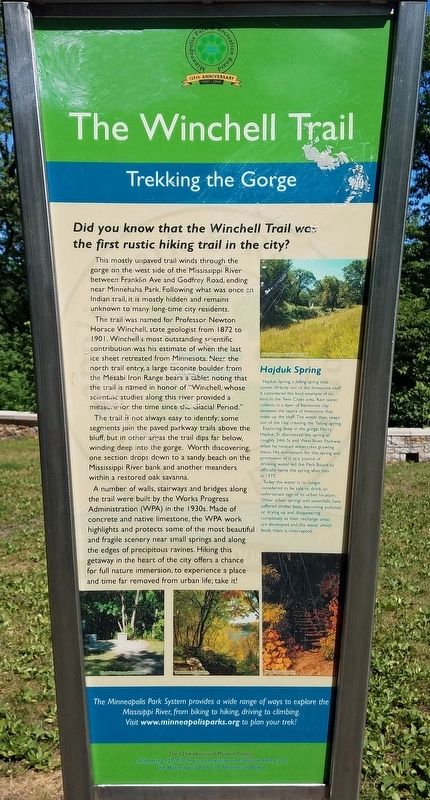
The Winchell Trail
Trekking the Gorge
Did you know that the Winchell Trail was the first rustic hiking trail in the city?
This mostly unpaved trail winds through the gorge on the west side of the Mississippi River between Franklin Ave and Godfrey Road, ending near Minnehaha Park. Following what was once an Indian trail, it is mostly hidden and remains unknown to many long-time city residents.
The trail was named for Professor Newton Horace Winchell, state geologist from 1872 to 1901. Winchell's most outstanding scientific contribution was his estimate of when the last ice sheet retreated from Minnesota. Near the north trail entry, a large taconite boulder from the Mesabi Iron Range bears a tablet noting that the trail is named in honor of "Winchell, whose scientific studies along this river provided a measure for the time since the Glacial Period."
The trail is not always easy to identify; some segments join the paved parkway trails above the bluff, but in other areas the trail dips far below, winding deep into the gorge. Worth discovering, one section drops down to a sandy beach on the Mississippi River bank and another meanders within a restored oak savanna.
A number of walls, stairways and bridges along the trail were built by the Works Progress Administration (WPA) in the 1930s. Made of concrete and native
Hajduk Spring
Hajduk Spring, a falling spring that comes directly out of the limestone bluff, is considered the best example of its kind in the Twin Cities area. Rain water collects in a layer of Bentonite clay between the layers of limestone that make up the bluff. The water then seeps out of the clay, creating the 'falling spring.'
Exploring deep in the gorge, Harry Hajduk, Sr. discovered the spring at roughly 24th St and West River Parkway when he noticed watercress growing there. His enthusiasm for the spring and promotion of it as a source of drinking water led the Park Board to officially name the spring after him in 1977.
Today the water is no longer considered to be safe to drink, an unfortunate sign of its urban location. Other urban springs and waterfalls have suffered similar fates, becoming polluted, or drying up and disappearing as their recharge areas are developed and the water which feeds them is intercepted.
Erected by Minneapolis Park and Recreation
Topics. This historical marker is listed in these topic lists: Environment • Parks & Recreational Areas. A significant historical year for this entry is 1872.
Location. 44° 55.41′ N, 93° 12.221′ W. Marker is in Minneapolis, Minnesota, in Hennepin County. It is in Hiawatha. Marker can be reached from West River Parkway north of East 44th Street. Marker is on a paved trail leading southeast from a parking area on West River Parkway. The path turns north and becomes the Winchell Trail leading upriver. Touch for map. Marker is at or near this postal address: 4357 W River Pkwy, Minneapolis MN 55406, United States of America. Touch for directions.
Other nearby markers. At least 8 other markers are within walking distance of this marker. Minneapolis Locks and Dams (approx. ¼ mile away); Mississippi River Gorge (approx. ¼ mile away); Big Water / Stairway of Water (approx. 0.6 miles away); Wing Dams (approx. 0.6 miles away); 1–Main Entrance Minnehaha Lower Glen (approx. 0.6 miles away); Geology of Minnesota (approx. 0.6 miles away); President Lyndon B. Johnson (approx. 0.6 miles away); The Lock and Dam No. 1 Story (approx. 0.6 miles away). Touch for a list and map of all markers in Minneapolis.
Credits. This page was last revised on February 12, 2023. It was originally submitted on June 29, 2021, by McGhiever of Minneapolis, Minnesota. This page has been viewed 356 times since then and 17 times this year. Photos: 1, 2. submitted on June 29, 2021, by McGhiever of Minneapolis, Minnesota. • Mark Hilton was the editor who published this page.

