Central Oklahoma City in Oklahoma County, Oklahoma — The American South (West South Central)
Indians, Railroads, Ranchers & the Military
The '89er Trail
— Oklahoma City April 20, 1889 —
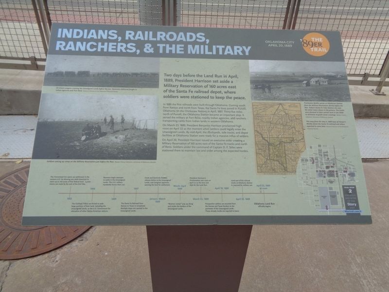
In 1886 the first railroads were built through Oklahoma. Coming south from Kansas and north from Texas, the Santa Fe lines joined in Purcell, Oklahoma (in the Chickasaw Nation) in April, 1887. Thirty-five miles north of Purcell, the Oklahoma Station became an important stop. It served the military at Fort Reno, nearby Indian agencies, and ranchers transporting cattle from Indian lands in western Oklahoma.
On March 23, 1889, President Benjamin Harrison proclaimed high noon on April 22 as the moment when settlers could legally enter the Unassigned Lands. By mid-April, the stockyards, side tracks, and depot facilities at Oklahoma Station were ready for a massive influx of settlers.
On April 20, President Harrison issued an executive order creating a Military Reservation of 160 acres east of the Santa Fe tracks and north of Reno. Soldiers under the command of Captain D.F. Stiles were stationed there to maintain law and order among the expected hordes.
(timeline at bottom:)
1862 - The Homestead Act opens up settlement in the western U.S. by allowing any adult American to claim up to 160 acres of free federal land. 15,000 claims are made by the end of the Civil War.
1866 - The Civilized Tribes are forced to cede large portions of their land, including the Unassigned Lands, to the U.S. Government for relocation of other Native American nations.
1880 - Boomers begin attempts to settle in the Unassigned Lands. The U.S. military repeatedly forces them out.
1887 - The Santa Fe Railroad from Kansas to Texas is completed. Multiple stops are opened in the Unassigned Lands.
January-March 1889 - Creek and Seminole Nations release claims to the Unassigned Lands, and Congress approves opening the land for settlement.
March-April 1889 - "Boomer camps" pop up along and inside the borders of the Unassigned Lands.
March 23, 1889 - President Harrison's Proclamation sets noon on April 22 as the time and date for the Land Run.
April 19, 1889 - Prospective settlers are escorted from the Kansas and Texas borders to the perimeter of the Unassigned Lands. Those already inside are required to leave.
April 20, 1889 - Land east of the railroad tracks at Oklahoma Station is reserved for military use.
April 22, 1889 at noon - Oklahoma Land Run officially begins.
(photo captions:)
·Ox-drawn wagons crossing the Unassigned Lands before the run. Teamsters delivered
freight to Indian agencies and Fort Reno.
·Soldiers setting up camp on the Military Reservation just before the Run.
·Postmaster Beidler points at Oklahoma Station from the Military Reservation shortly before the Run. Today's Santa Fe Train Station sits near the water tower shown in the picture. The tracks were elevated to their current level in the 1930s to minimize at-grade street crossings.
·This map from the May 4, 1889 issue of Harper's Weekly shows the Santa Fe railroad and others expected to come later.
Erected 2018 by Oklahoma City Community Foundation. (Marker Number 2.)
Topics and series. This historical marker is listed in these topic lists: Agriculture • Native Americans • Railroads & Streetcars • Settlements & Settlers. In addition, it is included in the Former U.S. Presidents: #23 Benjamin Harrison, and the The '89er Trail series lists. A significant historical date for this entry is April 20, 1889.
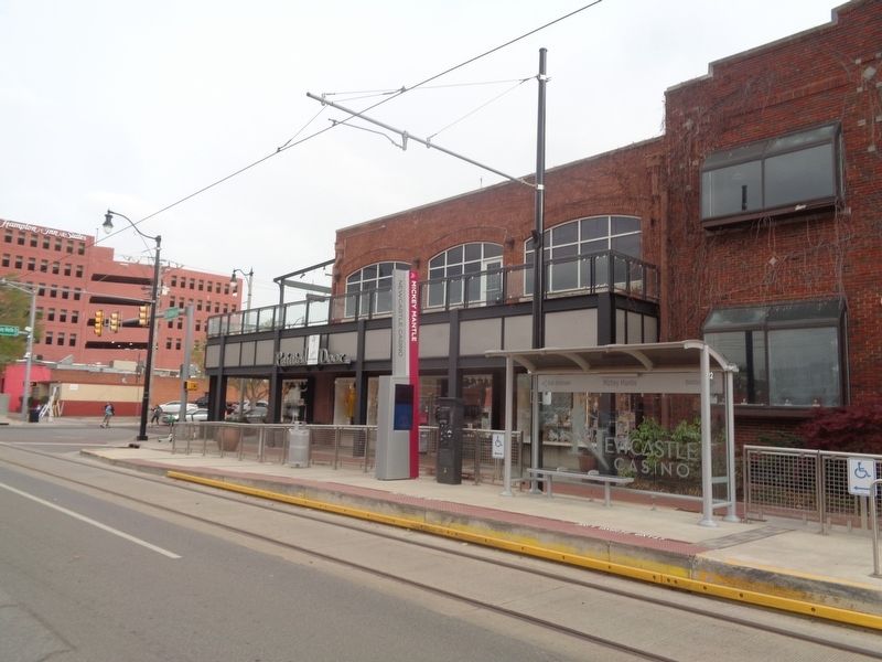
Location. 35° 27.981′ N, 97° 30.567′ W. Marker is in Oklahoma City, Oklahoma, in Oklahoma County. It is in Central Oklahoma City. Marker is on East Sheridan Avenue west of Mickey Mantle Drive, on the right when traveling east. Touch for map. Marker is at or near this postal address: 124 E Sheridan Ave, Oklahoma City OK 73104, United States of America. Touch for directions.
Other nearby markers. At least 8 other markers are within walking distance of this marker. The Boomers (a few steps from this marker); Military Land Becomes School Land (about 400 feet away, measured in a direct line); William B. Tietgens (about 400 feet away); Allie Pierce Reynolds (about 400 feet away); Bobby Murcer (about 400 feet away); John L.R. "Pepper" Martin (about 400 feet away); Carl Owen Hubbell (about 400 feet away); Paul Glee Waner (about 400 feet away). Touch for a list and map of all markers in Oklahoma City.
Credits. This page was last revised on February 16, 2023. It was originally submitted on July 1, 2021, by Jason Voigt of Glen Carbon, Illinois. This page has been viewed 177 times since then and 21 times this year. Photos: 1, 2. submitted on July 1, 2021, by Jason Voigt of Glen Carbon, Illinois.

