The Remembrance Structure
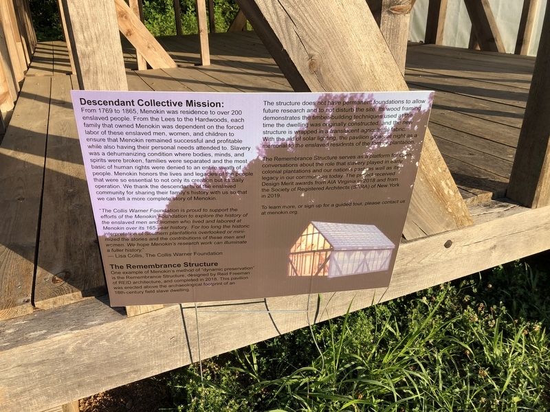
Descendant Collective Mission:
From 1769 to 1865, Menokin was residence to over 200 enslaved people. From the Lees to the Hardwoods, each family that owned Menokin was dependent on the forced labor of these enslaved men, women, and children to ensure that Menokin remained successful and profitable while also having their personal needs attended to. Slavery was a dehumanizing condition where bodies, minds, and spirits were broken, families were separated and the most basic of human rights were denied to an entire swath of people. Menokin honors the lives and legacies of the people that were so essential to not only its creation but its daily operation. We thank the descendants of the enslaved community for sharing their family's history with us so that we can tell a more complete story of Menokin.
"The Collis Warner Foundation is proud to support the efforts of the Menokin Foundation to explore the history of the enslaved men and women who lived to explore the history of the enslaved men and women who lived and labored at Menokin over its 165-year history. For too long the historic interpretations of Southern plantations overlooked or minimized the stories and the contributions of these men and women. We hope Menokin's research work can illuminate a fuller history."
—Lisa Collis, the Collis Warner Foundation
Click or scan to see
this page online
The Remembrance Structure
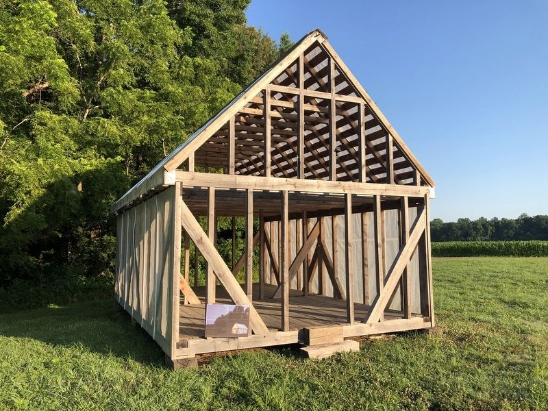
One example of Menokin's method of "dynamic preservation" is the Remembrance Structure, designed by Reid Freeman of REID architecture, and completed in 2018. This pavilion was erected above the archaeological footprint of an 18th-century field slave dwelling.
The structure does not have permanent foundations to allow future research and to not disturb the site. Its wood framing demonstrates the timber-building techniques used at the time the dwelling was originally constructed, and the new structure is wrapped in a translucent agricultural fabric. With the aid of solar lighting, the pavilion allows at night as a memorial to the enslaved residents of the former plantation.
The Remembrance Structure serves as a platform for open conversations about the role that slavery played in early colonial plantations and our nation's pas as well as the legacy in our communities today. The project received Design Merit awards from AIA Virginia in 2018 and from the Society of Registered ARchitects (SARA) of New York in 2019.
To learn more, or sign up for a guided tour,
Topics. This historical marker is listed in these topic lists: African Americans • Agriculture • Colonial Era. A significant historical year for this entry is 1769.
Location. 38° 0.41′ N, 76° 47.983′ W. Marker is near Warsaw, Virginia, in Richmond County. It can be reached from Menokin Road (Virginia Route 690) 1.8 miles south of Piney Grove Road ( Route 637), on the right when traveling south. Touch for map. Marker is at or near this postal address: 4037 Menokin Rd, Warsaw VA 22572, United States of America. Touch for directions.

Regionally, this marker is on the Northern Neck. It is also in the American South, specifically in the Upper South, in the Tidewater, in the Chesapeake Bay Region, and on the Eastern Seaboard. Globally, it is in the North Atlantic Region, North America, the Western Hemisphere, the Western World, and the Anglosphere. Historically, it finds itself in what was once the territory of the Mississippian Culture, one of the original Thirteen Colonies, one of the Confederate States of America, and the Antebellum South.
Other nearby markers. At least 8 other

Another marker is no longer nearby. Exterior Design (was approx. ¼ mile away but has been confirmed missing).
Credits. This page was last revised on October 4, 2025. It was originally submitted on July 5, 2021, by Devry Becker Jones of Washington, District of Columbia. This page has been viewed 313 times since then and 24 times this year. Photos: 1, 2. submitted on July 5, 2021, by Devry Becker Jones of Washington, District of Columbia. 3. submitted on October 2, 2025, by Evan Dwyer of Richmond, Virginia.
