Interpreting the Birthplace Site
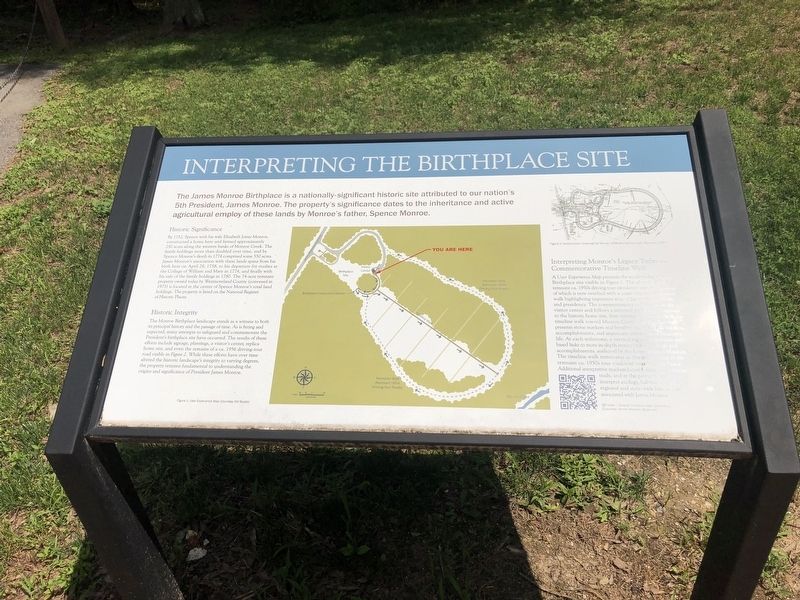
The James Monroe Building is a nationally-significant historic site attributed to our nation's 5th President, James Monroe. The property's significance dates to the inheritance and active agricultural employ of these lands by Monroe's father, Spence Monroe.
Historic Significance
By 1752, Spence with his wife Elizabeth Jones Monroe, constructed a home here and farmed approximately 250 acres along the western banks of Monroe Creek. The family holdings more than doubled over time, and by Spence Monroe's death in 1774 comprised some 550 acres. James Monroe's association with these lands spans from his birth here on April 28, 1758, to his departure for studies at the College of William and Mary in 1774, and finally with his sale of the family holdings in 1780. The 74-acre remnant property owned today by Westmoreland County (conveyed in 1973) is located at the center of Spence Monroe's total land holdings. The property is listed on the National Register of Historic Places.
Historic Integrity
The Monroe Birthplace landscape stands as a witness to both its principal history and the passage of time. As is fitting and expected,
this page online
Interpreting Monroe's Legacy Today — Commemorative Timeline
A User Experience Map presents the modern-day Monroe Birthplace site visible in Figure 1. The plan shows the remnant ca. 1950s driving tour circulation system, a portion of which is now overlaid with a commemorative timeline walk highlighting important eras of James Monroe's life and presidency. The commemorative walk begins at the visitor center and follows a remnant circular road around the historic home site, then turning back down the linear timeline walk toward Monroe Creek. The timeline walk presents stone markers and benches inscribed with the facts, accomplishments, and important milestones of Monroe's life.
Topics and series. This historical marker is listed in these topic lists: Colonial Era • Government & Politics • Parks & Recreational Areas • Settlements & Settlers. In addition, it is included in the Former U.S. Presidents: #05 James Monroe series list. A significant historical date for this entry is April 28, 1758.
Location. 38° 14.485′ N, 76° 59.312′ W. Marker is near Colonial Beach, Virginia, in Westmoreland County. It is on James Monroe Highway (Virginia Route 205) 0.3 miles north of Old Road, on the right when traveling north. Touch for map. Marker is at or near this postal address: 4460 James Monroe Hwy, Colonial Beach VA 22443, United States of America. Touch for directions.

Regionally, this marker is on the Northern Neck. It is also in the American South, specifically in the Upper South, in the Tidewater, in the Chesapeake Bay Region, and on the Eastern Seaboard. Globally, it is in the North Atlantic Region, North America, the Western Hemisphere, the Western World, and the Anglosphere. Historically, it finds itself in what was once the territory of the Mississippian Culture, one of the original Thirteen Colonies, one of the Confederate States of America, and the Antebellum South.
Other nearby markers. At least 8 other markers are within walking distance of this marker: Birthplace of James Monroe (a few steps from this marker); Revolutionary Idealist (within shouting distance of this marker); Birthright and Beginnings (within shouting distance of this marker); Soldier - Statesman President James Monroe (within shouting distance of this marker); Monroe's Childhood Home (within shouting distance of this marker); Service to the Commonwealth (about 300 feet away, measured in a direct line); Statesman at Home and Abroad (about 500 feet away); James Monroe Birthplace (about 600 feet away). Touch for a list and map of all markers in Colonial Beach.
Credits. This page was last revised on July 5, 2021. It was originally submitted on July 5, 2021, by Devry Becker Jones of Washington, District of Columbia. This page has been viewed 269 times since then and 23 times this year. Photos: 1, 2. submitted on July 5, 2021, by Devry Becker Jones of Washington, District of Columbia.
