Port Orford in Curry County, Oregon — The American West (Northwest)
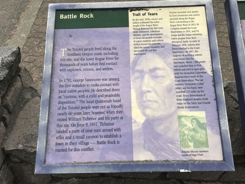
Battle Rock
In 1792, George Vancouver was among the first outsiders to make contact with local native peoples. He described them as "curious, with a mild and peaceable disposition." The local Quatomah band of the Tututní people were not as friendly nearly 60 years later, however, when they visited William Tichenor and his party at this site. On June 9, 1851, Tichenor landed a party of nine men armed with rifles and a small cannon to establish a town in their village — Battle Rock is named for this conflict.
Trail of Tears
By the early 1850s, miners and settlers infiltrated the entire length of the Rogue River. Mining destroyed the fish runs, while settlement, infectious diseases, and the development of farms devastated centuries of native tradition and culture. Settlers fenced the pastures, tilled the camas meadows, and decimated elk and deer populations.
Tension mounted, and attacks by Euro-Americans and natives occurred along the Rogue River culminating in the Rogue River Wars of 1855-56. Congress created the Coast Reservation in 1855, and US troops quickly began removing native peoples from their aboriginal lands. As early as February 1856, natives were force-marched to the Coast Reservation. By 1857, the majority of surviving natives were forced onto the reservation. About 1,200 people were marched here to Port Orford and held in open pens until the steamship Columbia deported them north to the Coast Reservation. The last resisters, Tecumtum (Chief John) and his band, were marched 125 miles up the coast. Many descendants of these displaced peoples reside today on the Siletz and Grande Ronde Reservations.
Caption: Ahnkuttie Tillicums (Ancestors) courtesy of Peggy O'Neal.
Topics. This historical marker is listed in these topic lists: Native Americans • Settlements & Settlers • Wars, US Indian. A significant historical month for this entry is February 1856.
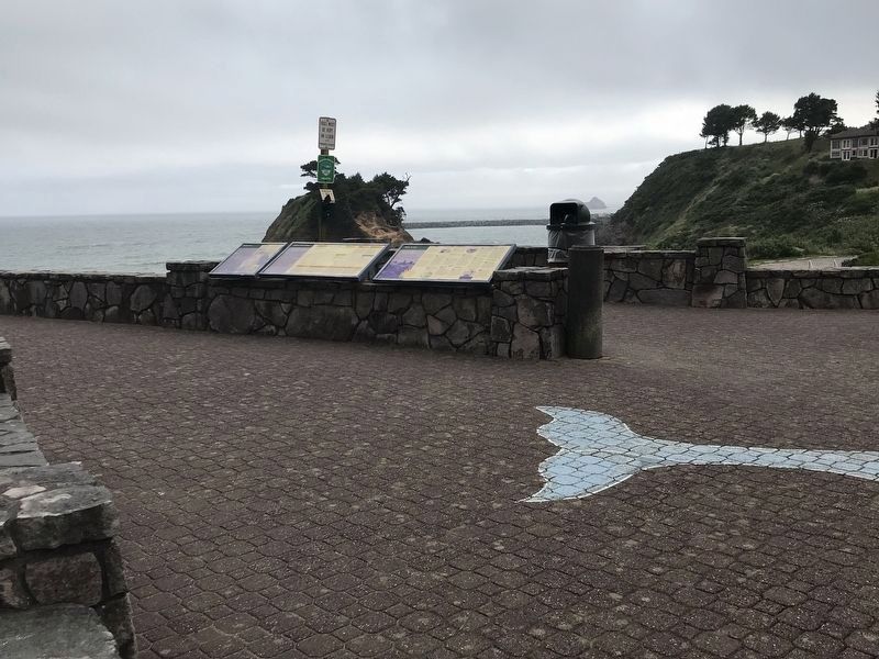
Location. 42° 44.58′ N, 124° 29.508′ W. Marker is in Port Orford, Oregon, in Curry County. Marker is at the intersection of Oregon Coast Highway (U.S. 101) and Jefferson Street, on the right when traveling east on Oregon Coast Highway. Marker is in the Battle Rock Wayside Park. Touch for map. Marker is at or near this postal address: 520 Jefferson Street, Port Orford OR 97465, United States of America. Touch for directions.
Other nearby markers. At least 8 other markers are within 8 miles of this marker, measured as the crow flies. Wreck of the Cottoneva (about 300 feet away, measured in a direct line); Battle Rock City Park (about 300 feet away); Oregon Beach Gold (approx. 5.4 miles
away); Toward a New Century (approx. 7.2 miles away); We Have a River in Common (approx. 7.2 miles away); Lifeline to the Past (approx. 7.2 miles away); a different marker also named Lifeline to the Past (approx. 7.3 miles away); The Pioneer Will ... and the Pioneer Way (approx. 7.3 miles away). Touch for a list and map of all markers in Port Orford.
Credits. This page was last revised on July 10, 2021. It was originally submitted on July 10, 2021, by Duane and Tracy Marsteller of Murfreesboro, Tennessee. This page has been viewed 139 times since then and 17 times this year. Photos: 1, 2. submitted on July 10, 2021, by Duane and Tracy Marsteller of Murfreesboro, Tennessee.

