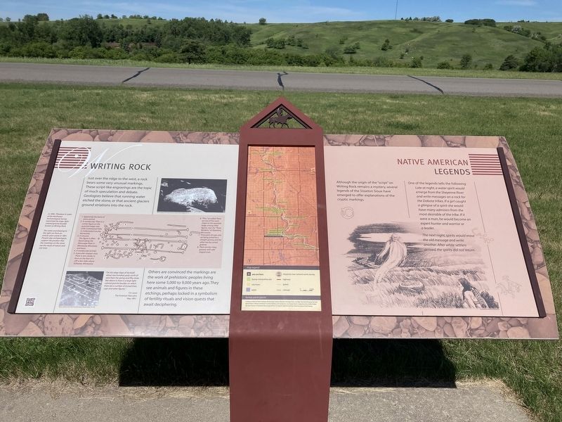
Writing Rock / Native American Legends
Others are convinced the markings are the work of prehistoric peoples living here some 5,000 to 9,000 years ago. They see animals and figures in these etchings, perhaps locked in a symbolism of fertility rituals and vision quests that await deciphering.
One of the legends tells the following:
Late at night, a water spirit would
emerge from the Sheyenne River
and write messages on a rock for
the Dakota tribes. If a girl caught
a glimpse of a spirit she would
have many admirers from the
most desirable of the tribe. If it
were a man, he would become an
expert hunter and warrior or
a leader.
The next night, spirits would erase the old message and write another. After white settlers arrived, the spirits did not return.
Captions:
In 1890, Theodore
H. Lewis
of the Northwest
Archaeological Survey
examined the large light-
colored granite boulder
known as Writing Rock
The notes and drawing to
the right are from an
article Lewis wrote in 1891.
Present-day archaeologists
support the position that
the markings on the stone
are the result of nature and
not man.
1. Apparently the horns of
some animal.
2. A nondescript. There is a
similar figure on the
quartzite ledge near
Little Cottonwood Falls,
in Cottonwood County
Minnesota
3. A crescent.
This figure is often o
found along the
Mississippi River in
Minnesota, Wisconsin,
and Iowa.
4. A nondescript animal.
5. A peculiar-shaped cross.
There is one similar in
form on the face of a
cliff a few miles above
Stillwater, Minnesota
6. "Pins, "so-called. There
are two of the same
shape on the quartzite
ledge, among other
figures, near the "Three
Maidens,"at Pipestone,
Minnesota.
7. Three pairs of cups, one
set being joined by a
straight groove and the
other two by curved
grooves
8. There are four long
grooves with odd-
shaped ends.
Erected by Federal Highway Administration Garrison Diversion Recreation Grant, and Valley City Food & Beverage Tax Fund.
Topics. This historical marker is listed in these topic lists: Anthropology & Archaeology
Location. 46° 31.115′ N, 97° 56.488′ W. Marker is near Fort Ransom, North Dakota, in Ransom County. Marker is on Walt Hjelle Parkway near 62nd Street Southeast, on the right when traveling north. Touch for map. Marker is in this post office area: Fort Ransom ND 58033, United States of America. Touch for directions.
Other nearby markers. At least 8 other markers are within 8 miles of this marker, measured as the crow flies. Historic Fort Ransom / Life at the Fort (here, next to this marker); Fort Ransom Historic Site (a few steps from this marker); Pyramid Hill / Fort Ransom’s Remarkable Survival (approx. 0.9 miles away); Standing Rock Lutheran Church (approx. 2 miles away); Timber Trestle Bridge (approx. 2.1 miles away); An Ancient Sea / Glacial Meltwater Trench (approx. 2˝ miles away); Native Prairies / Ecosystem Under Siege (approx. 2.6 miles away); Standing Rock Hill Historic Site (approx. 7.4 miles away). Touch for a list and map of all markers in Fort Ransom.
Credits. This page was last revised on July 12, 2021. It was originally submitted on July 12, 2021, by Connor Olson of Kewaskum, Wisconsin. This page has been viewed 554 times since then and 113 times this year. Photo 1. submitted on July 12, 2021, by Connor Olson of Kewaskum, Wisconsin. • Mark Hilton was the editor who published this page.
Editor’s want-list for this marker. A wide shot of the marker and its surroundings. • Can you help?
