Corona in Riverside County, California — The American West (Pacific Coastal)
Corona History
Magnolia Avenue Bridge
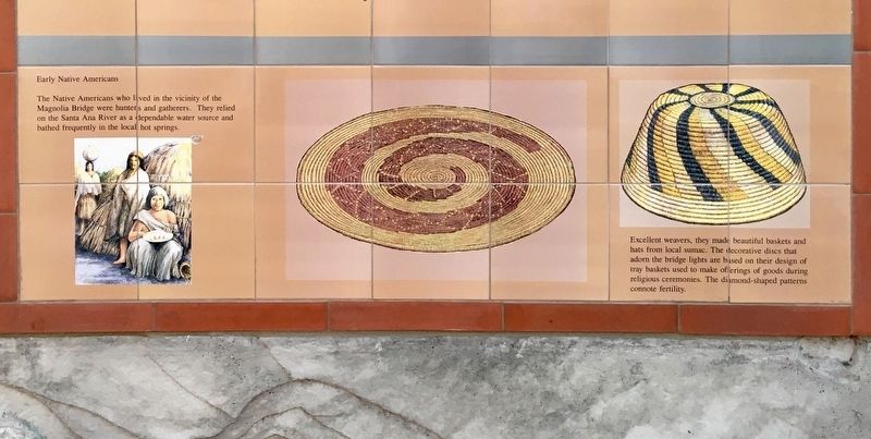
The Native Americans who lived in the vicinity of the Magnolia Bridge were hunters and gatherers. They relied on the Santa Ana River as a dependable water source and bathed frequently in the local hot springs.
Excellent weavers, they made beautiful baskets and hats from local sumac. The decorative discs that adorn the bridge lights are based on their design of tray baskets used to make offerings of goods during religious ceremonies. The diamond-shaped patterns connote fertility.
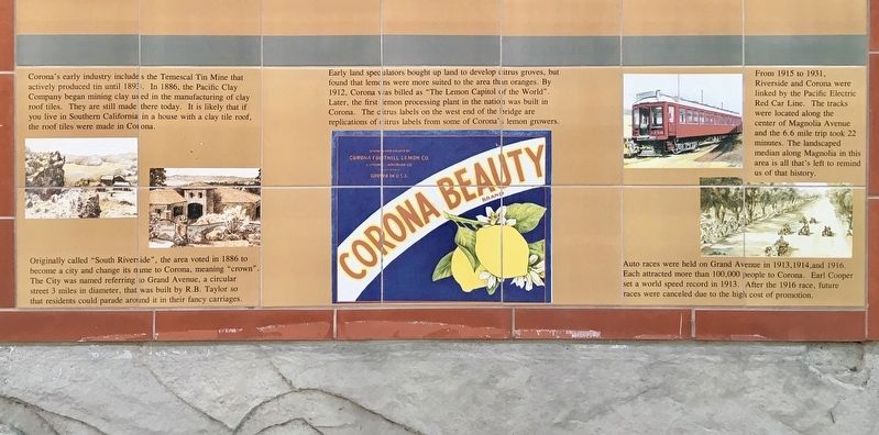
Corona's early industry includes the Temescal Tin Mine that actively produced tin until 1893. In 1886, the Pacific Clay Company began mining clay used in the manufacturing of clay roof tiles. They are still made there today. It is likely that if you live in Southern California in a house with a clay tile roof, the roof tiles were made in Corona.
Early land speculators bought up land to develop citrus groves, but found that lemons were more suited to the area than oranges. By 1912, Corona was billed as "The Lemon Capitol of the World". Later, the first lemon processing plant in the nation was built in Corona. The citrus labels on the west end of the bridge are replications of citrus labels from some of Corona's lemon growers.
From 1915 to 1931, Riverside and Corona were linked by the Pacific Electric Red Car Line. The tracks were located along the center of Magnolia Avenue and the 6.6 mile trip took 22 minutes. The landscaped median along Magnolia in this area is all that's left to remind us of that history.
Originally called "South Riverside", the area voted in 1886 to become a city and change its name to Corona, meaning "crown". The City was named referring to Grand Avenue, a circular street 3 miles in diameter, that was built by R.B. Taylor so that residents could parade around it in their fancy carriages.
Auto races were held on Grand Avenue in 1913, 1914, and 1916. Each attracted more than 100,000 people to Corona. Earl Cooper set a world speed record in 1913. After the 1916 race, future races were canceled due to the high cost of promotion.
Erected 2017 by Riverside County, and artist Jan K. Pratt.
Topics. This historical marker is listed in these topic lists: Agriculture • Industry & Commerce • Native Americans • Sports.
Location. 33° 53.236′ N, 117° 30.271′ W. Marker is in Corona, California, in Riverside County. Marker is on Magnolia Avenue, 0.6 miles east of McKinley Street. Located on a small access road south of the Magnolia Avenue Bridge, near the west end. Touch for map. Marker is at or near this postal address: 12650 Magnolia Ave, Riverside CA 92503, United States of America. Touch for directions.
Other nearby markers. At least 8 other markers are within 8 miles of this marker, measured as the crow flies. Corona Founders (approx. 3.1 miles away); Corona High School (approx. 4.2 miles away); Site of Butterfield Stage Station (approx. 4.9 miles away); Corona Historic Preservation Society (approx. 5.1 miles away); De Anza Crossing of the Santa Ana River (approx. 7.1 miles away); The First Marsh Grapefruit Trees into California (approx. 7.2 miles away); Parent Washington Navel Orange Tree (approx. 7.2 miles away); Serrano Tanning Vats (approx. 7.6 miles away). Touch for a list and map of all markers in Corona.
Credits. This page was last revised on March 10, 2023. It was originally submitted on July 19, 2021, by Craig Baker of Sylmar, California. This page has been viewed 346 times since then and 48 times this year. Photos: 1, 2, 3. submitted on July 19, 2021, by Craig Baker of Sylmar, California.


