Belmont in Mississippi County, Missouri — The American Midwest (Upper Plains)
The Battle of Belmont
A State Divided
— The Civil War in Missouri —
At Columbus, towering bluffs projected toward the river and provided the first ideal location below Cairo for the placement of artillery batteries. Both sides eyed this location as being strategically important to the control of the Mississippi River. To occupy Columbus, however, would be to violate Kentucky's declared neutrality in the Civil war. On September 3, 1861, the Confederacy made the first move in this direction when Polk's army occupied heights above Columbus.
By the time of the Battle of Belmont, the Columbus fortifications bristled with 140 artillery pieces, including a 128-pounder Whitworth rifled gun nicknamed "Lady Polk." The garrison consisted of 19,000 soldiers. From the fortifications, a mile-long chain had been extended across the river to Belmont to block Union gunboats. This massive chain, requiring a six-ton anchor to hold it in place, enjoyed only a brief career before breaking, apparently of its own weight. The anchor, a short section of the chain, and remnants of the fortifications are preserved at the Columbus-Belmont Battlefield State Park in Columbus, Kentucky.
Immediately after Polk's occupation of Columbus, Grant countered by moving up the Ohio River from Cairo and seizing Paducah, Kentucky on September 6, 1861. Paducah's location in proximity to the mouths of the Tennessee and Cumberland Rivers opened to Union forces a route of invasion into the heartland of the western Confederacy.
By November 1861, the Confederates had established an outpost, called Camp Johnston, at Belmont to serve as an observation post. The decision by Grant to assault this encampment was based on faulty information. He had been led to believe that Polk was to send troops to reinforce pro-Southern forces under General Sterling Price in southwest Missouri. Grant was also concerned that a Union detachment sent to drive the Southern partisan commander, M. Jeff Thompson, the elusive "Swamp Fox," from the state would be cut off and captured by Polk's troop movements.
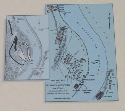
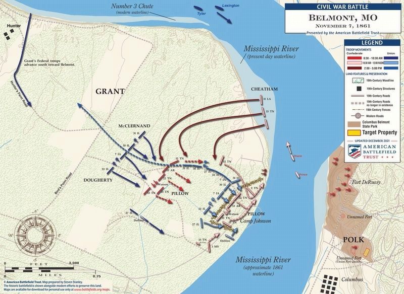
On the morning of November 7, a federal flotilla of four transports and two gunboats landed Grant's attack force of 3,114 men at Hunter's Point, two miles above Belmont. While this force attacked the Confederate camp, General C.F. Smith, Commander at Paducah, was to conduct a demonstration against Columbus from the Kentucky side of the river to discourage Polk from reinforcing Camp Johnston.
A mile march through woods and a tangle of brush brought Grant's two brigades into contact with four Confederate infantry regiments under Brigadier General Gideon Pillow. Formed in line of battle in a cornfield, this body of troops numbered roughly the same as Grant's but was poorly deployed. After more than an hour of hard fighting, the Confederates ran short of ammunition and Grant's men succeeded in scattering them.
The Federals then converged on the Confederate camp from two directions and drove its defenders toward the river where they found protection and concealment behind the nearly vertical embankment at the water's edge. Once in the camp, Grant lost control of his troops who abandoned the attack in order to loot the camp and celebrate what seemed to be an easy victory. This revelry proved premature, for Polk had been observing the progress of the battle from Columbus. While his big guns kept Grant's gunboats at a respectful distance, Polk sent two steamers across the river with additional regiments under Brigadier General Benjamin Cheatham. Their orders were to tear into Grant's flank and prevent his force from retreating to their transports.
Grant described the reaction of his men to the approaching reinforcements, "At first some of the officers seemed to think that to be surrounded was to be placed in a hopeless position, where there was nothing to do with surrender. But when I announced that we had cut our way in and could cut our way out just as well, it seemed a new revelation to officers and soldiers." The way back involved fierce fighting and many Union casualties, but Grant managed to get most of his army back to the safety of the transports. Grant was the last federal to leave the field. He boarded the transport by guiding his horse down the nearly perpendicular river bank and trotting him across a narrow gang plank.
The battle of Belmont had lasted six hours. The Union lost 120 killed, 383 wounded, and 104 captured or missing for a total of 607 casualties, or 20% of the total force. On the Confederate side, 105 were killed, 419 wounded, and 117 captured or missing for a total of 641 casualties, or 16% of the total force engaged.
Grant himself, acknowledged the criticisms of the North that the Battle of Belmont was a wholly unnecessary battle barren of results. But he still insisted, in his Personal Memoirs, that he had accomplished his objectives. He felt he had prevented troops from being detached from Columbus for service
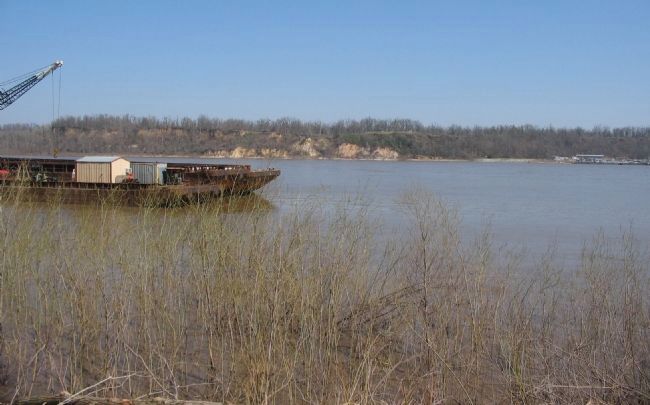
Photographed By Craig Swain, March 17, 2009
4. The Mississippi River at Belmont
Looking from the Missouri shore toward Columbus, Kentucky. The river is approximately 800 yards wide at this point. The bluffs on the Kentucky side have eroded somewhat since the war, but are still imposing. In the center of view on the bluffs are pavilions in Columbus-Belmont State Park. The giant chain spanned the river near this point. And of course to the left is a river barge, indicating this section of the river sees a lot of traffic even in modern times.
Polk won the Battle of Belmont, but his successful defense was in vain. Four months after Belmont, Grant launched an attack from Paducah on Forts Henry and Donelson on the Tennessee and Cumberland Rivers. With the surrender of these forts to Grant, Polk was flanked at Columbus and compelled to abandon the massive fortifications of this "Gibraltar of the West" without a shot being fired.
Erected by Missouri Department of Natural Resources.
Topics and series. This historical marker is listed in this topic list: War, US Civil. In addition, it is included in the Former U.S. Presidents: #18 Ulysses S. Grant, and the Missouri - A State Divided: The Civil War in Missouri series lists. A significant historical month for this entry is September 1713.
Location. 36° 45.952′ N, 89° 7.429′ W. Marker is in Belmont, Missouri, in Mississippi County. Marker is on State Highway 80, on the
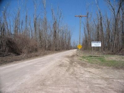
Photographed By Craig Swain, March 17, 2009
5. Grant's Landing
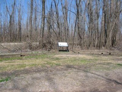
Looking north from the parking area. Grant's initial landing, and the site of the evacuation, was roughly two miles north of Belmont at Hunter's Point. Today the river has changed course, leaving a dead river bend and Island No. 4 on the western shore (thus part of Kentucky on the Missouri side of the river). The site of Hunter's Point is on private property, beyond the end of this service road.
Other nearby markers. At least 8 other markers are within walking distance of this marker. Fourth United States Colored Heavy Artillery (approx. 0.6 miles away in Kentucky); African Americans at Columbus during the Civil War (approx. 0.7 miles away in Kentucky); The Mississippi River in the Civil War (approx. 0.7 miles away in Kentucky); Earthquakes Along the Mississippi (approx. 0.7 miles away in Kentucky); Anchor and Chain (approx. 0.7 miles away in Kentucky); Polk's Firepower (approx. 0.7 miles away in Kentucky); In Search Of .... (approx. 0.7 miles away in Kentucky); "Gibraltar of the West" (approx. 0.7 miles away in Kentucky).
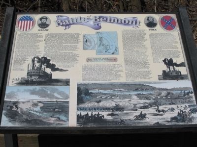
More about this marker. Flanking the marker title are portraits of Generals Grant and Polk. In the center is a wartime map of the battle. Beside the text to the left is a sketch showing a steamboat unloading soldiers. To the right of the text is another sketch showing one of the light gunboats similar to those used at Belmont. In the lower left of the marker is a sketch which appears to show the river from the Kentucky side. On the lower right a wartime sketch depicts the fighting at Belmont.
Also see . . .
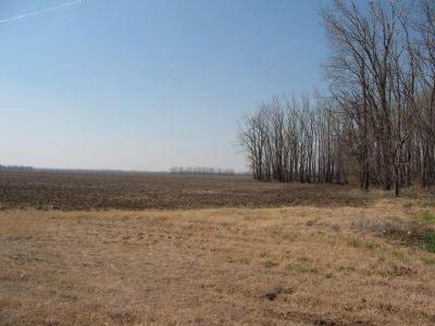
Photographed By Craig Swain, March 17, 2009
6. The Federal Advance
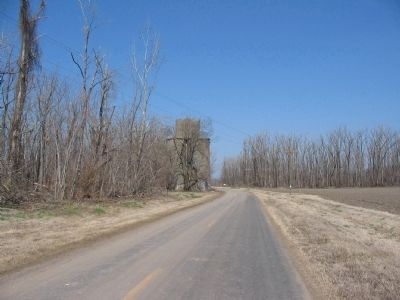
Looking from the state highway to the northwest, at a point about 500 yards west of the marker. Grant's brigades advanced south from Hunter's Point over what was heavy thickets at the time. The 27th Illinois Infantry moved through those thickets along a plank road in this vicinity, arriving on the Confederates left flank at a critical phase of the battle.
Credits. This page was last revised on April 23, 2022. It was originally submitted on April 8, 2009, by Craig Swain of Leesburg, Virginia. This page has been viewed 5,531 times since then and 151 times this year. Photos: 1, 2, 3, 4, 5, 6, 7. submitted on April 8, 2009, by Craig Swain of Leesburg, Virginia. 8. submitted on April 23, 2022.
