Near Benton in Polk County, Tennessee — The American South (East South Central)
Ocoee Dam #1
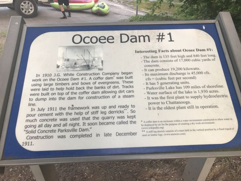
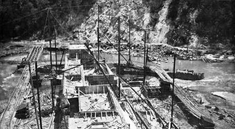
In July 1911 the framework was up and ready to pour cement with the help of stiff leg derricks.** So much concrete was used that the quarry was kept going all day and all night. It soon became called the “Solid Concrete Parksville Dam.”
Construction was completed in late December 1911.
Interesting Facts about Ocoee Dam #1:
• The dam is 135 feet high and 840 feet long.
• The dam consists of 17,000 cubic yards of concrete.
• It can produce 19,200 kilowatts.
• Its maximum discharge is 45,000 cfs. cfs = (cubic feet per second)
• It has 5 generating units.
• Parksville Lake has 109 miles of shoreline.
• Water surface of the lake is 1,930 acres.
• It was the first plant to supply hydroelectric power to Chattanooga.
• It is the oldest plant still in operation.
* A coffer dam is an enclosure within a water environment constructed to allow water to be displaced by air for the purpose of creating a dry work environment. (www.wikipedia.org)
** A stiff leg derrick consists of a mast held in the vertical position by a fixed tripod of steel or timber legs. (www.answers.com)
Topics. This historical marker is listed in these topic lists: Man-Made Features • Waterways & Vessels. A significant historical month for this entry is December 1911.
Location. 35° 5.756′ N, 84° 39.087′ W. Marker is near Benton, Tennessee, in Polk County. Marker can be reached from U.S. 64, on the right when traveling east. Marker is near Lower Ocoee River Put-in within Sugarloaf Mountain Park on the dam's south side. Touch for map. Marker is at or near this postal address: 2144 US-64, Benton TN 37307, United States of America. Touch for directions.
Other nearby markers. At least 8 other markers are within 6 miles of this marker, measured as the crow flies. Ocoee No. 1 (about 300 feet away, measured in a direct line); a different marker also named Ocoee No. 1 (about 300 feet away); The Halfway House (approx. 4.6 miles away); Nancy Ward (approx. 5 miles away); a different marker also named Nancy Ward (approx. 5 miles away); Polk County World Wars Memorial (approx. 5.3 miles away); Polk County Veterans Monument (approx. 5.3 miles away); Polk County Confederate Monument (approx. 5.3 miles away). Touch for a list and map of all markers in Benton.
Credits. This page was last revised on July 26, 2021. It was originally submitted on July 26, 2021, by Duane and Tracy Marsteller of Murfreesboro, Tennessee. This page has been viewed 182 times since then and 13 times this year. Photos: 1, 2. submitted on July 26, 2021, by Duane and Tracy Marsteller of Murfreesboro, Tennessee.
Editor’s want-list for this marker. Wide photo of marker and surrounding area in context. • Can you help?

