Point Pleasant in Mason County, West Virginia — The American South (Appalachia)
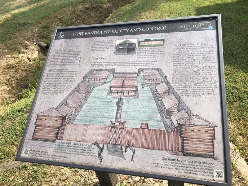
Fort Randolph: Safety and Control
Rivers to Ridges Heritage Trail
Protecting the Frontier
In 1754, Colonel George Washington ordered the Virginia regiment to construct a line of forts from the Potomac River to North Carolina along the Appalachian Mountains. Settlers hoped these forts would protect them from their enemies during the French and Indian War. More fortifications were built in the 1770s-1790s reaching to the Ohio River. This extensive network of 140+ forts in Virginia helped the United States gain control of the Ohio River Valley in 1794.
Siege of Fort Randolph
The Shawnees declared war on the Virginians after the murder of Principal Chief Cornstalk. In May 1778, a small force attempted to lure soldiers out of the fort, but Captain William McKee and his men remained inside. When asked to surrender, McKee sent his refusal by the Grenadier Squaw, the sister of Cornstalk who still sought peace between the combatants. The Shawnees attacked the fort, but could not dislodge the Virginians. Instead, they gathered and slaughtered nearby cattle and moved up the Kanawha River looking for more vulnerable targets. The fort held, but it took 16 more years for the United States to establish control of the area.
Four Forts at Point Pleasant
The Virginian militia built a Stockade, the first fort, to protect the wounded after October 10, 1774 battle of Point Pleasant.
After 1774, Captain William Russell's Fincastle Company created a "small palisaded rectangle, about eighty yards long, with block-houses at two of its corners and cabins for barracks within," the second fort. This Large Fort was named Ft. Blair after John Blair, a Virginian who died two years earlier. In June 1775, Ft. Blair was abandoned and later destroyed.
Captain Matthew Arbuckle's Virginia soldiers constructed a third floor, a Large Fort, at Point Pleasant including a stockade and blockhouses with additional buildings at the behest of the Continental Congress in 1776. garrisoned by at least 100 men and paid for by Congress, Fort Randolph was named after the president of the First Continental Congress, Peyton Randolph, who died the previous year. Principal Chief Cornstalk was murdered here in 1777 and the fort survived a siege in 1778. The fort was abandoned in 1779 and promptly burned by American Indians.
Colonel Thomas Lewis built a fourth fort, type unknown, as early as 1780 that last until at least 1792.
[Captions:]
Types of Forts
A blockhouse could simply designate a house (wood, stone, or brick) with gun slots. The term also applied to a two-story building where the second story projected beyond the first story such as Ft. Halifax, Maine (right).
A
A large fort such as Fort Randolph (below) typically combined the features of a stockade and a blockhouse, where the blockhouses were constructed as bastions at the corner(s). Additional buildings (barracks) were constructed to house soldiers for continual occupation.
Fort Randolph - Artist's Concept
Blockhouses would have been constructed at all four corners of the fort, which stood near the current American Legion at 2nd Street and Main Street in Point Pleasant. Sketch courtesy of the Fort Randolph Committee.
Erected by Rivers to Ridges Heritage Trail.
Topics. This historical marker is listed in these topic lists: Colonial Era • Forts and Castles • War, US Revolutionary • Wars, US Indian. A significant historical month for this entry is May 1778.
Location. 38° 50.235′ N, 82° 7.352′ W. Marker is in Point Pleasant, West Virginia, in Mason County. Marker is on Lighthouse Lane just west of Krodel Park Road, on the right when traveling west. Touch for map. Marker is at or near this postal address: 419 Krodel Park Rd, Point Pleasant WV 25550, United States of America. Touch for directions.
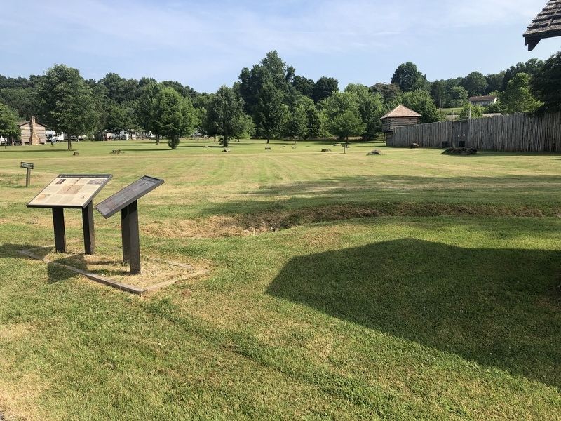
Other nearby markers. At least 8 other markers are within walking distance of this marker. The Ohio River: A Contested Frontier, 1754-1794 (here, next to this marker); Andrew & Charles Lewis March (about 700 feet away, measured in a direct line); Boone’s Trading Post (approx. 0.4 miles away); Point Pleasant - Henderson Bridge (approx. 0.9 miles away); Korean and Vietnam Wars Memorial (approx. 0.9 miles away); 502 Viand Street (approx. 0.9 miles away); Gold Star Mothers (approx. 0.9 miles away); Historic Point Pleasant (approx. 0.9 miles away). Touch for a list and map of all markers in Point Pleasant.
Credits. This page was last revised on August 3, 2021. It was originally submitted on August 3, 2021, by Devry Becker Jones of Washington, District of Columbia. This page has been viewed 311 times since then and 67 times this year. Photos: 1, 2. submitted on August 3, 2021, by Devry Becker Jones of Washington, District of Columbia.

