Alexandria in Jefferson County, New York — The American Northeast (Mid-Atlantic)
Cranberry Creek Wildlife Management Area
The Battle of Cranberry Creek
Photographed by Robert Rusaw, August 9, 2021
1. Cranberry Creek Wildlife Management Area Marker
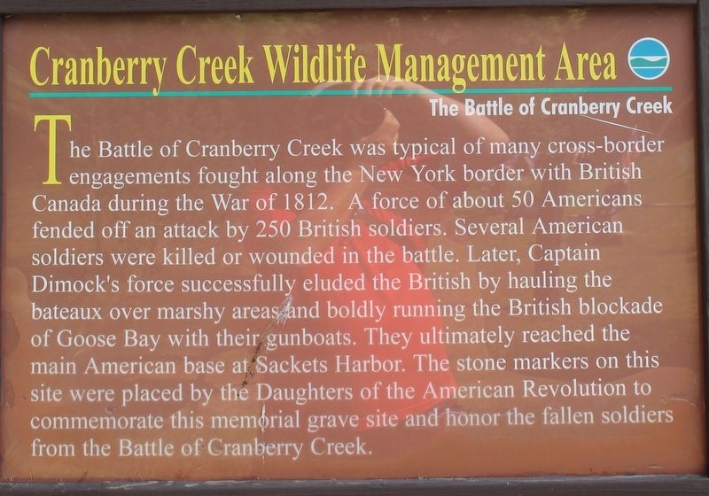
The Battle of Cranberry Creek was typical of many cross-border engagements fought along the New York border with British Canada during the War of 1812. A force of about 50 Americans fended off an attack by 250 British Soldiers. Several American soldiers were killed or wounded in the battle. Later, Captain Dimock's forces successfully eluded the British by hauling the bateaux over marshy areas and boldly running the British blockade of Goose Bay with gunboats. They ultimately reached the main American base at Sackets Harbor. The stone markers on this site were placed by the Daughters of the American Revolution to commemorate this memorial grave site and honor the fallen soldiers from the Battle of Cranberry Creek.
Topics and series. This historical marker is listed in these topic lists: Cemeteries & Burial Sites • Patriots & Patriotism • War of 1812 • Waterways & Vessels. In addition, it is included in the Daughters of the American Revolution (DAR) series list. A significant historical year for this entry is 1812.
Location. 44° 19.872′ N, 75° 52.941′ W. Marker is in Alexandria, New York, in Jefferson County.
this page online

Regionally, this marker is in Upstate New York and in the Adirondacks & North Country. It is also in the American Northeast and in the Mid-Atlantic. Globally, it is in North America, on the Great Lakes, in the Western Hemisphere, in the Western World, and in the Anglosphere. Historically, it finds itself in what was once the Viceroyalty of New France, the Haudenosaunee (Iroquois) Confederacy, New Netherland, and one of the original Thirteen Colonies.
Other nearby markers. At least 8 other markers are within 3 miles of this marker, measured as the crow flies: A different marker also named Cranberry Creek Wildlife Management Area (here, next to this marker); The Battle of Cranberry Creek (about 500 feet away, measured in a direct line); Veterans Memorial (approx. 1.7 miles away); World War Memorial (approx. 1.7 miles away); a different marker
Photographed by Robert Rusaw, August 9, 2021
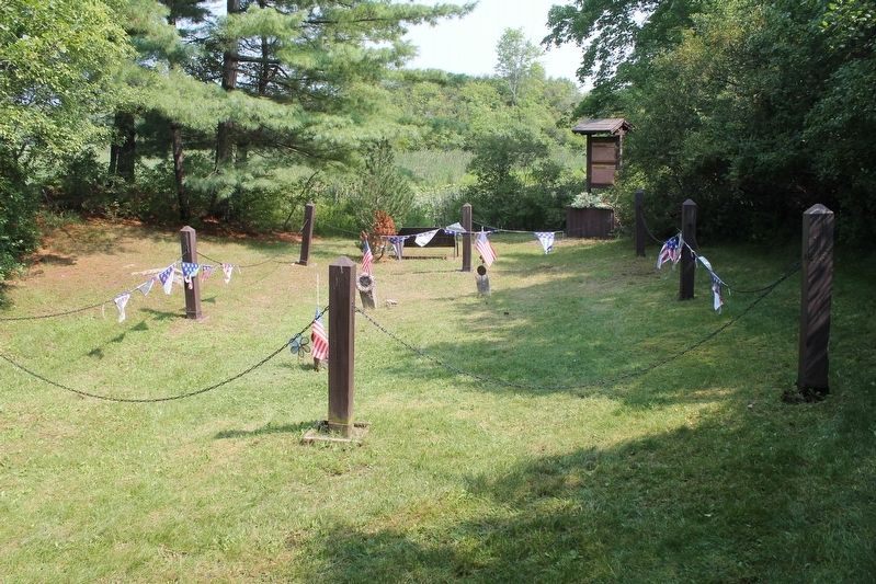
2. The Battle of Cranberry Creek burial site
Also see . . . Cranberry Creek Wildlife Management Area- New York State Department of Environmental Conservation. (Submitted on August 14, 2021, by Michael Herrick of Southbury, Connecticut.)
Additional commentary.
1. Battle of Cranberry Creek burial site
The Daughters of the American Revolution installed three polished granite markers on the shore of Cranberry Creek in memory of the fallen American soldiers in the War of 1812 battle of Cranberry Creek.
Editor’s Note: Those three granite markers qualify for inclusion in our database. We would appreciate if one of our readers that are in the area could photograph them and add them to the database.
— Submitted March 19, 2024, by Carolyn Sanders of Plano, Texas.

Photographed by Robert Rusaw, August 9, 2021
3. The Battle of Cranberry Creek burial site
Credits. This page was last revised on March 19, 2024. It was originally submitted on August 10, 2021, by Robert Rusaw of Massena, New York. This page has been viewed 485 times since then and 82 times this year. Photos: 1, 2, 3. submitted on August 10, 2021, by Robert Rusaw of Massena, New York. • Michael Herrick was the editor who published this page.
