Loup City in Sherman County, Nebraska — The American Midwest (Upper Plains)
Dead Horse Creek
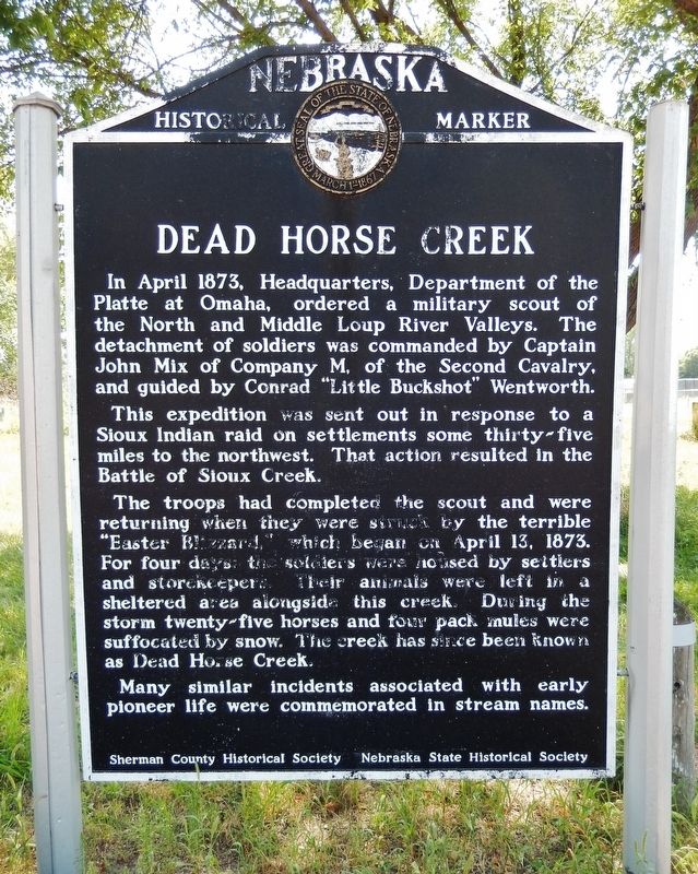
In April 1873, Headquarters, Department of the Platte at Omaha, ordered a military scout of the North and Middle Loup River Valleys. The detachment of soldiers was commanded by Captain John Mix of Company M, of the Second Cavalry, and guided by Conrad “Little Buckshot” Wentworth.
This expedition was sent out in response to a Sioux Indian raid on settlements some thirty-five miles to the northwest. That action resulted in the Battle of Sioux Creek.
The troops had completed the scout and were returning when they were struck by the terrible “Easter Blizzard,” which began on April 13, 1873. For four days, the soldiers were housed by settlers and storekeepers. Their animals were left in a sheltered area alongside this creek. During the storm twenty-five horses and four pack mules were suffocated by snow. The creek has since been known as Dead Horse Creek.
Many similar incidents associated with early pioneer life were commemorated in stream names.
Erected by Sherman County Historical Society; and Nebraska State Historical Society. (Marker Number 322.)
Topics and series. This historical marker is listed in these topic lists: Disasters • Settlements & Settlers • Wars, US Indian • Waterways & Vessels. In addition, it is included in the Nebraska State Historical Society series list. A significant historical date for this entry is April 13, 1873.
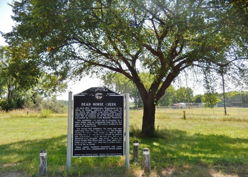
Location. 41° 16.312′ N, 98° 58.259′ W. Marker is in Loup City, Nebraska, in Sherman County. Marker is on State Highway 92 just east of State Highway 10, on the right when traveling east. Marker is located in a pull-out on the south side of Nebraska Highway 92, just north of Dead Horse Creek. Touch for map. Marker is in this post office area: Loup City NE 68853, United States of America. Touch for directions.
Other nearby markers. At least 7 other markers are within 14 miles of this marker, measured as the crow flies. The Loup City Riot, 1934 (approx. 0.3 miles away); Sherman County Courthouse (approx. 0.3 miles away); Loup City Township Carnegie Library (approx. 0.4 miles away); Jenner's Park (approx. 0.7 miles away); Austin (approx. 5.7 miles away); Arcadia Congregational Church (approx. 13.1 miles away); Arcadia Centennial 1885-1985 (approx. 13.3 miles away).
Also see . . . The Easter Blizzard of 1873. Prairie Bluestem website entry (Submitted on December 4, 2022, by Larry Gertner of New York, New York.)
Credits. This page was last revised on December 4, 2022. It was originally submitted on August 14, 2021, by Cosmos Mariner of Cape Canaveral, Florida. This page has been viewed 350 times since then and 33 times this year. Photos: 1, 2. submitted on August 14, 2021, by Cosmos Mariner of Cape Canaveral, Florida.

