Farragut in Knox County, Tennessee — The American South (East South Central)
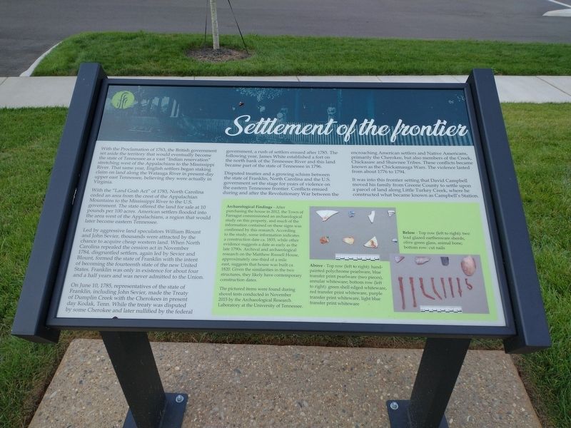
Settlement of the Frontier
With the Proclamation of 1763, the British government set aside territory that would eventually become the state of Tennessee as a vast “Indian reservation” stretching west of the Appalachians to the Mississippi River. That same year, English settlers began staking claim on land along the Watauga River in present-day upper east Tennessee, believing they were actually in Virginia.
With the “Land Grab Act” of 1783, North Carolina ceded an area from the crest of the Appalachian Mountains to the Mississippi River to the U.S. government. The state offered the land for sale at 10 pounds per 100 acres. American settlers flooded into the area west of the Appalachians, a region that would later become eastern Tennessee.
Led by aggressive land speculators William Blount and John Sevier, thousands were attracted by the chance to acquire cheap western land. When North Carolina replealed the cession act in November 1784, disgruntled settlers, again led by Sevier and Blount, formed the state of Franklin with the intent of becoming the fourteenth state of the new United States. Franklin was only in existence for about four and a half years and was never admitted to the Union.
On June 10, 1785, representatives of the state of Franklin, including John Sevier, made the Treaty of Duplin Creek with the Cherokees in present day Kodak, Tenn. While the treaty was disputed by some Cherokee and later nullified by the federal government, a rush of settlers ensued after 1785. The following year, James White established a fort on the north bank of the Tennessee River and this land became part of the the state of Tennessee in 1796.
Disputed treaties and a growing schism between the state of Franklin, North Carolina and the U.S. government set the stage for years of violence on the eastern Tennessee frontier. Conflicts ensued during and after the Revolutionary War between the encroaching American settlers and Native Americans, primarily the Cherokee, but also members of the Creek, Chickasaw and Shawnee Tribes. These conflicts became known as the Chickamauga Wars. The violence lasted from about 1776 to 1794.
It was into this frontier setting that David Campbell moved his family from Greene County to settle upon a parcel of land along Little Turkey Creek, where he constructed what became known as Campbell’s Station.
Archaeological Findings – After purchasing the house in 2012, the Town of Farragut commissioned an archaeological study on this property, and much of the information contained on these signs was confirmed by this research. According to the study, some information indicates a construction date ca. 1835, while other evidence suggests a date as early as
the late 1790s. Archival and archaeological research on the Matthew Russell House, approximately one-third of a mile east, suggest that house was built ca. 1820. Given the similarities in the two structures, they likely have contemporary construction dates.
Above – Top row (left to right): hand-painted polychrome pearlware, blue transfer print pearlware (two pieces), annular whiteware; bottom row (left to right): green shell edged whiteware, red transfer print whiteware, purple transfer print whiteware, light blue transfer print whiteware.
Below – Top row (left to right): two lead glazed earthenware shreds, olive green glass, animal bone; bottom row: cut nails.
Topics. This historical marker is listed in these topic lists: Anthropology & Archaeology • Colonial Era • Settlements & Settlers • Wars, US Indian. A significant historical date for this entry is June 10, 1785.
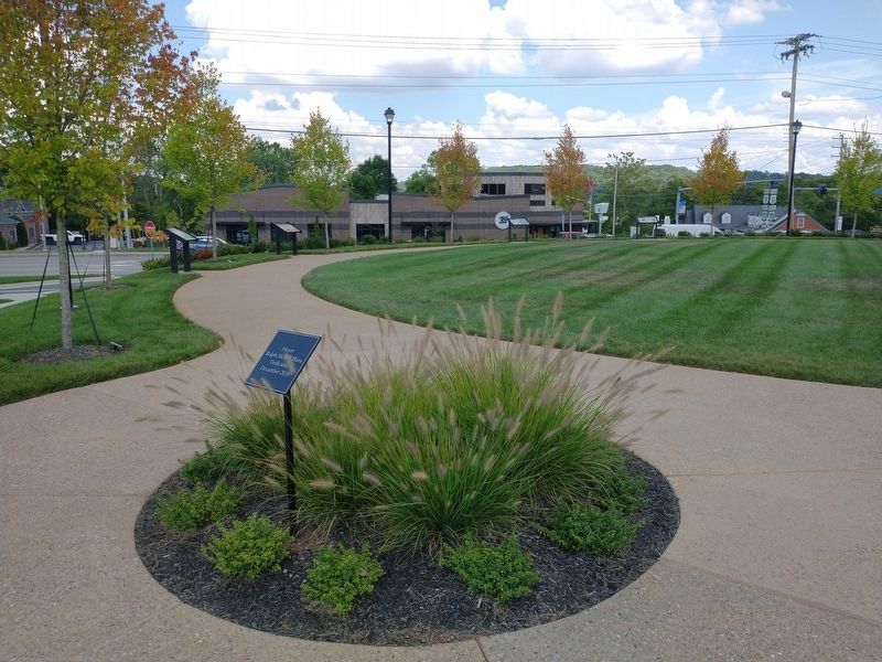
Location. 35° 52.894′ N, 84° 9.661′ W. Marker is in Farragut, Tennessee, in Knox County. Marker is at the intersection of North Campbell Station Road and Kingston Pike, on the left when traveling north on North Campbell Station Road. The marker is located in Mayor Ralph McGill Plaza. Touch for map. Marker is in this post office area: Knoxville TN 37934, United States of America. Touch for directions.
Other nearby markers. At least 8 other markers are within walking distance of this marker. David Campbell builds a station (here, next to this marker); During the Civil War (here, next to this marker); After the Civil War (here, next to this marker); Admiral David Glasgow Farragut Monument (approx. 0.2 miles away); Battle of Campbell's Station (approx. ¼ mile away); Loveville (approx. half a mile away); Archibald Roane (approx. half a mile away); David Glasgow Farragut (approx. half a mile away). Touch for a list and map of all markers in Farragut.
Related markers. Click here for a list of markers that are related to this marker.
Credits. This page was last revised on August 17, 2021. It was originally submitted on August 15, 2021, by Tom Bosse of Jefferson City, Tennessee. This page has been viewed 216 times since then and 41 times this year. Photos: 1, 2. submitted on August 15, 2021, by Tom Bosse of Jefferson City, Tennessee. • J. Makali Bruton was the editor who published this page.

