Fort Hill in Lynchburg, Virginia — The American South (Mid-Atlantic)
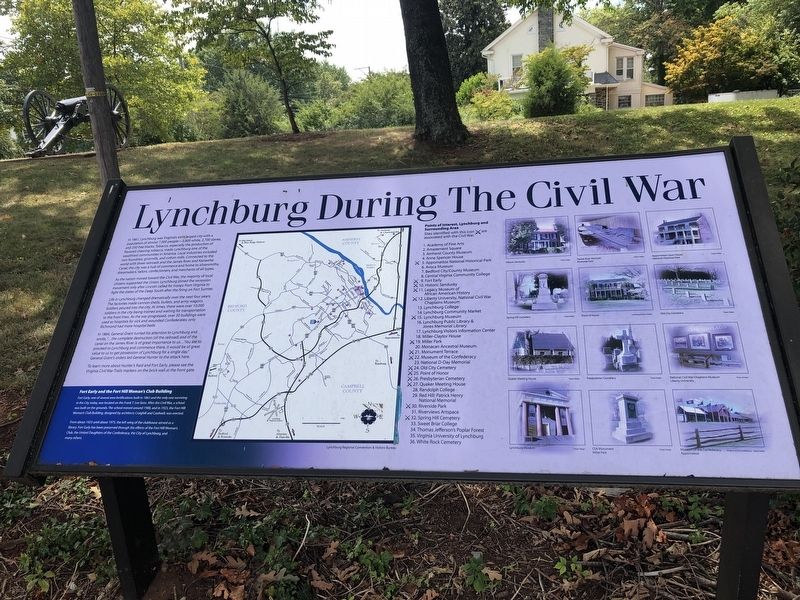
Lynchburg During The Civil War
In 1861, Lynchburg was Virginia's sixth largest city with a population of almost 7,000 people—3,800 white, 2,700 slaves, and 350 free blacks. Tobacco, especially the production of flavored chewing tobacco, made Lynchburg one of the wealthiest communities in America. Local industries included iron foundries, gristmills, and cotton mills. Connected to the world with three railroads and the James River and Kanawha Canal, the city was a hub of commerce and home to silversmiths, dressmakers, tailors, confectioners, and merchants of all types.
As the nation moved toward the Civil War, the majority of local citizens supported the Union. Lynchburg joined the secession movement only after Lincoln called for troops from Virginia to fight the states of the Deep South after firing on Fort Sumter.
Life in Lynchburg changed dramatically over the next four years. The factories made cannon shells, bullets, and army wagons. Soldiers poured into the city. At times, there were over 10,000 soldiers in the city being trained and waiting for transportation to the front lines. As the war progressed, over 30 buildings were used as hospitals for sick and wounded Confederates; only Richmond had more hospital beds.
In 1864, General Grant turned his attention to Lynchburg and wrote, "…the complete destruction [of the railroad] and of the canal on the James River is of great importance to us… You are to proceed to Lynchburg and commence there. It would be of great value to us to get possession of Lynchburg for a single day." General Grant's orders led General Hunter to the attack here.
To learn more about Hunter's Raid and Fort Early, please see the Virginia Civil War Trails markers on the brick wall at the front gate.
[Sidebar:]
Fort Early and the Fort Hill Woman's Club Building
Fort Early, one of several area fortifications built in 1863 and the only one surviving in the City today, was located on the Frank T. Lee farm. After the Civil War, a school was built on the grounds. The school moved around 1900, and in 1923, the Fort Hill Woman's Club Building, designed by architects Craighill and Cardwell, was erected.
From about 1923 until about 1975, the left wing of the clubhouse served as a library. Fort Early has been preserved through the efforts of the Fort Hill Woman's Club, the United Daughters of the Confederacy, the City of Lynchburg, and many others.
Topics. This historical marker is listed in these topic lists: Forts and Castles • Industry & Commerce • War, US Civil • Waterways & Vessels. A significant historical year for this entry is 1861.
Location. 37° 23.397′ N, 79° 10.393′ W. Marker is in Lynchburg, Virginia. It is in Fort Hill. Marker is at the intersection of Memorial Avenue (Virginia Route 163) and Fort Avenue (Business U.S. 460), on the left when traveling north on Memorial Avenue. Touch for map. Marker is in this post office area: Lynchburg VA 24501, United States of America. Touch for directions.
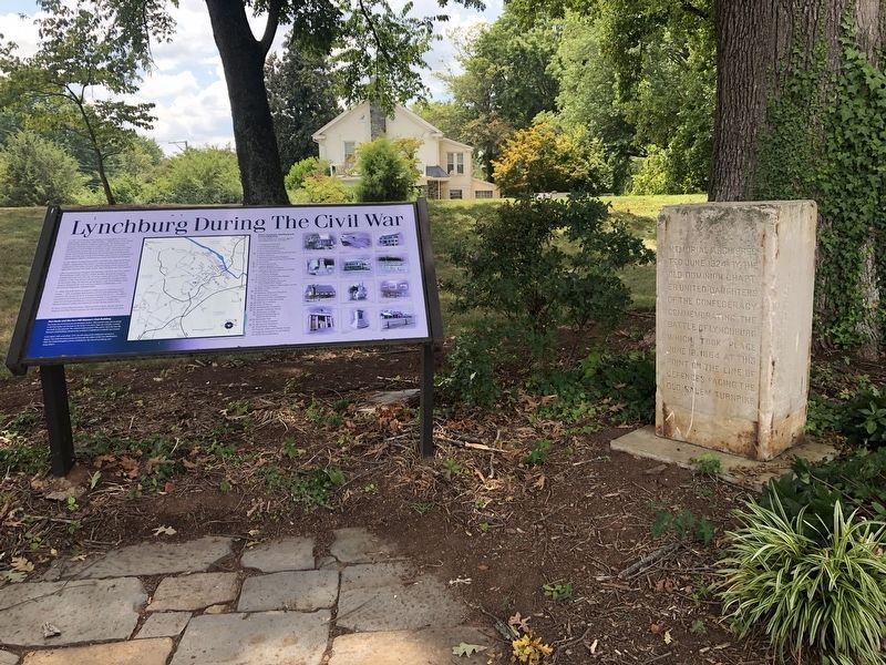
Other nearby markers. At least 8 other markers are within one mile of this marker, measured as the crow flies. Battle of Lynchburg Memorial Arch (here, next to this marker); This Reservation (here, next to this marker); Jubal Early Memorial (within shouting distance of this marker); Fort Early (within shouting distance of this marker); a different marker also named Fort Early (within shouting distance of this marker); Spring Hill Cemetery (approx. 0.6 miles away); Lynchburg College (approx. 0.9 miles away); Memorial Avenue (approx. one mile away). Touch for a list and map of all markers in Lynchburg.
Credits. This page was last revised on February 1, 2023. It was originally submitted on August 16, 2021. This page has been viewed 119 times since then and 21 times this year. Photos: 1, 2. submitted on August 16, 2021.

