Near Gilboa in Schoharie County, New York — The American Northeast (Mid-Atlantic)
The Long Path
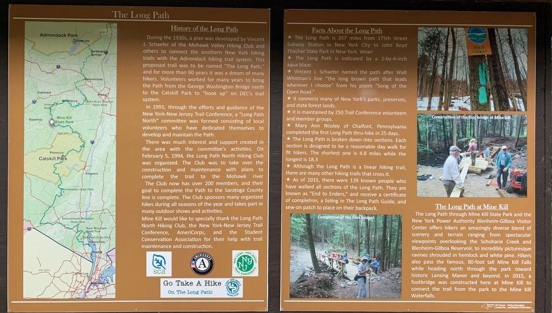
History of the Long Path
During the 1930s, a plan was developed by Vincent J. Schaefer of the Mohawk Valley Hiking Club and others to connect the southern New York hiking trails with the Adirondack hiking trail system. This proposed trail was to be named "The Long Path," and for more than 60 years it was a dream of many hikers. Volunteers worked for many years to bring the Path from the George Washington Bridge north to the Catskill Park to "hook up” on DEC's trail system.
In 1991, through the efforts and guidance of the New York-New Jersey Trail Conference, a "Long Path North” committee was formed consisting of local volunteers who have dedicated themselves to develop and maintain the Path. There was much interest and support created in the area with the committee's activities. On February 5, 1994, the Long Path North Hiking Club was organized. The Club was to take over the construction and maintenance with plans to complete the trail to the Mohawk River.
The Club now has over 200 members, and their goal to complete the Path to the Saratoga County line is complete. The Club sponsors many organized hikes during all seasons of the year and takes part in many outdoor shows and activities.
Mine Kill would like to specially thank the Long Path North Hiking Club, the New York-New Jersey Trail Conference, AmeriCorps, and the Student Conservation Association for their help with trail maintenance and construction.
Facts About the Long Path
* The Long Path is 357 miles from 175th Street Subway Station in New York City to John Boyd Thacher State Park in New York. Wow!
* The Long Path is indicated by a 2-by-4-inch aqua blaze.
* Vincent J. Schaefer named the path after Walt Whitman's line "the long brown path that leads wherever I choose” from his poem "Song of the Open Road."
* It connects many of New York's parks, preserves, and state forest lands.
* It is maintained by 250 Trail Conference volunteers and member groups.
* Mary Ann Nissley of Chalfont, Pennsylvania completed the first Long Path thru-hike in 25 days.
* The Long Path is broken down into sections. Each section is designed to be a reasonable day walk for fit hikers. The shortest one is 4.8 miles while the longest is 18.3
* Although the Long Path is a linear hiking trail, there are many other hiking trails that cross it.
* As of 2015, there were 139 known people who have walked all sections of the Long Path. They are known as "End to Enders,” and receive a certificate of completion, a listing in The Long Path Guide, and sew-on patch to place on their backpack.
The Long Path at Mine Kill
The Long Path through Mine Kill State Park and the New York Power Authority Blenheim-Gilboa Visitor Center offers hikers an amazingly diverse blend of scenery and terrain ranging from spectacular viewpoints overlooking the Schoharie Creek and Blenheim-Gilboa Reservoir, to incredibly picturesque ravines shrouded in hemlock and white pine. Hikers also pass the famous, 80-foot tall Mine Kill Falls while heading north through the park toward historic Lansing Manor and beyond. In 2015, a footbridge was constructed here at Mine Kill to connect the trail from the park to the Mine Kill Waterfalls.
Erected by New York Parks, Recreation, and Historic Preservation, NY Power Authority.
Topics. This historical marker is listed in these topic lists: Parks & Recreational Areas • Roads & Vehicles • Sports. A significant historical date for this entry is February 5, 1994.
Location. 42° 25.643′ N, 74° 28.309′ W. Marker is near Gilboa, New York, in Schoharie County. Marker can be reached from New York State Route 30, 0.1 miles north of Mine Kill Road, on the right when traveling north. Marker is at the Mine Kills Falls Overlook. Touch for map. Marker is in this post office area: Gilboa NY 12076, United States of America. Touch for directions.
Other nearby markers. At least 8 other markers are within 3 miles of this marker, measured as the crow flies. Town of Gilboa (a few steps from this marker); Blenheim-Gilboa Bluebird Trail (approx. 0.9 miles away); Manor House (approx. 1˝ miles away); The Gilboa Fossils (approx. 2.4 miles away); Schoharie County (approx. 2.4 miles away); Gilboa Settlement (approx. 2.7 miles away); Gen. Freegift Patchin (approx. 2.9 miles away); Indian Trail (approx. 3 miles away). Touch for a list and map of all markers in Gilboa.
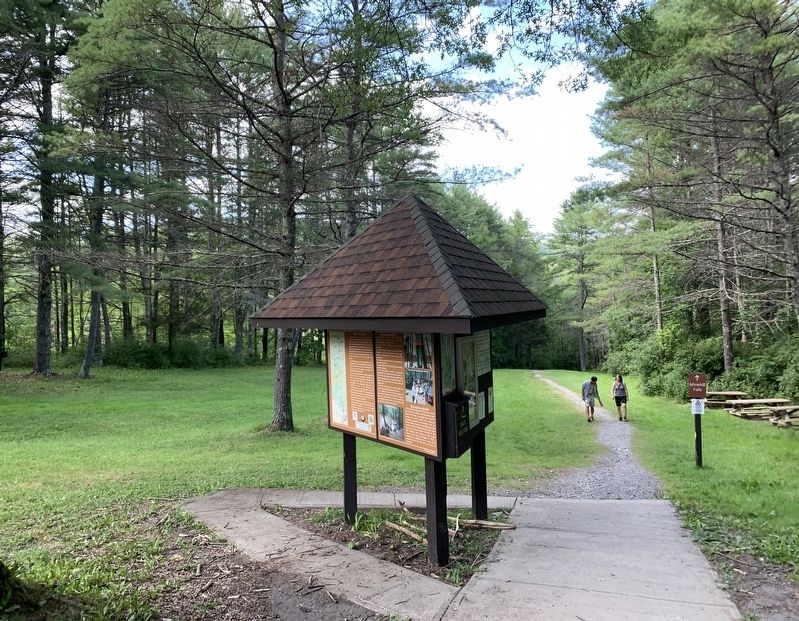
More about this marker. The marker has three sides, the first side presented the Long Path, the next side described animals in the area, and the last last side described the the Blenheim-Gilboa Pumped Storage Power Project. The latter two sides had no historic data, and were not transcribed.
Additional commentary.
1. Completing the Long Path north of Thacher Park by Landmarks of Vincent J Schaefer
The original vision of the Long Path was to have a hiking trail celebrating the eastern NY highlands from New York City to the top of Whiteface Man in the northern Adirondacks. From the 1960s to 2020, the traditional Long Path hike has started near New York City and "ended" at Thacher Park just outside of Albany. However, the originator, the late Vincent J Schaefer (1906-1993), suggested that a continuous trail would be foolhardy in the populated areas of the Capital District--Albany County, Schenectady County, etc. So in 1991 he completed his revised vision by creating for the Long Path north of Gilboa, NY, a 15 mile wide corridor with 80+ "Landmarks" --- places of cultural, geologic, historic or with spectacular views that were identified in his typewritten & pocket-sized "Field Guide to Landmarks of the Long Path Northern Section from Gilboa to Whiteface."
In 2021 Dave Bourque and Jim Schaefer (son of VJS) put together a scan of Schaefer's unpublished "Field Guide" showing all of Long Path North landmarks. What's more, Warren County Planning Department agreed to adopt the Long Path North Landmarks as an ongoing project for all locations north of Gilboa--including many ion Warren County.
The Long Path North Project has developed a documenting website that functions currently for the purposes of providing accurate details about each of the 80+ landmarks. Each will be GPS located, mapped, photographed, trailhead or related access identified, nearby attractions and more during the 2021-2022 hiking seasons. Hikers will be encouraged to "complete" the Long Path using the landmarks as points of completion. More information will be forthcoming so that the Historical Marker Database has everything and links to the ongoing work of the Long Path North Project. Note To Editor only visible by Contributor and editor
— Submitted December 28, 2021, by James M Schaefer of Schenectady, New York.
Credits. This page was last revised on January 29, 2022. It was originally submitted on August 17, 2021, by Steve Stoessel of Niskayuna, New York. This page has been viewed 191 times since then and 23 times this year. Photos: 1, 2. submitted on August 17, 2021, by Steve Stoessel of Niskayuna, New York. • Michael Herrick was the editor who published this page.

