Near Mercer in Mercer County, Missouri — The American Midwest (Upper Plains)
Mercer County
[side 1]
Here in Missouri's north central glacial plains, Mercer County was organized, 1845. Named for Rev. War Gen. Hugh Mercer, the county is in territory ceded by Iowa, Sac, and Fox tribes in 1824. Indians hunted in the area into the 1840's. The first settler in Mercer County, James Parsons, came to what is now Princeton, 1837. Early settlers were from Ky., Tenn., Ohio, and Ill.
Princeton, the county seat, was laid out, 1846, on high ground overlooking the Weldon River Valley and named for 1777 Battle of Princeton where General Mercer lost his life. With coming of Chicago, Rock Is. & Pac. R.R., 1871, the town grew as shipping and trading point. From 1871 to 1911, Princeton suffered a number of damaging fires, one side of the square burned five times.
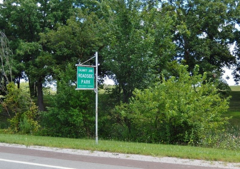
Calamity Jane, colorful character of the western frontier, was born Martha Jane Canary near Princeton about 1852. By her claim she was pony-express rider and scout with Gen. George Custer. She died in 1903 and is buried by Wild Bill Hickok in Deadwood, S. Dak. Calamity Jane Roadside Park near Princeton was named for her.
[side 2]
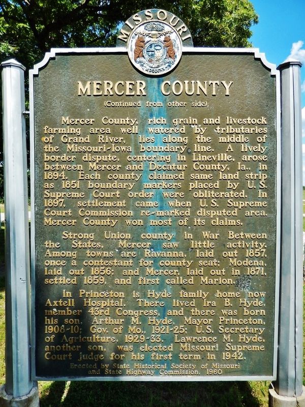
Mercer County, rich grain and livestock farming area well watered by tributaries of Grand River, lies along the middle of the Missouri-Iowa boundary line. A lively border dispute, centering in Lineville, arose between Mercer and Decatur County, Ia., in 1894. Each county claimed same land strip as 1851 boundary markers placed by U.S. Supreme Court order were obliterated. In 1897, settlement came when U.S. Supreme Court Commission re-marked disputed area. Mercer County won most of its claims.
Strong Union county in War Between the States, Mercer saw little activity. Among towns are Ravanna, laid out 1857, once a contestant for county seat; Modena, laid out 1858; and Mercer, laid out in 1871, settled 1859, and first called Marion.
In Princeton is Hyde family home now Axtell Hospital. There lived Ira B. Hyde, member 43rd Congress, and there was born his son, Arthur M. Hyde, Mayor Princeton, 1908-10; Gov. of Mo., 1921-25; U.S. Secretary of Agriculture, 1929-33. Lawrence M. Hyde, another son, was elected Missouri Supreme Court Judge for his first term in 1942.
Erected 1960 by State Historical Society of Missouri; and State Highway Commission.
Topics and series. This historical marker is listed in these topic lists: Native Americans • Settlements & Settlers • War, US Civil • Women. In addition, it is included in the Missouri, The State Historical Society of series list. A significant historical date for this entry is February 14, 1845.
Location. 40° 27.422′ N, 93° 32.818′ W. Marker is near Mercer, Missouri, in Mercer County. Marker can be reached from Emmy Place (U.S. 65) just north of Design Place (Empire Loop), on the right when traveling north. Marker is located near the picnic tables on the east side of Calamity Jane Roadside Park. Touch for map. Marker is in this post office area: Mercer MO 64661, United States of America. Touch for directions.
Other nearby markers. At least 3 other markers are within 5 miles of this marker, measured as the crow flies. Calamity Jane (approx. 4.6 miles away); Princeton (approx. 4.6 miles away); In Honor of Our Boys Who Answered Their Country's Call (approx. 4.6 miles away).
Also see . . .
1. Mercer County (Wikipedia). Most Mercer county residents had roots in northern U.S. states "back east" like Pennsylvania, Ohio, and Indiana, and did not have the strong slave-holding tradition of other northern Missouri counties like Macon, Audrain, and Monroe, whose population largely emigrated from Southern states. Fewer than 20 Mercer County men fought for the Confederacy, while well over 1,000 volunteered for Union service. (Submitted on August 17, 2021, by Cosmos Mariner of Cape Canaveral, Florida.)
2. History of Mercer County. It is not known that any white man settled in the territory now Mercer County until 1837, and up to that time the land was the hunting place of tribes of Fox, Sioux and Pottawottomie Indians. The first
to visit the county were traders, who made no permanent residence, but would spend a few months each year in bartering for the peltries of the Indians. (Submitted on August 17, 2021, by Cosmos Mariner of Cape Canaveral, Florida.)
Credits. This page was last revised on September 3, 2021. It was originally submitted on August 17, 2021, by Cosmos Mariner of Cape Canaveral, Florida. This page has been viewed 431 times since then and 78 times this year. Photos: 1, 2, 3, 4, 5. submitted on August 17, 2021, by Cosmos Mariner of Cape Canaveral, Florida.


