Tacoma in Pierce County, Washington — The American West (Northwest)
Browns Point Light Station
Photographed by William Fischer, Jr., August 3, 2021
1. Browns Point Light Station Marker
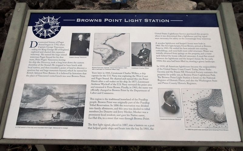
Documented history of Puget Sound began in 1792, when Captain George Vancouver, sailing for King George III of England, explored and charted this expansive waterway. He named the large inland waterway Puget Sound for his first mate, Peter Puget. Vancouver, leaving his ship the Discovery, took a long boat down the eastern shoreline of the Sound. He stopped to have lunch with local natives, and then rounded a point of land to discover a spacious bay and large mountain beyond, which he named for British Admiral Peter Rainier. It is believed by historians that the place of Vancouver's noted lunch was near Browns Point.
Years later in 1841, Lieutenant Charles Wilkes, a ship captain for the U.S. Navy, was exploring the West Coast and Puget Sound. He charted and named this site Point Harris after a sail maker on his ship. In 1877, Lieutenant Ambrose Wyckoff of the U.S. Navy surveyed the point area and renamed it Point Brown. Finally, in 1903, the name was officially changed to Browns Point by the Department of Labor and Commerce.
This region is the traditional homeland of the Puyallup people. Browns Point was originally part
this page online
The first light signal, placed in 1887, was a lantern on a post that helped guide ships and boats into the bay. In 1901, the United States Lighthouse Service purchased this property when it was determined that a lighthouse and fog signal were necessary for safety on the increasingly busy waterway.
A wooden lighthouse and keeper's house were built in 1903. The first light keeper, Oscar Brown, arrived at Browns Point in 1903. He settled his farm animals into existing outbuildings, and soon built more solid structures. Water was initially obtained from springs on the property, and a water tank behind the house collected rainwater. A mud flat existed between the lighthouse and the keeper's house. By the early 1930s this area had been filled in, creating a grassy landscape.
In 1939, all American lighthouses became the responsibility of the United States
Photographed by William Fischer, Jr., August 3, 2021
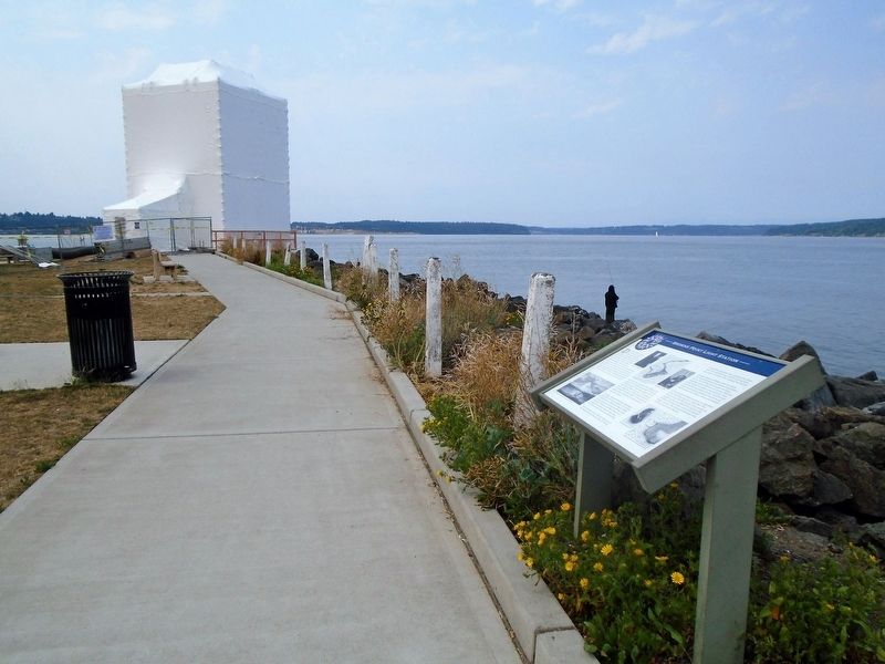
2. Browns Point Light Station Marker
[Photo captions, clockwise from bottom left, read]
• A 1792 sketch of the bay and mountain from Capt. Vancouver's voyage.
• Captain George Vancouver
• Browns Point was originally named Point Harris in 1841, after a sailmaker on Lieutenant Wilke's [sic] ship.
• Lieutenant Charles Wilkes
• Lieutenant Ambrose Wyckoff
• In 1888 the point was surveyed and renamed Point Brown
Erected by Points NE Historical Society.
Topics and series. This historical marker is listed in these topic lists: Charity & Public Work • Communications • Parks & Recreational Areas • Waterways & Vessels. In addition, it is included in the Lighthouses series list. A significant historical year for this entry is 1792.
Location. 47° 18.361′ N, 122° 26.624′ W. Marker is in Tacoma, Washington, in Pierce County. It can be reached from Tulalip Street
Photographed by William Fischer, Jr., August 3, 2021
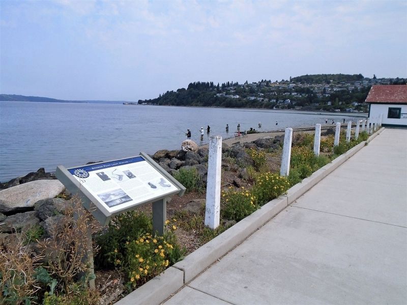
3. Browns Point Light Station Marker

Regionally, this marker is in the Puget Sound Region and in Greater Seattle. It is also on the American Pacific Coast, in the Pacific Northwest, and in the Lewis & Clark Corridor. Globally, it is in North America, in the Cascade Range, in the Inside Passage, on the Ring of Fire, on the Pacific Rim, in the Western Hemisphere, in the Western World, and in the Anglosphere.
Other nearby markers. At least 8 other markers are within walking distance of this marker: Generator Building (within shouting distance of this marker); Captain George Vancouver at Browns Point (within shouting distance of this marker); Boat House and Oil House (within shouting distance of this marker); The Browns Point Light Keeper's Cottage (within shouting distance of this marker); Light Keeper's Cottage (within shouting distance of this marker); The Browns Point Lighthouse (within shouting distance of this marker); Crew Quarters (within shouting distance
via Metro Parks Tacoma, unknown
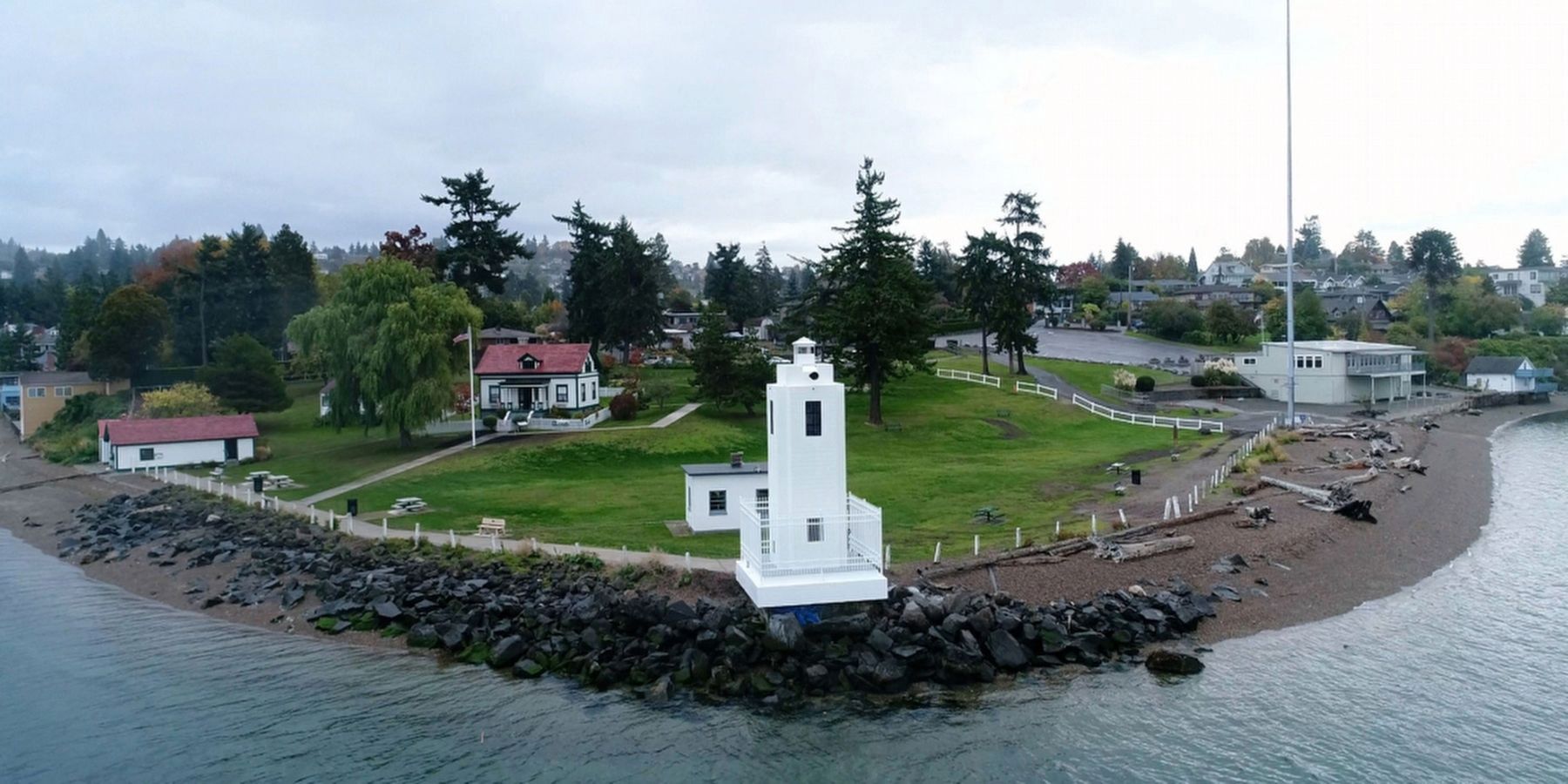
4. Browns Point Light Station - after renovation
National Register of Historic Places Nomination Form
Click for more information.
Click for more information.
Another marker is no longer nearby. The Browns Point Boat House and Oil House (was within shouting distance of this marker but has been replaced with another marker now near it).
Also see . . .
1. Browns Point Lighthouse Park. Metro Parks Tacoma website entry (Submitted on August 22, 2021, by William Fischer, Jr. of Reynoldsburg, Ohio.)
2. Lighthouse Restoration Is Happening Now!. Points NE Historical Society website entry (Submitted on August 22, 2021, by William Fischer, Jr. of Reynoldsburg, Ohio.)
Credits. This page was last revised on October 23, 2021. It was originally submitted on August 22, 2021, by William Fischer, Jr. of Reynoldsburg, Ohio. This page has been viewed 388 times since then and 43 times this year. Photos: 1, 2, 3. submitted on August 22, 2021, by William Fischer, Jr. of Reynoldsburg, Ohio. 4. submitted on October 22, 2021, by Larry Gertner of New York, New York.
