Near Glenpool in Tulsa County, Oklahoma — The American South (West South Central)
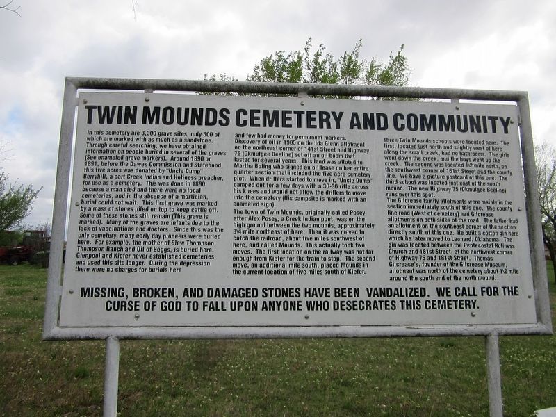
Twin Mounds Cemetery and Community
In this cemetery are 3,300 grave sites, only 500 of which are marked with as much as a sandstone. Through careful searching, we have obtained information on people buried in several of the graves (See enameled grave markers). Around 1890 or 1891, before the Dawes Commission and Statehood, this five acres was donated by "Uncle Dump" Berryhill, a part Creek Indian and Holiness preacher, for use as a cemetery. This was done in 1890 because a man died and there were no local cemeteries, and in the absence of a mortician, burial could not wait. This first grave was marked by a mass of stones piled on top to keep cattle off. Some of these stones still remain (This grave is marked). Many of the graves are infants due to the lack of vaccinations and doctors. Since this was the only cemetery, many early day pioneers were buried here. For example, the mother of Slew Thompson, Thompson Ranch and Oil of Beggs, is buried here. Glenpool and Kiefer never established cemeteries and used this site longer. During the depression there were no charges for burials here and few had money for permanent markers. Discovery of oil in 1905 on the Ida Glenn allotment on the northeast corner of 141st Street and Highway 75 (Okmulgee Beeline) set off an oil boom that lasted for several years. This land was allotted to Martha Boling she signed an oil lease on her entire quarter section that included the five acre cemetery plot. When drillers started to move in, "Uncle Dump" camped out for a few days with a 30-30 rifle across his knees and would not allow the drillers to move into the cemetery (His campsite is marked with an enameled sign).
The town of Twin Mounds, originally called Posey, after Alex Posey, a Creek Indian poet, was on the high ground between the two mounds, approximately 3/4 mile northeast of here. Then it was moved to catch the railroad, about five miles southwest of here, and called Mounds. This actually took two moves. The first location on the railway was not far enough from Kiefer for the train to stop. The second move, an additional mile south, placed Mounds in the current location of five miles south of Kiefer.
Three Twin Mounds schools were located here. The first, located just north and slightly west of here along the small creek, had no bathrooms. The girls went down the creek, and the boys went up the creek. The second was located 1/2 mile north, on the southwest corner of 161st Street and the county line. We have a picture postcard of this one. The third school was located just east of the south mound. The new Highway 75 (Okmulgee Beeline) runs over this spot.
The Gilcrease family allotments were mainly in the section immediately south of this one. The county line road (West of cemetery) had Gilcrease allotments on both sides of the road. The father had an allotment on the southeast corner of the section directly south of this one. He built a cotton gin here which he later moved to Leonard, Oklahoma. The gin was located between the Pentecostal Holiness Church and 181st Street, at the northwest corner of Highway 75 181st Street. Thomas Gilcrease's founder of the Gilcrease Museum, allotment was north of the cemetery about 1/2 mile around the south end of the north mound.
Missing, broken, and damaged stones have been vandalized. We call for the curse of God to fall upon anyone who desecrates this cemetery.
Topics. This historical marker is listed in these topic lists: Cemeteries & Burial Sites • Native Americans • Railroads & Streetcars • Settlements & Settlers. A significant historical year for this entry is 1880.
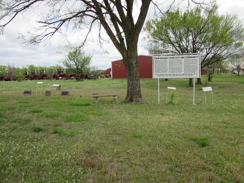
Location. 35° 55.324′ N, 96° 1.724′ W. Marker is near Glenpool, Oklahoma, in Tulsa County. Marker is on 33rd West Avenue, 2 miles south of State Route 67, on the right when traveling north. The marker is located inside the cemetery. Touch for map. Marker is in this post office area: Glenpool OK 74033, United States of America. Touch for directions.
Other nearby markers. At least 8 other markers are within 9 miles of this marker, measured as the crow flies. Twin Mounds Community (within shouting distance of this marker); First Gas Processing Plant West of Mississippi River (approx. 2.7 miles away);
Glenn Pool (approx. 2.7 miles away); Sapulpa (approx. 6.1 miles away); Earle Berryhill Building (approx. 7.1 miles away); Rock Creek Bridge (approx. 7.8 miles away); Washington Irving (approx. 8.4 miles away); Washington Irving’s Camp (approx. 8.4 miles away). Touch for a list and map of all markers in Glenpool.
Additional commentary.
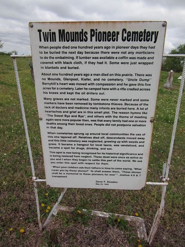
1. Additional marker text
When people died one hundred years ago in pioneer days they had to buried the next day because there were not any morticians to do the embalming. If lumber was available a coffin was made and covered with black cloth, if they had it. Some were just wrapped in blankets and buried.
About one hundred years ago a man died on this prairie. There was no Mounds, Glenpool, Kiefer, and no cemetery. "Uncle Dump" Berryhill's heart was moved with compassion and he gave this five acres for a cemetery. Later he camped here with a rifle cradled across his knees and kept the oil drillers out.
Many graves are not marked. Some were never marked and some markers have been removed by tombstone thieves. Because of the lack of doctors and medicine many infants are buried here. A lot of heartaches and grief are in this small plot. The reason hymns like "The Sweet Bye and Bye", and others with the theme of meeting again were more popular then, was that every family had one or more deaths among their loved ones. People did not postpone salvation in that day.
When cemeteries sprung up around local communities the use of this one tapered off. Relatives died off, descendants moved away and this little cemetery was neglected, growing up with weeds and grass. It became a hangout for local teens, was vandalized, and became a spot for drugs, drinking, and sex.
This spot is now being recognized for its historical significance and is being restored from neglect. These dead were once as active as you and I when they began to settle this part of the world. We ask you enter this spot with respect for them.
"When your children ask their fathers in time to come saying, "What mean you by these stones?" Ye shall answer them, "These stones shall be a memorial to these pioneers. for ever". Joshua 4:6 & 7 transposed.
Gene F. Sivadon
May 25, 1992
— Submitted September 2, 2021.
Credits. This page was last revised on September 2, 2021. It was originally submitted on August 30, 2021, by Jason Armstrong of Talihina, Oklahoma. This page has been viewed 457 times since then and 88 times this year. Photos: 1, 2, 3. submitted on August 30, 2021, by Jason Armstrong of Talihina, Oklahoma. • J. Makali Bruton was the editor who published this page.


