Warwick, Hamlet of Pine Island in Orange County, New York — The American Northeast (Mid-Atlantic)
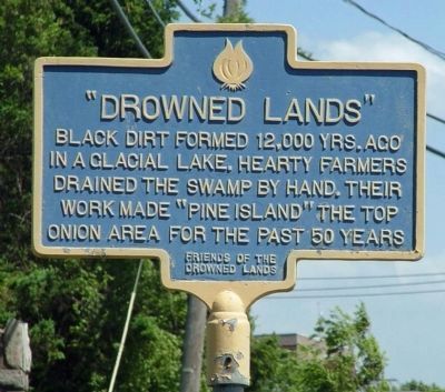
“Drowned Lands”
Erected by Friends of the Drowned Lands.
Topics. This historical marker is listed in these topic lists: Agriculture • Man-Made Features • Natural Features • Notable Places.
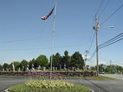
Location. 41° 17.816′ N, 74° 27.836′ W. Marker is on Warwick, Hamlet of Pine Island, New York, in Orange County. Marker is on Pine Island Turnpike (County Route 1) 0.1 miles west of Pulaski Highway (County Route 6), on the right. Touch for map. Marker is at or near this postal address: 664 Pine Island Tpke, Pine Island NY 10969, United States of America. Touch for directions.
Other nearby markers. At least 8 other markers are within 5 miles of this marker, measured as the crow flies. Amity Church (approx. 2 miles away); Edenville (approx. 3.1 miles away); South Orange Memorial Rock - WWII (approx. 3.6 miles away in New Jersey); Lime Kiln (approx. 3.9 miles away); Spanktown School (approx. 4.2 miles away); Price's Switch Schoolhouse (approx. 4.8 miles away in New Jersey); Orange County (approx. 4.8 miles away); Masonic Lodge (approx. 4.8 miles away).
Also see . . .
1. Drowned Lands of the Wallkill. As recorded in History of Sussex and Warren Co., NJ, By James P. Snell, 1881
Transcribed by Joe Bartolotta, February 2004 (Submitted on May 16, 2010.)
2. The Black Dirt Region. A short Wikipedia article on the area. (Submitted on May 16, 2010.)
3. Drowned Lands of the Wallkill. (Submitted on May 17, 2010, by Clifton Patrick of Chester, NY, United States.)
4. Wikipedia entry for the Black Dirt Region. (Submitted on May 17, 2010, by Clifton Patrick of Chester, NY, United States.)
Credits. This page was last revised on September 6, 2021. It was originally submitted on May 9, 2010, by Clifton Patrick of Chester, NY, United States. This page has been viewed 1,269 times since then and 28 times this year. Last updated on September 1, 2021, by Sue Gardner of Warwick, New York. Photos: 1, 2. submitted on May 9, 2010, by Clifton Patrick of Chester, NY, United States. • Michael Herrick was the editor who published this page.

