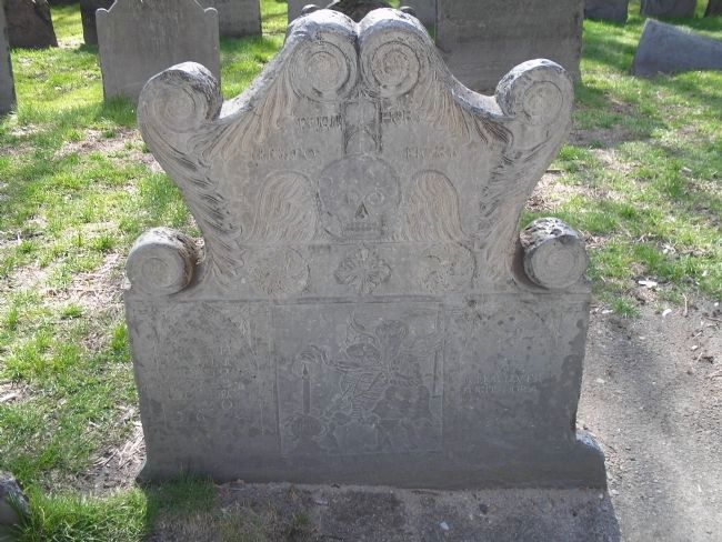
Downtown in Boston in Suffolk County, Massachusetts — The American Northeast (New England)
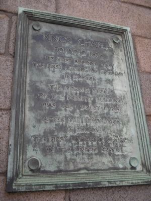
King's Chapel
Founded 1686
Inscription.
Its first building was the first Church of England in Boston.
The corner stone of the present building was laid August 11, 1749.
After the Revolution it became the first Unitarian church in the United States.
Erected by Kings Chapel.
Topics and series. This historical marker is listed in these topic lists: Churches & Religion • Colonial Era. In addition, it is included in the National Historic Landmarks, and the Unitarian Universalism (UUism) series lists. A significant historical year for this entry is 1686.
Location. 42° 21.483′ N, 71° 3.612′ W. Marker is in Boston, Massachusetts, in Suffolk County. It is in Downtown. Marker is at the intersection of Tremont Street and School Street, on the left when traveling south on Tremont Street. Touch for map. Marker is in this post office area: Boston MA 02108, United States of America. Touch for directions.
Other nearby markers. At least 8 other markers are within walking distance of this marker. The Chevalier de Saint Sauveur (a few steps from this marker); Life and Death in Colonial Boston (a few steps from this marker); a different marker also named King's Chapel (a few steps from this marker); King's Chapel and Beyond (a few steps from this marker); Omni Hotels: The Parker House (a few steps from this marker); King’s Chapel Burial Ground (within shouting distance of this marker); Welcome to King’s Chapel Burying Ground (within shouting distance of this marker); William Dawes Jr. (within shouting distance of this marker). Touch for a list and map of all markers in Boston.
Also see . . .
1. King's Chapel and Burying Ground. Details of the Freedom Trail from the City of Boston website. (Submitted on April 19, 2009, by Bill Coughlin of Woodland Park, New Jersey.)
2. A Brief History. History page on King's Chapel's web site. (Submitted on November 20, 2021, by Devry Becker Jones of Washington, District of Columbia.)
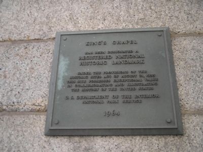
Photographed By Bill Coughlin, April 14, 2009
3. National Historic Landmark Marker
has been designated a
Registered National
Historic Landmark
Under the provisions of the
Historic Sites Act of August 21, 1935
this site possesses exceptional value
in commemorating or illustrating
the history of the United States
U.S. Department of the Interior
National Park Service
1964
Credits. This page was last revised on January 30, 2023. It was originally submitted on April 19, 2009, by Bill Coughlin of Woodland Park, New Jersey. This page has been viewed 1,250 times since then and 41 times this year. Photos: 1, 2, 3, 4, 5, 6. submitted on April 19, 2009, by Bill Coughlin of Woodland Park, New Jersey.
