Near Chivington in Kiowa County, Colorado — The American Mountains (Southwest)
Sand Creek as Camp Site
Sand Creek Massacre National Historic Site
Photographed by Connor Olson, August 30, 2021
1. Sand Creek as Camp Site Marker
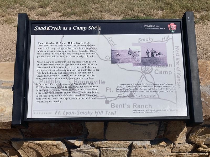
Camp Site Along the Smokey Hill Lodgepole Trail
In the 1800's Plains tribes like the Cheyenne and Arapaho moved their camps using travois to carry their possessions. Made by securing lodge poles to a horse, the ends of the travois dragged along the ground, creating trails across the prairie. These trails came to be known as lodge pole trails.
When moving to a different camp, the tribes would go from one water source to the next, generally within the distance a person could walk in a day. Rivers, creeks, small lakes, and springs were favorable camping areas. The Smoky Hill Lodge Pole Trail had many such areas along it, including Sand Creek. The Cheyenne, Arapaho, and the other plains tribes used these trails and camped by water sources near them.
In October, 1864, the Cheyenne and Arapaho chose Sand Creek as their camp site while they waited for news on peace talks. There were many reasons to choose Sand Creek. Even when water wasn't present in the creek, a trench could be dug into the creek bed and the water that pooled into it supplied camp livestock. Fresh water springs nearby provided water for
this page online
“A lodge trail ran from near Fort Lyon in a northeasterly direction to the head of the Smoky Hill, and we were encamped where this trail crossed Sand Creek. This place was well known to all the Cheyennes and Arapahos and they had used it as a camping ground for many years.”
George Bent (from Life of George Bent by George Hyde)
Caption: Many tribes, including the Blackfoot (pictured on right) and the Cheyenne (pictured on left) used travois of varying shapes and sizes.
Erected by National Park Service.
Topics. This historical marker is listed in this topic list: Indigenous Peoples and Communities. A significant historical month for this entry is October 1864.
Location. 38° 32.838′ N, 102° 30.466′ W. Marker is near Chivington, Colorado, in Kiowa County. It can be reached from County Highway W east of Chief White Antelope Way. Located on the Monument Hill Trail. Touch for map. Marker is in this post office area: Eads CO 81036, United States of America. Touch for directions.

Regionally, this marker is in the Eastern Plains. It is also in the American Mountain West, on the Southern Plains, and specifically
Photographed by Connor Olson, August 30, 2021
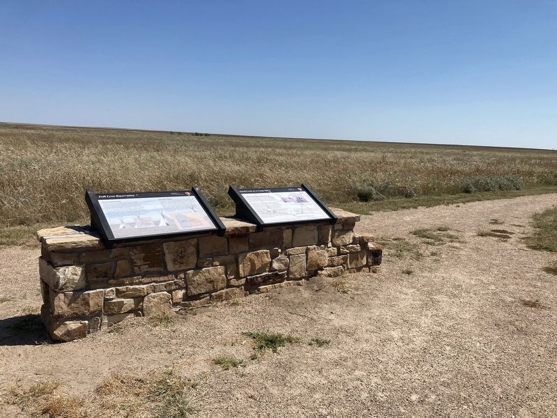
2. Sand Creek Camp Site Marker can be seen on the right
Other nearby markers. At least 8 other markers are within walking distance of this marker: Fort Lyon Reservation (here, next to this marker); Conscience and Courage (approx. ¼ mile away); Sacred Memory (approx. ¼ mile away); Welcome to the Sand Creek Massacre National Historic Site (approx. ¼ mile away); A Chief’s Village (approx. ¼ mile away); Cheyenne and Arapaho Village at Sand Creek (approx. ¼ mile away); Humans and the Prairie (approx. 0.3 miles away); Why A 33 Star Flag (approx. 0.3 miles away). Touch for a list and map of all markers in Chivington.
Other markers no longer nearby. The Attack (was about 300 feet away, measured in a direct line but has been permanently removed); The Sand Creek Massacre (was approx. ¼ mile away but has been permanently removed); Healing (was approx. ¼ mile away but has been permanently removed); Testimony (was approx. ¼ mile away but has been permanently removed); Pleas for Peace (was approx. ¼ mile away but has been permanently removed); Why? (was approx. ¼ mile away but has been permanently removed); Remains (was approx. ¼ mile away but has been permanently removed); Returned to Sand Creek (was approx. ¼ mile away but has been permanently removed).
Credits. This page was last revised on July 5, 2025. It was originally submitted on September 3, 2021, by Connor Olson of Menomonee Falls, Wisconsin. This page has been viewed 391 times since then and 57 times this year. Photos: 1, 2. submitted on September 3, 2021, by Connor Olson of Menomonee Falls, Wisconsin. • Andrew Ruppenstein was the editor who published this page.
