Old Saybrook Center in Middlesex County, Connecticut — The American Northeast (New England)
Battlefields of the Pequot War
Siege and Battle of Saybrook Fort Historical Route
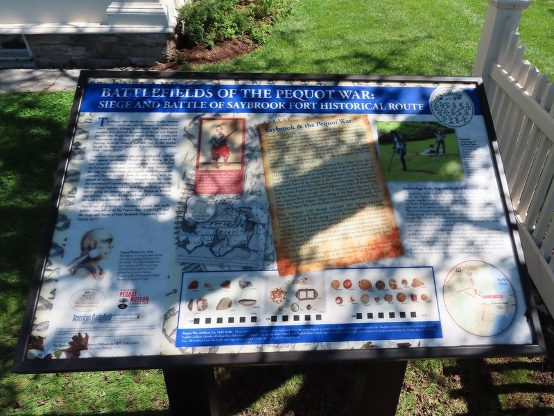
The Pequot War was the first major conflict between Native Americans and Europeans in northeastern North America. It began in September 1636, lasted eleven months, and involved thousands of Native and English peoples who fought several major battles in present-day Connecticut. In the early months of the war most of the fighting occurred about a half-mile east of this marker during the Siege and Battle of Saybrook Fort (September 1636 - March 1637).
Lieutenant Lion Gardiner successfully defended Saybrook Fort against unrelenting Pequot attacks during the fall and winter of 1636-1637, during which time over half of the fort garrison became casualties. In early March 1637 the siege was lifted when the English-allied Narragansett attacked Pequot country from the east, along with the arrival of reinforcements from Massachusetts Bay under the command of Captain John Underhill. For the rest of the war Saybrook Fort was where most English forces gathered before going on campaigns against the Pequot at Mistick and Quinnipiac. After the war Saybrook Fort remained in use until it was destroyed by fire in 1647.
This is one of a series of informative panels that mark historic sites related to the Pequot War (1636-1637) and the Siege and Battle of Fort Saybrook (September 1636 - March 1637).
Saybrook & the Pequot War
During the early 17th century, approximately 8,000 Pequot lived within territory defined by the present Connecticut towns of Groton, Ledyard, Stonington, and North Stonington. In the early 1630's a smallpox epidemic swept through northeastern North America reducing the Pequot population to 4,000 in the years before the Pequot War. The Pequot War grew out of the rapid cultural, political and economic changes that occurred in the region following the arrival of Dutch fur traders in 1611. In the 1620s and early 1630s, the Pequot exerted control along the shores of Long Island Sound and the lower Connecticut River Valley to dominate the fur and wampum trade with the Dutch.
The arrival of the English in the Connecticut River Valley in the fall of 1633 sowed the seeds of the Pequot War, when English settlers sought to break the Dutch monopoly by establishing their own trade relations with local tribes. Following the murder of Virginia trader John Stone just north of Saybrook Point by the Pequot in the summer of 1634, the English in Boston demanded the killers who were never surrendered. By late summer 1636, another English captain, John Oldham, was killed off Block Island, and the Pequot were wrongly blamed. A Massachusetts Bay army of 90 men attacked Block Island before sailing to the Pequot (Thames) River where they burned Pequot villages in retaliation for Stone's
death. This began the Pequot War, and the Pequot quickly besieged Saybrook Fort.
From September 1636 through mid-April 1637 fighting continued between English and Pequot forces around Saybrook Point and Lyndes Point to the south. By the spring of 1637 the victorious Pequot reduced Lieutenant Lion Gardiner's small garrison to a dozen men. The siege was only lifted when reinforcements arrived from Boston under the command of Captain John Underhill and as the Narragansett invaded eastern Pequot territory. From Saybrook Fort, English commanders planned the attack on the Pequot Fort at Mistick which proved to be the turning point of the war. Saybrook Fort remained a major staging ground for English forces until the end of the war.
More information can be found here at the Old Saybrook Historical Society (www.saybrookhistory.org) or at the Mashantucket Pequot Museum & Research Center (www.pequotmuseum.org).
Archaeology of the Siege and Battle of Saybrook Fort
In recognition of the national significance of the Pequot War (1636- 1637), the National Park Service, American Battlefield Protection Program awarded several grants to document sites related to the Siege and Battle of Saybrook Fort (1636-1637). Fieldwork occurred between 2012 and 2013 about a mile east of this marker on Saybrook Point. The archaeological survey not only identified the fort location but also found several other important combat actions from the time of the Pequot War. Hundreds of artifacts were recovered by archaeologists from Mashantucket Pequot Museum & Research Center and are now in the care of the Old Saybrook Historical Society.
An important goal of the Battlefields of the Pequot War project is to increase public awareness of Pequot War battle sites, such as Saybrook Fort, as a means of promoting historical preservation. Informative markers are located throughout Saybrook Point detailing significant sites associated with the Siege and Battle of Saybrook Fort. A walking tour of the Saybrook battle sites is also available for visitors to enjoy. Maps are available at the General William Hart House or at www.saybrookhistory.org.
( photo captions )
Pequot Warrior, Ca. 1620 — Illustration of a Pequot man during the time of trading relations with the Dutch. The Native peoples of the Connecticut River and Long Island Sound would have been adorned in a similar fashion. Courtesy of the Mashantucket Pequot Museum & Research Center
Dutch Soldier, Ca. 1607 - Image of an early 17th century Dutch soldier from an 1607 military training manual. The earliest Dutch traders to arrive at Seabrooke, or Saybrook, would have been similarly equipped. (Jacob de Gheyn, Exercise of Armes, 1607)
Battlefield Archaeology on Saybrook Point - Archaeologists from the Mashantucket Pequot Museum & Research Center metal detecting and digging shovel test pits on Saybrook Point. The flags mark potential artifacts for recovery. Courtesy of the Mashantucket Pequot Museum & Research Center
Pequot War Artifacts, Ca. 1635-1638 — These artifacts were recovered from Saybrook Point by archaeologists in search of the Battle and Siege of Saybrook Fort. Buckles and buttons (center) were dropped by English soldiers, chunks of ballast flint (left) found in North Cove signify where Dutch and English ships loaded cargo, and musket balls (right) are evidence of combat actions from the Pequot siege of Saybrook.
Background Image: The figure of the Indians fort or Palizado in New England Captain John Underhill • Newes from America, 1637
Topics. This memorial is listed in these topic lists: Colonial Era • Native Americans. A significant historical month for this entry is March 1637.
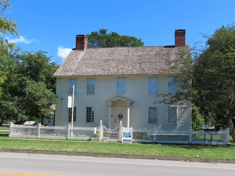
Location. 41° 17.226′ N, 72° 22.521′ W. Marker is in Old Saybrook, Connecticut, in Middlesex County. It is in Old Saybrook Center. Memorial is at the intersection of Main Street (Connecticut Route 154) and Sand Creek Drive, on the left when traveling south on Main Street. Located in front of the Old Saybrook Historical Society. Touch for map. Marker is in this post office area: Old Saybrook CT 06475, United States of America. Touch for directions.
Other nearby markers. At least 8 other markers are within walking distance of this marker. Old Saybrook Historical Society and the General William Hart House (a few steps from this marker); Old Saybrook Historical Society (within shouting distance of this marker); Lafayette's Tour (within shouting distance of this marker); The First Church of Christ in Saybrook (within shouting distance of this marker); Say-Brooke (within shouting distance of this marker); Third Meetinghouse (within shouting distance of this marker); Anna Louise James (about 300 feet away, measured in a direct line); In this shop… (about 300 feet away). Touch for a list and map of all markers in Old Saybrook.
Also see . . .
1. Old Saybrook Historical Society. (Submitted on September 5, 2021, by Michael Herrick of Southbury, Connecticut.)
2. Saybrook Fort & the Pequot War. (Submitted on September 22, 2021, by Michael Herrick of Southbury, Connecticut.)
3. Fort Saybrook Monument Park – Visit CT. (Submitted on September 22, 2021, by Michael Herrick of Southbury, Connecticut.)
4. Pequot War (Wikipedia). (Submitted on September 5, 2021, by Michael Herrick of Southbury, Connecticut.)
Credits. This page was last revised on February 10, 2023. It was originally submitted on September 5, 2021, by Michael Herrick of Southbury, Connecticut. This page has been viewed 236 times since then and 22 times this year. Photos: 1, 2. submitted on September 5, 2021, by Michael Herrick of Southbury, Connecticut.

