Quincy in Adams County, Illinois — The American Midwest (Great Lakes)
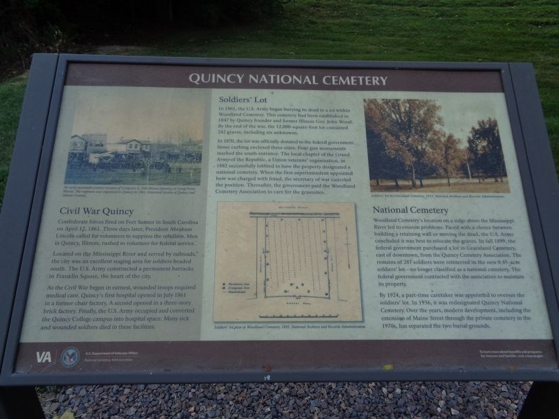
Quincy National Cemetery
Confederate forces fired on Fort Sumter in South Carolina on April 12, 1861. Three days later, President Abraham Lincoln called for volunteers to suppress the rebellion. Men in Quincy, Illinois, rushed to volunteer for federal service.
Located on the Mississippi River and served by railroads, the city was an excellent staging area for soldiers headed south. The U.S. Army constructed a permanent barracks in Franklin Square, the heart of the city.
As the Civil War began in earnest, wounded troops required medical care. Quincy's first hospital opened in July 1861 in a former chair factory. A second opened in a three-story brick factory. Finally, the U.S. Army occupied and converted the Quincy College campus into hospital space. Many sick and wounded soldiers died in these facilities.
Soldiers' Lot
In 1861, the U.S. Army began burying its dead in a lot within Woodland Cemetery. This cemetery had been established in 1847 by Quincy founder and former Illinois Gov. John Wood. By the end of the war, the 12,000-square-foot lot contained 242 graves, including six unknowns.
In 1870, the lot was officially donated to the federal government. Stone curbing enclosed three sides. Four gun monuments marked the south entrance. The local chapter of the Grand Army of the Republic, a Union veterans' organization, in 1882 successfully lobbied to have the property designated a national cemetery. When the first superintendent appointed here was charged with fraud, the secretary of war canceled the position. Thereafter, the government paid the Woodland Cemetery Association to care for the gravesites.
National Cemetery
Woodland Cemetery's location on a ridge above the Mississippi River led to erosion problems. Faced with a choice between building a retaining wall or moving the dead, the U.S. Army concluded it was best to relocate the graves. In fall 1899, the federal government purchased a lot in Graceland Cemetery, east of downtown, from the Quincy Cemetery Association. The remains of 287 soldiers were reinterred in the new 0.45-acre soldiers' lot - no longer classified as a national cemetery. The federal government contracted with the association to maintain its property.
By 1924, a part-time caretaker was appointed to oversee the soldiers' lot. In 1936, it was redesignated Quincy National Cemetery. Over the years, modern development, including the extension of Maine Street through the private cemetery in the 1970s, has separated the two burial grounds.
Erected by U.S. Department of Veterans Affairs.
Topics and series. This historical marker is listed in
these topic lists: Cemeteries & Burial Sites • War, US Civil • Waterways & Vessels. In addition, it is included in the National Cemeteries series list. A significant historical date for this entry is April 12, 1861.
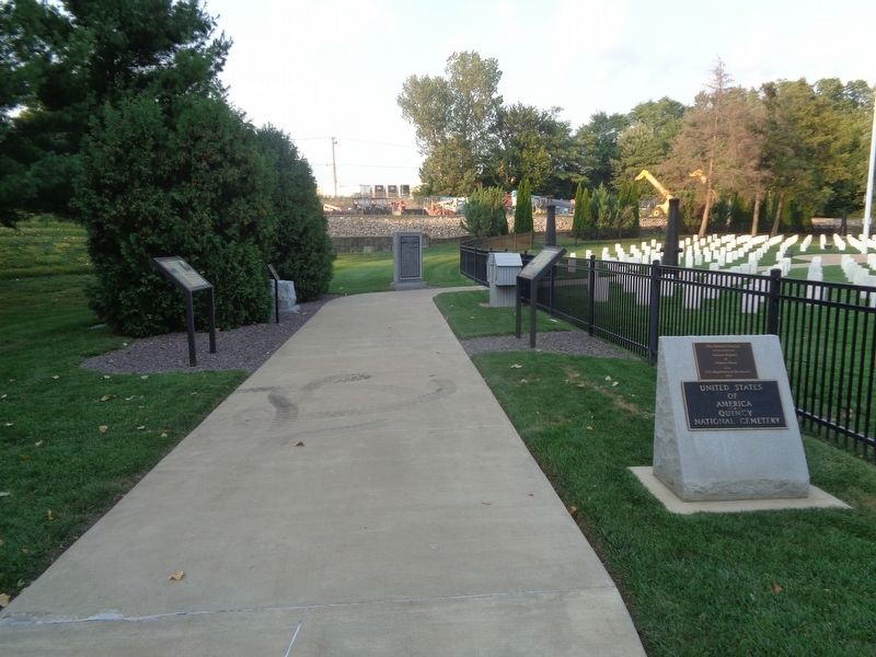
Location. 39° 55.928′ N, 91° 21.374′ W. Marker is in Quincy, Illinois, in Adams County. Marker can be reached from Maine Street north of Tisha Drive. Marker is located at Quincy National Cemetery. Touch for map. Marker is at or near this postal address: 3701 Maine St, Quincy IL 62305, United States of America. Touch for directions.
Other nearby markers. At least 8 other markers are within 2 miles of this marker, measured as the crow flies. In Honor of Those Who Gave the Ultimate Sacrifice (here, next to this marker); A National Cemetery System (here, next to this marker); Thomas Scott Baldwin 1858-1923 (approx. 0.6 miles away); Madison Park (approx. 1.1 miles away); Dr. Thomas Edgar Musselman (approx. 1.1 miles away); Charley's Run (approx. 1.1 miles away); Charles Henry Bull House (approx. 1.7 miles away); R. F. Newcomb House (approx. 1.8 miles away). Touch for a list and map of all markers in Quincy.
Also see . . .
1. Quincy National Cemetery on Wikipedia. (Submitted on September 8, 2021, by Jason Voigt of Glen Carbon, Illinois.)
2. Quincy National Cemetery. From the U.S. Department of Veterans' Affairs website. (Submitted on September 8, 2021, by Jason Voigt of Glen Carbon, Illinois.)
Credits. This page was last revised on September 8, 2021. It was originally submitted on September 8, 2021, by Jason Voigt of Glen Carbon, Illinois. This page has been viewed 167 times since then and 24 times this year. Photos: 1, 2. submitted on September 8, 2021, by Jason Voigt of Glen Carbon, Illinois.

