
Columbia Island in Southwest Washington in Washington, District of Columbia — The American Northeast (Mid-Atlantic)
The Boundary Channel
George Washington Memorial Parkway
| — | National Park Service, U.S. Department of the Interior | — |
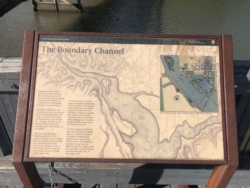
England's King Charles I granted the entire Potomac River to Maryland in 1632. Four centuries later Maryland, Virginia, and the District of Columbia were still arguing over their mutual boundary.
Alexander's Island was one controversial site. It was known for its "bogs and swamps and frogs." At low tide the island was attached to - and claimed by - Virginia. At high tide the Potomac River encircled it, making it part of the District of Columbia.
Tensions over Alexander's Island exploded in 1904. A group of enraged men carrying axes and sledgehammers raided the Alexander Island Race Track in an attempt to close it. The District of Columbia did not permit race track betting, while Virginia did.
In 1915 the Army Corps of Engineers began dredging the Potomac River. In the process they completely removed the swampy landmass that was Alexander's Island. In its place they created the Boundary Channel, which runs beneath this footbridge, and Columbia Island, which is visible across the channel from you.
In 1934 Congress determined that, while Alexander's Island had once definitely been part of Virginia, its destruction shifted the
this page online
Captions:
The Boundary Channel and Columbia Island on a World War II era map.
A surveyor's map from 1794 shows the narrow bog that attached Alexander's Island to the Virginia shoreline.
Erected by National Park Service, U.S. Department of the Interior.
Topics. This historical marker is listed in these topic lists: Colonial Era • Political Subdivisions • Waterways & Vessels. A significant historical year for this entry is 1632.
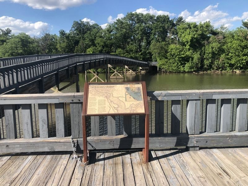
Location. This marker has been replaced by another marker nearby. It was located near 38° 52.713′ N, 77° 3.193′ W. Marker was in Southwest Washington in Washington, District of Columbia. It was on Columbia Island. It could be reached from Boundary Channel Drive. The marker is on a deck before the footbridge that crosses over to Columbia Island and the Lyndon B. Johnson Memorial Grove. It can be reached from the large parking lot to the northeast of the Pentagon. Touch for map. Marker was at or near this postal address:

Regionally, this marker was in the Washington Metropolitan Area. It was also in the American Northeast, in the Upper South, in the Mid-Atlantic, in the Tidewater, and in the Chesapeake Bay Region. Globally, it was in North America, the Western Hemisphere, the Western World, and the Anglosphere.
Other nearby markers. At least 8 other markers are within walking distance of this location: "Where flowers bloom, so does hope" (here, next to this marker); Architect of the Great Society (here, next to this marker); The Memorial Grove (about 500 feet away); Tomb of Remembrance (approx. 0.3 miles away in Virginia); Navy and Marine Memorial (approx. 0.4 miles away); Building a Beautiful Bridge (approx. half a mile away); An Engineering Marvel (approx. half a mile away); Canada's Gift to the United States (approx. 0.6 miles away). Touch for a list and map of all markers in Southwest Washington.
Other markers no longer nearby. Tomorrow is ours to win or lose (was about 500 feet away, measured in a direct line but has been reported
Photographed by J. Makali Bruton, October 10, 2016
3. The Boundary Channel Marker
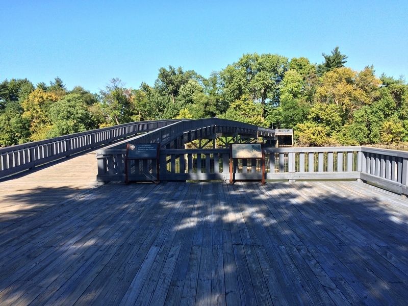
The marker is to the right. To the left is a panel that simply says "Lyndon Baines Johnson Memorial Grove on the Potomac."
Related marker. Click here for another marker that is related to this marker. This marker has been replaced by the linked marker.
Additional commentary.
1. Location of the Marker
As discussed on the marker, the border of the District of Columbia and Virginia is on the shore of the Potomac River. Since the display is on a deck built over the river, it is legally, albeit barely, in the District, even though the attached parking lot is in Arlington, Virginia.
— Submitted May 31, 2020, by Devry Becker Jones of Washington, District of Columbia.
Photographed by J. Makali Bruton, October 10, 2016
4. The Boundary Channel Marker
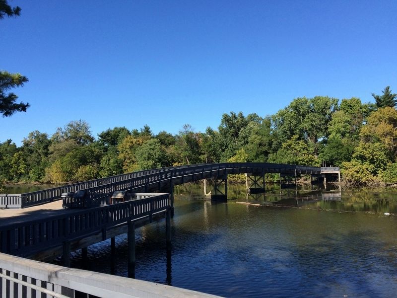
This view shows the footbridge, Boundary Channel and Columbia Island mentioned in the marker text.
Credits. This page was last revised on January 31, 2023. It was originally submitted on October 13, 2016, by J. Makali Bruton of Washington, District of Columbia. This page has been viewed 1,552 times since then and 171 times this year. Last updated on September 9, 2021, by Shane Oliver of Richmond, Virginia. Photos: 1, 2. submitted on May 31, 2020, by Devry Becker Jones of Washington, District of Columbia. 3, 4. submitted on October 13, 2016, by J. Makali Bruton of Washington, District of Columbia. • Devry Becker Jones was the editor who published this page.
