Near Spotsylvania Courthouse in Spotsylvania County, Virginia — The American South (Mid-Atlantic)
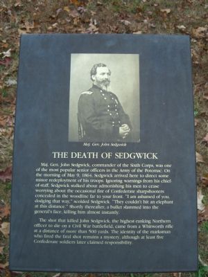
The Death of Sedgwick
Photographed by Kevin W., November 19, 2007
1. The Death of Sedgwick Marker
The shot that killed John Sedgwick, the highest-ranking Northern officer to die on a Civil War battlefield, came from a Whitworth rifle at a distance of more than 500 yards. The identity of the marksman who fired the fatal shot remains a mystery, although at least five Confederate soldiers later claimed responsibility.
Topics. This historical marker is listed in this topic list: War, US Civil. A significant historical date for this entry is May 9, 1864.
Location. This marker has been replaced by another marker nearby. 38° 13.081′ N,
this page online

Regionally, this marker is in the Washington Metropolitan Area, in Northern Virginia, and in the Piedmont. It is also in the American South, specifically in the Upper South, in the Mid-Atlantic, and on the Eastern Seaboard. Globally, it is in the North Atlantic Region, North America, the Western Hemisphere, the Western World, and the Anglosphere. Historically, it finds itself in what was once the territory of the Mississippian Culture, one of the original Thirteen Colonies, one of the Confederate States of America, and the Antebellum South.
Other nearby markers. At least 8 other markers are within walking distance of this location: Sedgwick (here, next to this marker); Laurel Hill Trail (here, next to this marker);
Photographed by Kevin W., November 19, 2007
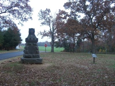
2. The Death of Sedgwick Marker is on the right.
Other markers no longer nearby. Spotsylvania Campaign (was a few steps from this marker but has been permanently removed); a different marker also named Spotsylvania Campaign (was a few steps from this marker but has been permanently removed).
Related marker. Click here for another marker that is related to this marker. New Marker At This Location also titled "The Death of Sedgwick".
Photographed by Kevin W., November 19, 2007
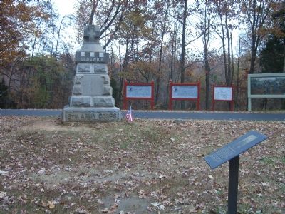
3. The Death of Sedgwick Marker
Library of Congress, May 20, 2016
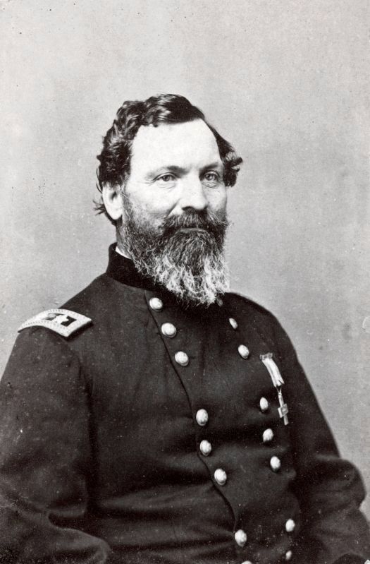
4. Major General John Sedgwick
of 2nd Regular Army Cavalry Regiment
of 2nd Regular Army Cavalry Regiment
by Brady's National Photographic Portrait Galleries 1861 and 1864.
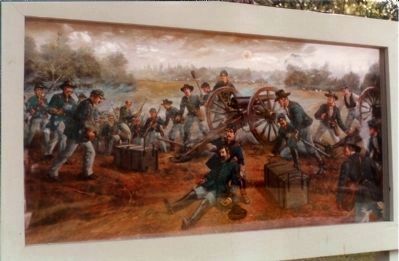
Photographed by Mike Stroud, circa 1991
5. The Death of Sedgwick Artist Illustration
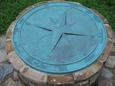
Photographed by Craig Swain, July 6, 2008
6. Spotsylvania "Compass"
As at other locations in the Fredericksburg and Spotsylvania National Military Park, a compass indicates the direction and distance to locations important to the battle and campaigns. From the north (right) are indicated Chancellorsville (6.3 m), Washington (60 m), Bloody Angle (0.9 m), Lee's Final Line (0.7 m), Federal Line (2.1 m), Spotsylvania C.H. (2 m), Confederate front (0.3 m), Richmond (50 m), Po River (1 m), Shady Grove Church (5.5 m), Todd's Tavern (3.5 m), and Brock-Plank Crossroads (7.7 m).
Credits. This page was last revised on November 14, 2021. It was originally submitted on November 19, 2007, by Kevin W. of Stafford, Virginia. This page has been viewed 2,297 times since then and 80 times this year. Last updated on September 10, 2021, by Bradley Owen of Morgantown, West Virginia. Photos: 1, 2, 3. submitted on November 19, 2007, by Kevin W. of Stafford, Virginia. 4. submitted on September 17, 2020, by Allen C. Browne of Silver Spring, Maryland. 5. submitted on March 29, 2008, by Mike Stroud of Bluffton, South Carolina. 6. submitted on August 13, 2008, by Craig Swain of Leesburg, Virginia. • J. Makali Bruton was the editor who published this page.
