Ketchikan in Ketchikan Gateway Borough, Alaska — Northwest (North America)
Proud Canoes & Coastal Traders
Inscription.
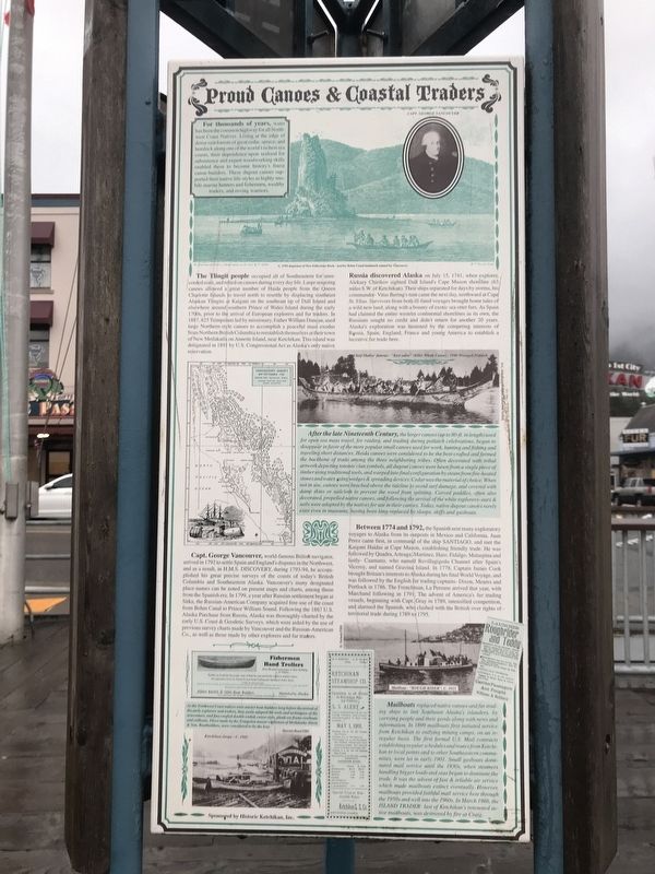
For thousands of years, water has been the common highway for all Northwest Coast Natives. Living at the edge of dense rain forests of great cedar, spruce, and hemlock along one of the world's richest sea coasts, their dependence upon seafood for subsistence and expert woodworking skills enabled them to become history's finest canoe builders. These dugout canoes supported their native lifestyles as highly mobile marine hunters and fishermen, wealthy traders, and roving warriors.
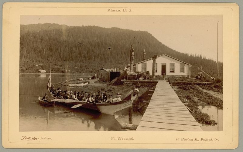
The Tlingit people occupied all of Southeastern for unrecorded eons, and relied on canoes during everyday life. Large seagoing canoes allowed a great number of Haida people from the Queen Charlotte Islands to travel north to resettle by displacing southeast Alaskan Tlingits at Kaigani on the southeast tip of Dall Island and elsewhere around southern Prince of Wales Island during the early 1700s, prior to the arrival of European explorers and fur traders. In 1887, 825 Tsimpsians led by missionary, Father William Duncan, used large Northern-style canoes to accomplish a peaceful mass exodus from Northern British Columbia to reestablish themselves at their town of New Metlakatla on Annette Island, near Ketchikan. This island was designated in 1891 by U.S. Congressional Act as Alaska's only native reservation.
Russia discovered Alaska on July 15, 1741, when explorer Aleksey Chirikov sighted Dall Island's Cape Muzon shoreline (63 miles S.W. of Ketchikan). Their ships separated for days by storms, his commander Vitus Bering's turn came the next day, northward at Cape St. Elias. Survivors from both ill-fated voyages brought home tales of a wild new land, along with a bounty of exotic sea otter furs. As Spain had claimed the entire western continental shorelines as its own, the Russians sought no credit and didn't return for another 20 years. Alaska's exploration was hastened by the competing interests of Russia, Spain, England, France and young America to establish a lucrative fur trade here.
Between 1774 and 1792, the Spanish sent many exploratory voyages to Alaska from its outposts in Mexico and California. Juan Perez came first, in command of the ship Santiago, and met the Kaigani Haidas at Cape Muzon, establishing friendly trade. He was followed by Quadra, Arteaga, Martinez, Haro, Fidalgo, Malaspina and lastly Caamano, who named Revillagigedo Channel after Spain's Viceroy, and named Gravina Island. In 1778, Captain James Cook brought Britain's interests to Alaska during his final World Voyage, and was followed by the English fur trading captains Dixon, Meares and Portlock in 1786. The Frenchman La Perouse arrived that year, with Marchand following in 1791. The advent of America's fur trading
vessels, beginning with Capt. Gray in 1789, intensified competition and alarmed the Spanish, who clashed with the British over rights of-territorial trade during 1789 to 1795.
Capt. George Vancouver, world-famous British navigator, arrived in 1792 to settle Spain and England's disputes in the Northwest, and as a result, in H.M.S. Discovery during 1793-94, he accomplished his great precise surveys of the coasts of today's British Columbia and Southeastern Alaska. Vancouver's many designated place-names can be noted on present maps and charts, among those from the Spanish era. In 1799, a year after Russian settlement began at Sitka, the Russian-American Company acquired free-use of the coast from Behm Canal to Prince William Sound. Following the 1867 U.S. Alaska Purchase from Russia, Alaska was thoroughly charted by the early U.S. Coast & Geodetic Surveys, which were aided by the use of previous survey charts made by Vancouver and the Russian-American Co., as well as those made by other explorers and fur traders.
Captions
(Top) C. 1793 depiction of New Eddystone Rock — nearby Behm Canal landmark named by Vancouver.
(Top, inset) Capt. George Vancouver.
(Middle, top) Chief Shakes' famous “Keet yakw” (Killer Whale Canoe) 1940 Wrangell Potlatch O.C. Schellerand/Tongass Historical Society
(Middle)
After the late nineteenth century, the larger canoes (up to 80 ft. in length) used for open sea mass travel, for raiding, and trading during potlatch celebrations, began to disappear in favor of the more popular small canoes used for work, hunting and fishing and traveling short distances. Haida canoes were considered to be the best-crafted and formed the backbone of trade among the three neighboring tribes. Often decorated with tribal artwork depicting totemic clan symbols, all dugout canoes were hewn from a single piece of timber using traditional tools, and warped into final configuration by steam from fire-heated stones and water, using wedges & spreading devices. Cedar was the material of choice. When not in use, canoes were beached above the tideline to avoid surf damage, and covered with damp skins or sailcloth to prevent the wood from splitting. Carved paddles, often also decorated, propelled native canoes, and following the arrival of the white explorers oars & sails were adapted by the natives for use in their canoes. Today, native dugout canoes rarely exist even in museums, having been long-replaced by sloops, skiffs and gasboats.
(Bottom, left) As the Northwest Coast natives were master boat-builders long before the arrival of the early explorers and traders, they easily adapted the tools and techniques of the newcomers, and fine-crafted double-ended,
canoe-style, plank-on-frame rowboats and sailboats. Those made by the Tsimpsian master craftsmen of Metlakatda, Davis & Son, Boatbuilders, were considered to be the best. Photo: Ketchikan sloops, c. 1905 Harriet Hunt,THS
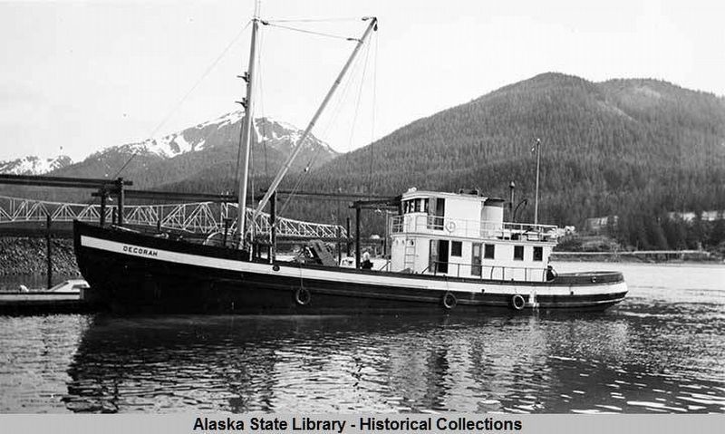
(Bottom, right) Mailboats replaced native canoes and fur trading ships to link Southeast Alaska's islanders by carrying people and their goods along with news and information. In 1899 mailboats first initiated service from Ketchikan to outlying mining camps, on an irregular basis. The first formal U.S. Mail contracts establishing regular schedules and routes from Ketchikan to local points and to other Southeastern communities were let in early 1901. Small gasboats dominated mail service until the 1930s, when steamers handling bigger loads and seas began to dominate the trade. It was the advent of fast & reliable air service which made mailboats extinct eventually. However, mailboats provided faithful mail service here through the 1950s and well into the 1960s. In March 1986, the Island Trader, last of Ketchikan's renowned active mailboats, was destroyed by fire at Craig. (Photo) Mailboat Rough Rider, c. 1915. D. Nichols/THS
Erected by Historic Ketchikan, Inc.
Topics. This historical marker is listed in these topic lists: Communications • Native Americans • Waterways & Vessels. A significant historical month for this entry is March 1986.
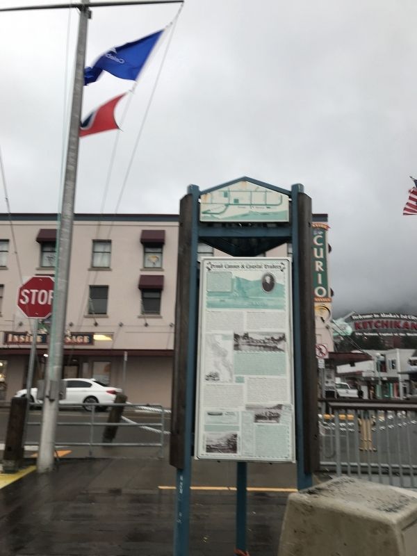
Location. 55° 20.475′ N, 131° 38.829′ W. Marker is in Ketchikan, Alaska, in Ketchikan Gateway Borough. Marker is at the intersection of Front Street and Mission Street, on the right when traveling south on Front Street. Touch for map. Marker is at or near this postal address: 131 Front Street, Ketchikan AK 99901, United States of America. Touch for directions.
Other nearby markers. At least 8 other markers are within walking distance of this marker. Star-crossed Square Riggers (here, next to this marker); When 'Steam was Queen' (here, next to this marker); Ketchikan Waterfront from Pennock Island, 1905 (within shouting distance of this marker); Tongass Trading Company (within shouting distance of this marker); Trials by Fire (within shouting distance of this marker); South Front Street (within shouting distance of this marker); Spirit & Sparks (within shouting distance of this marker); The Gilmore Hotel (about 400 feet away, measured in a direct line). Touch for a list and map of all markers in Ketchikan.
Credits. This page was last revised on September 16, 2021. It was originally submitted on September 16, 2021, by Duane and Tracy Marsteller of Murfreesboro, Tennessee. This page has been viewed 140 times since then and 23 times this year. Photos: 1, 2, 3, 4. submitted on September 16, 2021, by Duane and Tracy Marsteller of Murfreesboro, Tennessee.


