Near Fairfax in Fairfax County, Virginia — The American South (Mid-Atlantic)
La Batalla de Ox Hill (Chantilly)
옥스힐 전투 (챈틀리)
— Sendero Interpretativo — 해석적 자취 —

Photographed By Devry Becker Jones (CC0), September 19, 2021
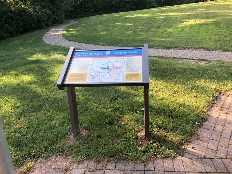
1. Tablero Interpretativo “La Batalla de Ox Hill (Chantilly)”
Senderos de la Guerra Civil en Virginia.
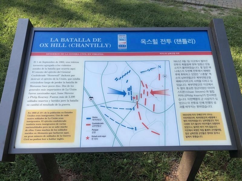
El 1 de Septiembre de 1862, una intensa tormenta agregada a los violentos sonidos de la batalla que ocurría aquí. El intento del ejército de la Unión, que estaba retirándose luego de perder la batalla de Manassas hace pocos días. Dos de los generales más importantes de La Unión fueron asesinados aquí, Isaac Stevens y Philip Kearney. Fueron más de 2,100 soldados muertos y heridos pero la batalla no cambió el resultado de la guerra.
En 1860 el 13% de la población en Estados Unidos eran inmigrantes. Uno de cada cuatro soldados de La Unión eran inmigrantes. El ejército confederado también tenía inmigrantes de varias nacionalidades pero no se sabe mucho de ellos. Como muchos de los soldados nacidos en Alemania que lucharon aquí, un gran número de soldados de la Guerra Civil no podían leer o hablar inglés.
1862년 9월 1일 이곳에서 벌어진 전투의 폭발음에 맞춰 엄청난 천둥 소리가 울려퍼졌습니다. 몇 일전 매 나세스의 두번째 전트에서 패배한 후에 후퇴하고 있었던 “스톤월” 잭 슨의 남부연합군은 북부연방군을 패배시키려고자 사력을 다하고 있 었습니다. 북부연밤군은 이곳에서 두 명의 중요한 장군이었던 아이작 스티븐스(Isaac Stevens) 와 필립 커어니(Philip Kearny)가 전사하였 습니다. 이천백명의 군 사상자가 있 었으나 이 전트로 인해 전쟁의 성 과를 바꾸지는 못하였습니다.
1860년대 미국 전체인구의 13%는 이민자였으며, 북부연방군의 4명중에 1 명이 이민자였습니다. 남부연합군도 역시 다양한 국가 출신의 이민자들이 포함되어 있었으나, 알려진 바가 거의 없습니다. 이곳에서 싸웠던 독일 출생의 군인처렁, 많은 남북전쟁 군인들은 영어로 읽거나 말하지 못했습니다.
Virginia Civil War Trails.
On September 1, 1862, an intense storm added to the violent sounds of the battle that was taking place here. The attempt of the Union army, which was retreating after losing the Battle of Manassas a few days ago. Two of the most important generals in The Union were assassinated here, Isaac Stevens and Philip Kearney. More than 2,100 soldiers were killed and wounded but the battle did not change the outcome of the war.
In 1860, 13% of the population in the United States were immigrants. One in four Union soldiers were immigrants. The Confederate Army also had immigrants of various nationalities but not much is known about them. Like many of the German-born soldiers who fought here, large numbers of Civil War soldiers could not read or speak English.
Erected by Virginia Civil War Trails.
Topics and series. This historical marker is listed in these topic lists: Communications • Settlements & Settlers • War, US Civil. In addition, it is included in the Virginia Civil War Trails series list. A significant historical year for this entry is 1862.
Location. 38° 51.864′ N, 77° 22.19′ W. Marker is near Fairfax, Virginia, in Fairfax County.

Photographed By Devry Becker Jones (CC0), September 19, 2021
2. Tablero Interpretativo “La Batalla de Ox Hill (Chantilly)”
Other nearby markers. At least 8 other markers are within walking distance of this marker. Who Fought Here: The Generals (here, next to this marker); Where the Battle was Fought (here, next to this marker); Wounds Suffered at Ox Hill (Chantilly) (here, next to this marker); Sequel to Second Manassas (here, next to this marker); Ox Hill Battlefield Park & Interpretive Trail (here, next to this marker); The Wounded Left Behind (here, next to this marker); Aftermath: The Invasion of Maryland (a few steps from this marker); General Reno's Probe East of Ox Road (within shouting distance of this marker). Touch for a list and map of all markers in Fairfax.
Credits. This page was last revised on December 22, 2022. It was originally submitted on September 20, 2021, by Devry Becker Jones of Washington, District of Columbia. This page has been viewed 168 times since then and 22 times this year. Photos: 1, 2. submitted on September 20, 2021, by Devry Becker Jones of Washington, District of Columbia. 3. submitted on December 22, 2022, by Adam Margolis of Mission Viejo, California.
