Near Fairfax in Fairfax County, Virginia — The American South (Mid-Atlantic)
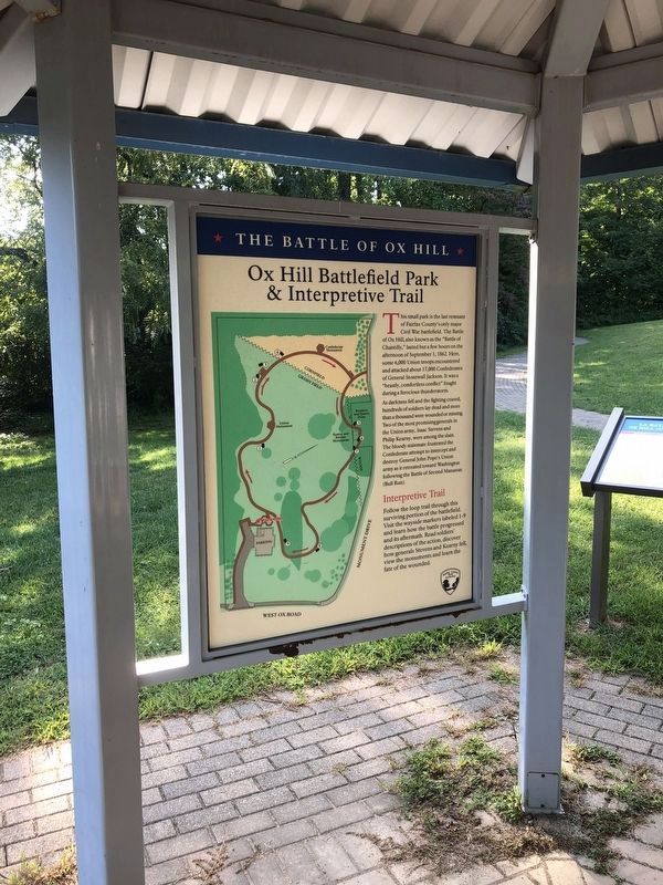
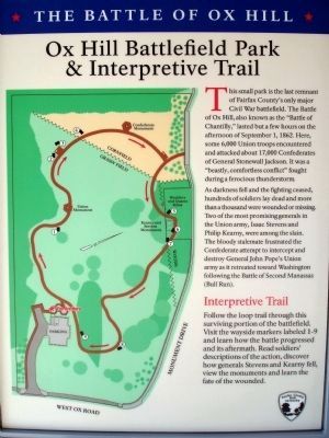
Ox Hill Battlefield Park & Interpretive Trail
★ The Battle of Ox Hill ★
This small park is the last remnant of Fairfax County’s only major Civil War battlefield. The Battle of Ox Hill, also known as the “Battle of Chantilly,” lasted but a few hours on the afternoon of September 1, 1862. Here, some 6,000 Union troops encountered and attacked about 17,000 Confederates of General Stonewall Jackson. It was a “beastly, comfortless conflict” fought during a ferocious thunderstorm.
As darkness fell and the fighting ceased, hundreds of soldiers lay dead and more than a thousand were wounded or missing. Two of the most promising generals in the Union army, Isaac Stevens and Philip Kearny, were among the slain. The bloody stalemate frustrated the Confederate attempt to intercept and destroy General John Pope’s Union army as it retreated toward Washington following the Battle of Second Manassas (Bull Run).
Interpretive Trail
Follow the loop trail through this surviving portion of the battlefield. Visit the wayside markers labeled 1-9 and learn how the battle progressed and its aftermath. Read soldiers’ descriptions of the action, discover how generals Stevens and Kearny fell, view the monuments and learn the fate of the wounded.
Erected 2008 by Fairfax County Park Authority.
Topics and series. This historical marker is listed in this topic list: War, US Civil. In addition, it is included in the Battlefield Trails - Civil War, the Former U.S. Presidents: #14 Franklin Pierce, and the Former U.S. Presidents: #22 and #24 Grover Cleveland series lists. A significant historical date for this entry is September 1, 1862.
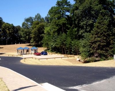
Location. 38° 51.862′ N, 77° 22.193′ W. Marker is near Fairfax, Virginia, in Fairfax County. Marker can be reached from West Ox Road (Virginia Route 608). These panels are on the left of three interpretive kiosks at the Ox Hill Battlefield Park. Touch for map. Marker is at or near this postal address: 4134 West Ox Road, Fairfax VA 22033, United States of America. Touch for directions.
Other nearby markers. At least 8 other markers are within walking distance of this marker. Sequel to Second Manassas (here, next to this marker); Wounds Suffered at Ox Hill (Chantilly) (here, next to this marker); La Batalla de Ox Hill (Chantilly) (here, next to this marker); Who Fought Here: The Generals (here, next to this marker); Where the Battle was Fought (here, next to this marker); The Wounded Left Behind (a few steps from this marker); Aftermath: The Invasion of Maryland (within shouting distance

Photographed By Devry Becker Jones (CC0), September 19, 2021
2. Ox Hill Battlefield Park & Interpretive Trail Marker
Related markers. Click here for a list of markers that are related to this marker. The Battle of Chantilly or Ox Hill Markers
Credits. This page was last revised on September 23, 2021. It was originally submitted on January 24, 2009. This page has been viewed 2,943 times since then and 15 times this year. Last updated on September 20, 2021. Photos: 1. submitted on January 24, 2009. 2. submitted on September 20, 2021, by Devry Becker Jones of Washington, District of Columbia. 3, 4. submitted on January 24, 2009. • J. Makali Bruton was the editor who published this page.


