Port Isabel in Cameron County, Texas — The American South (West South Central)
A View from the Top
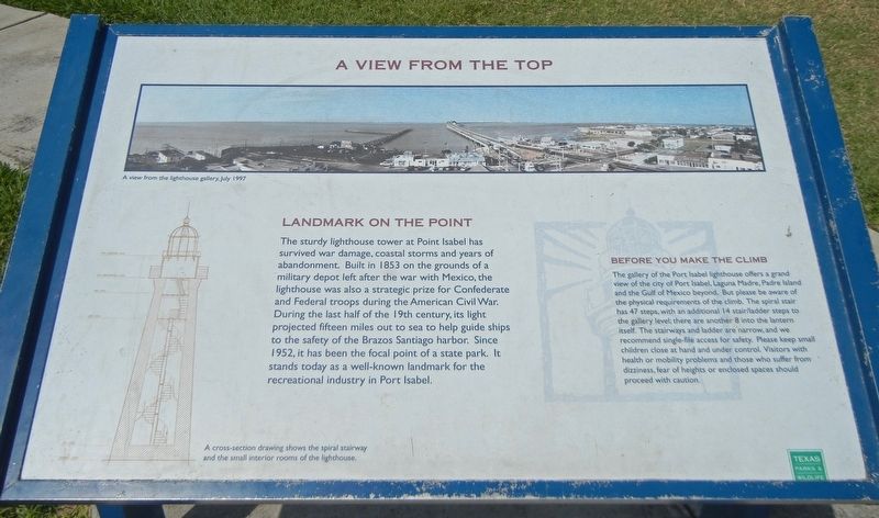
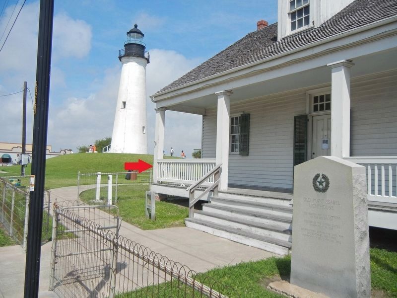
The sturdy lighthouse tower at Point Isabel has survived war damage, coastal storms and years of abandonment. Built in 1853 on the grounds of a military depot left after the war with Mexico, the lighthouse was also a strategic prize for Confederate and Federal troops during the American Civil War. During the last half of the 19th century, its light projected fifteen miles out to sea to help guide ships to the safety of the Brazos Santiago harbor. Since 1952, it has been the focal point of a state park. It stands today as a well-known landmark for the recreational industry in Port Isabel.
Before you make the climb
The gallery of the Port Isabel lighthouse offers a grand view of the city of Port Isabel, Laguna Madre, Padre Island and the Gulf of Mexico beyond. But please be aware of the physical requirements of the climb. The spiral stair has 47 steps, with an additional 14 stair/ladder steps to the gallery level; there are another 8 into the lantern itself. The stairways and ladder are narrow, and we recommend single-file access for safety. Please keep small children close at hand and under control. Visitors with health or mobility problems and those who suffer from dizziness, fear of heights or enclosed spaces should proceed with caution.
Captions
(Top) A view from the lighthouse gallery, July 1997.
(Bottom) A cross-section drawing shows the spiral stairway and the small interior rooms of the lighthouse.
Erected by Texas Parks and Wildlife Department.
Topics. This historical marker is listed in these topic lists: Architecture • Communications • Parks & Recreational Areas • Waterways & Vessels. A significant historical year for this entry is 1853.
Location. 26° 4.674′ N, 97° 12.433′ W. Marker is in Port Isabel, Texas, in Cameron County. Marker can be reached from East Queen Isabella Boulevard, on the right when traveling west. Touch for map. Marker is at or near this postal address: 421 E Queen Isabella Blvd, Port Isabel TX 78578, United States of America. Touch for directions.
Other nearby markers. At least 8 other markers are within walking distance of this marker. Old Point Isabel Lighthouse (a few steps from this marker); Point Isabel Lighthouse (a few steps from this marker); Port of Matamoros (within shouting distance of this marker); Site of Fort Polk (within shouting distance of this marker); Port Isabel, C.S.A. (about 500 feet away, measured in a direct line); Charles Champion (about 600 feet away); Queen Isabel Inn (approx. 0.2 miles away); Port Isabel Cemetery (approx. ¼ mile away). Touch for a list and map of all markers in Port Isabel.
Credits. This page was last revised on September 30, 2021. It was originally submitted on September 21, 2021, by Duane and Tracy Marsteller of Murfreesboro, Tennessee. This page has been viewed 151 times since then and 10 times this year. Photos: 1. submitted on September 21, 2021, by Duane and Tracy Marsteller of Murfreesboro, Tennessee. 2. submitted on September 30, 2021, by Duane and Tracy Marsteller of Murfreesboro, Tennessee.

