Old Saybrook Center in Middlesex County, Connecticut — The American Northeast (New England)
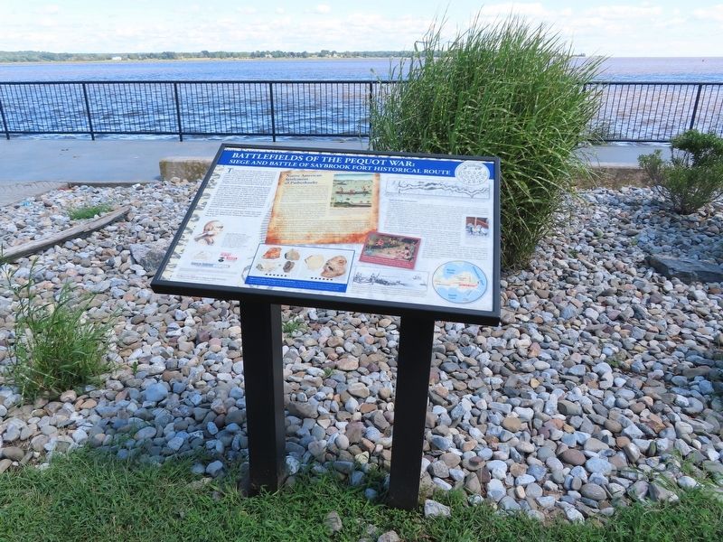
Battlefields of the Pequot War
Siege and Battle of Saybrook Fort Historical Route
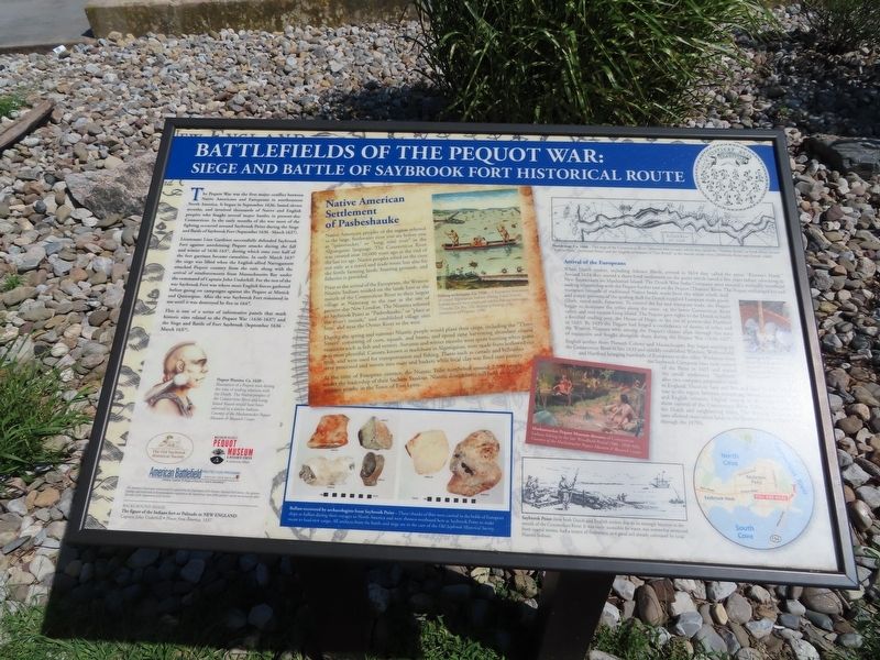
The Pequot War was the first major conflict between Native Americans and Europeans in northeastern North America. It began in September 1636, lasted eleven months, and involved thousands of Native and English peoples who fought several major battles in present-day Connecticut. In the early months of the war most of the fighting occurred about a half-mile east of this marker during the Siege and Battle of Saybrook Fort (September 1636 - March 1637).
Lieutenant Lion Gardiner successfully defended Saybrook Fort against unrelenting Pequot attacks during the fall and winter of 1636-1637, during which time over half of the fort garrison became casualties. In early March 1637 the siege was lifted when the English-allied Narragansett attacked Pequot country from the east, along with the arrival of reinforcements from Massachusetts Bay under the command of Captain John Underhill. For the rest of the war Saybrook Fort was where most English forces gathered before going on campaigns against the Pequot at Mistick and Quinnipiac. After the war Saybrook Fort remained in use until it was destroyed by fire in 1647.
This is one of a series of informative panels that mark historic sites related to the Pequot War (1636-1637) and the Siege and Battle of Fort Saybrook (September 1636 - March 1637).
Native American Settlement of Pasbeshauke
Native American peoples of the region referred to the large, freshwater river you see before you as “quinetucket,” or “long, tidal river” in the Algonquian language. The Connecticut River was created over 10,000 years ago at the end of the last ice age. Native peoples relied on the river not only as a travel and trade route but also for the fertile farming lands, hunting grounds, and fisheries it provided.
Prior to the arrival of the Europeans, the Western Niantic Indians resided on the lands here at the mouth of the Connecticut River to their largest village at Nameaug to the east at the site of present-day New London. The Niantics referred to Saybrook Point as “Pasbeshauke,” or “place at the river's mouth,” and established village sites here, and near the Oyster River to the west.
During the spring and summer Niantic people would plant their crops, including the “Three Sisters” consisting of corn, squash, and beans, and spend time harvesting abundant coastal resources such as fish and oysters. Autumn and winter months were spent hunting when game was most plentiful. Canoes, known as muhshoon in Algonquian, were made from hollowed out trees, and were used for transportation and fishing. Plants such as cattails and bulrushes were processed and woven into mats and baskets while local clay was fired into pottery.
At the time of European contact, the Niantic Tribe numbered around 2,500 people under the leadership of their Sachem Sassious. Niantic descendants still hold an annual reunion nearby in the Town of East Lyme.
Arrival of the Europeans
When Dutch traders, including Adriaen Block, arrived in 1614 they called the point "Kieveets Hoek." Around 1624 they started a short-lived settlement on the point which lasted a few years before relocating to New Amsterdam on Manhattan Island. The Dutch West India Company soon entered a mutually beneficial trading relationship with the Pequot further east on the Pequot (Thames) River. The Pequot exchanged fur and wampum (strands of traditional Native beads made from the white whelk shell and purple portions of the quahog shell for Dutch supplied European trade goods (cloth, metal tools, firearms). To control the fur and wampum trade, the Pequot began to dominate the tribes along the coast, up the lower Connecticut River valley, and into eastern Long Island. The Pequot gave rights to the Dutch to build a fortified trading post, the House of Hope, at the site of present-day Hartford in 1633. By 1635 the Pequot had forged a confederacy of dozens of tribes and the Western Niantics were among the Pequot's closest allies through this time of expansion and fought alongside them during the Pequot War (1636-1637).
English settlers from Plimoth Colony and Massachusetts Bay began arriving on the Connecticut River in late 1633 and quickly established Windsor, Wethersfield, and Hartford bringing hundreds of Europeans to the valley. Workmen from the Saybrook Company later took control of the Point in 1635 and named the small settlement “Saybrook” after two company proprietors back in England, Viscount Saye and Sele and Lord Brooke. Tensions rose in the region between competing Native American, Dutch and English interests. English victory in the Pequot War gave them control of the Connecticut River Valley to the protest of the Dutch and neighboring tribes. The Western Niantics were later allotted reservation lands in the Town of Lyme at Black Point through the 1870's.
( photo captions )
Fishing techniques, Ca. 1590 — A European illustration of coastal Algonquian Indians fishing. Local Niantic Indians would have employed similar fishing techniques. (Theodor De Bry, The Method of Fishing of the Inhabitants of Virginia, 1590)
Quahog shells — Purple and white Quahog shells needed to produce wampum. Courtesy of David Firearrow, Mashantucket Pequot
Mashantucket Pequot Museum diorama of Connecticut Indians fishing in the late Woodland Period (500 – 1650 A).
Saybrook Point drew both Dutch and English settlers due to its strategic location at the mouth of the Connecticut River. It was easily accessible by water, was somewhat protected from coastal storms, had a source of freshwater, and good soil already cultivated by local Niantic Indians.
Ballast recovered by archacologists from Saybrook Point — These chunks of flint were carried in the holds of European ships as ballast during their voyages to North America and were thrown overboard here at Saybrook Point to make room to load new cargo. All artifacts from the battle and siege are in the care of the Old Saybrook Historical Society.
Background Image: The figure of the Indians fort or Palizado in New England Captain John Underhill • Newes from America, 1637
Topics. This historical marker is listed in these topic lists: Colonial Era • Native Americans. A significant historical month for this entry is March 1637.
Location. 41° 17.048′ N, 72° 20.99′ W. Marker is in Old Saybrook, Connecticut, in Middlesex County. It is in Old Saybrook Center. Marker can be reached from College Street (Connecticut Route 154) east of Fenwick Street, on the left when traveling east. Located next to the Pavilion at Saybrook Point. Touch for map. Marker is at or near this postal address: 155 College Street, Old Saybrook CT 06475, United States of America. Touch for directions.
Other nearby markers. At least 8 other markers are within walking distance of this marker. Welcome to Fort Saybrook Monument Park (about 300 feet away, measured in a direct line); The Ferry (about 300 feet away); Lighthouses and River Pilots (about 300 feet away); Connecticut Valley Railroad Roundhouse & Turntable Site (about 400 feet away); The Connecticut Valley Railroad (about 400 feet away); Welcome to Fort Saybrook (about 500 feet away); The Saybrook Bar (about 600 feet away); Fishing on the Connecticut (about 600 feet away). Touch for a list and map of all markers in Old Saybrook.
Also see . . .
1. Old Saybrook Historical Society. (Submitted on September 22, 2021, by Michael Herrick of Southbury, Connecticut.)
2. Saybrook Fort & the Pequot War. (Submitted on September 22, 2021, by Michael Herrick of Southbury, Connecticut.)
3. Fort Saybrook Monument Park – Visit CT. (Submitted on September 22, 2021, by Michael Herrick of Southbury, Connecticut.)
4. Pequot War (Wikipedia). (Submitted on September 22, 2021, by Michael Herrick of Southbury, Connecticut.)
Credits. This page was last revised on February 10, 2023. It was originally submitted on September 22, 2021, by Michael Herrick of Southbury, Connecticut. This page has been viewed 192 times since then and 7 times this year. Photos: 1, 2, 3. submitted on September 22, 2021, by Michael Herrick of Southbury, Connecticut.


