Santa Fe in Santa Fe County, New Mexico — The American Mountains (Southwest)
1777
1777
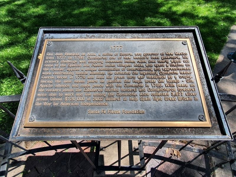
Don Juan Bautista de Anza, a native of Sonora, was governor of New Mexico from 1777 to 1788. Considered one of New Mexico's best governors his primary challenge was stopping incessant Indian raids that nearly wiped out some of the Spanish and Pueblo Indian villages. Anza, who spent a lifetime on the frontier, applied a unique combination of understanding and aggressiveness when confronting hostile enemies. He defeated the legendary Comanche leader Cuerno Verde in 1779 and took his green horn war headpiece as a trophy. During the next seven years he pacified the Hopi, broke the Navajo Gila Apache alliance and made peace with the Comanche in 1786. With peace on the eastern plains the Ciboleros (buffalo hunters) and Comancheros (traders) were able to work and live among the Comanche. Anza collected 3,677 silver pesos (about $120,000 in 2002 dollars) to help Spain fight Great Britain in the War for American Independence.
Santa Fe Fiesta Foundation
Topics. This historical marker is listed in these topic lists: Colonial Era • Native Americans • War, US Revolutionary. A significant historical year for this entry is 1777.
Location. 35° 41.222′ N, 105° 56.163′ W. Marker is in Santa Fe, New Mexico, in Santa Fe County. Marker is on East Palace Avenue east of Cathedral Place, on the right when traveling east. Touch for map. Marker is in this post office area: Santa Fe NM 87501, United States of America. Touch for directions.
Other nearby markers. At least 8 other markers are within walking distance of this marker. 1827 (here, next to this marker); 1712 (here, next to this marker); 1788 (here, next to this marker); 1630 (here, next to this marker); 1850 (here, next to this marker); 1848 (here, next to this marker); 1998 (here, next to this marker); Santa Fe Cathedral Park and Monument (a few steps from this marker). Touch for a list and map of all markers in Santa Fe.
Credits. This page was last revised on September 23, 2021. It was originally submitted on September 23, 2021, by J. Makali Bruton of Accra, Ghana. This page has been viewed 79 times since then and 12 times this year. Photos: 1, 2. submitted on September 23, 2021, by J. Makali Bruton of Accra, Ghana.

