Chattanooga in Hamilton County, Tennessee — The American South (East South Central)
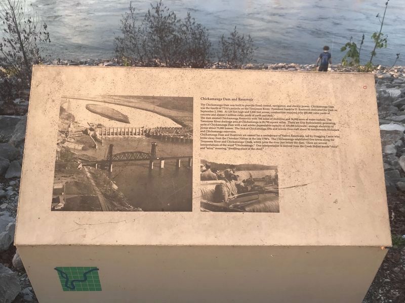
Chickamauga Dam and Reservoir
Inscription.
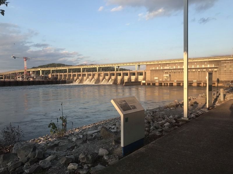
The Chickamauga Dam was built to provide flood control, navigation, and electric power. Chickamauga Dam was the fourth of TVA's projects on the Tennessee River. President Franklin D. Roosevelt dedicated the Dam on September 2, 1940. At 129 feet high and 5,800 feet across, construction required over 500,000 cubic yards of concrete and almost 3 million cubic yards of earth and rock.
The dam created Chickamauga Reservoir with 784 miles of shoreline and 36,000 acres of water surface, The Tennessee River drainage area at Chickamauga is 20,790 square miles. There are four hydroelectric generating units at Chickamauga Dam with a net winter dependable capacity of 129,000 kilowatts — enough electricity to power about 75,000 homes. The lock at Chickamauga lifts and lowers river craft about 50 feet between Nickajack and Chickamauga reservoirs.
Chickamauga Dam and Reservoir are named for a confederacy of Native Americans, led by Dragging Canoe who broke away from the Cherokee Nation in the late 1700's. The Chickamauga established five towns along the Tennessee River and Chickamauga Creek, which joins the river just below the dam. There are several interpretations of the word “Chickamauga.” One interpretation is derived from the Creek Indian words “chica” and “mica,” meaning, “dwelling place of the chief.”
Topics. This historical marker is listed in these topic lists: Native Americans • Waterways & Vessels. A significant historical date for this entry is September 2, 1940.
Location. 35° 6.143′ N, 85° 13.932′ W. Marker is in Chattanooga, Tennessee, in Hamilton County. Marker is along the Tennessee Riverwalk between the dam and Chattanooga State Community College. Touch for map. Marker is at or near this postal address: 4501 Amnicola Highway, Chattanooga TN 37406, United States of America. Touch for directions.
Other nearby markers. At least 8 other markers are within 3 miles of this marker, measured as the crow flies. Cincinnati Southern Railway Bridge (approx. 0.2 miles away); Roxbury Indian Mound (approx. 1.8 miles away); Sherman Crosses the River (approx. 1.9 miles away); Alexander's Brigade (approx. 2.1 miles away); 63rd Illinois Infantry (approx. 2.1 miles away); Giles A. Smith's Brigade (approx. 2.1 miles away); 127th Illinois Infantry (approx. 2.1 miles away); 116th Illinois Infantry (approx. 2.1 miles away). Touch for a list and map of all markers in Chattanooga.
Also see . . . Chickamauga. Details about the dam and surrounding area by the Tennessee Valley Authority. (Submitted on September 29, 2021, by Duane and Tracy Marsteller of Murfreesboro, Tennessee.)
Credits. This page was last revised on September 29, 2021. It was originally submitted on September 29, 2021, by Duane and Tracy Marsteller of Murfreesboro, Tennessee. This page has been viewed 290 times since then and 27 times this year. Photos: 1, 2. submitted on September 29, 2021, by Duane and Tracy Marsteller of Murfreesboro, Tennessee.

