
Near Goochland in Goochland County, Virginia — The American South (Mid-Atlantic)
Bolling Hall
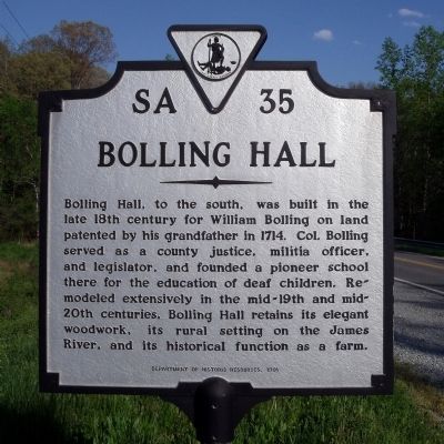
Photographed by Bernard Fisher, April 26, 2009
1. Bolling Hall Marker
Erected 1991 by Department of Historic Resources. (Marker Number SA-35.)
Topics and series. This historical marker is listed in these topic lists: Agriculture • Colonial Era • Education • Settlements & Settlers. In addition, it is included in the Virginia Department of Historic Resources (DHR) series list. A significant historical year for this entry is 1714.
Location. 37° 42.341′ N, 77° 56.749′ W. Marker is near Goochland, Virginia, in Goochland County. It is at the intersection of River Road West (Virginia Route 6) and Rock Castle Road ( Route 600), on the right when traveling west on River Road West. Touch for map. Marker is in this post office area:
this page online

Regionally, this marker is in Virginia’s Piedmont, in Central Virginia, and in the Richmond Metropolitan Area. It is also in the American South and specifically in the Upper South. Globally, it is in the North Atlantic Region, North America, the Western Hemisphere, the Western World, and the Anglosphere. Historically, it finds itself in what was once the territory of the Mississippian Culture, one of the original Thirteen Colonies, one of the Confederate States of America, and the Antebellum South.
Other nearby markers. At least 8 other markers are within 4 miles of this marker, measured as the crow flies: Bolling Island (here, next to this marker); Dungeness (a few steps from this marker); Byrd Presbyterian Church (approx. 0.6 miles away); The Lock-Keeper's House (approx. 2.3 miles away); Central High School (approx. 3 miles away); Freedom of Choice (approx. 3.3 miles away); Goochland County Courthouse (approx. 3.7 miles away); Goochland Courthouse (approx. 3.7 miles away). Touch for a list and map of all markers in Goochland.
Also see . . . Bolling Hall.
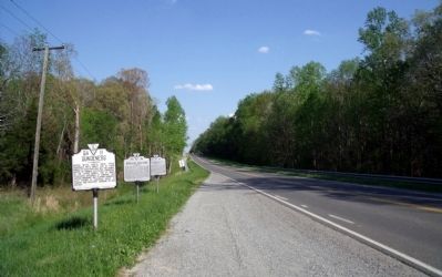
Photographed by Bernard Fisher, April 26, 2009
2. River Road West & Rock Castle Road Markers (facing east).
Credits. This page was last revised on November 5, 2021. It was originally submitted on April 27, 2009, by Bernard Fisher of Richmond, Virginia. This page has been viewed 2,982 times since then and 42 times this year. Photos: 1, 2. submitted on April 27, 2009, by Bernard Fisher of Richmond, Virginia.
