Morelia, Michoacán, Mexico — The Pacific Coast (and Central Highlands)
Cuauhtémoc Forest
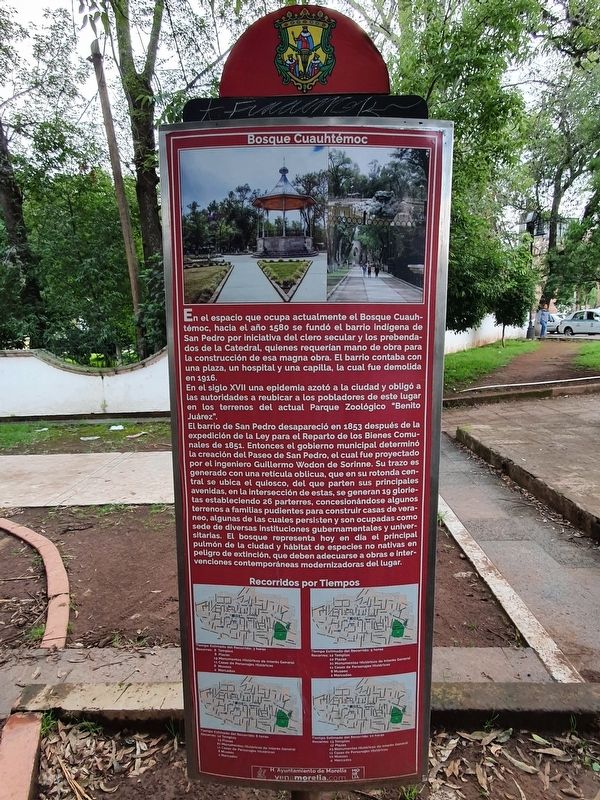
En el espacio que ocupa actualmente el Bosque Cuauhtémoc, hacia el año 1580 se fundó el barrio indígena de San Pedro por iniciativa del clero secular y los prebendados de la Catedral, quienes requerían mano de obra para la construcción de esa magna obra. El barrio contaba con una plaza, un hospital y una capilla, la cual fue demolida en 1916.
En el siglo XVII una epidemia azotó a la ciudad y obligó a las autoridades a reubicar a los pobladores de este lugar en los terrenos del actual Parque Zoológico "Benito Juárez".
El barrio de San Pedro desapareció en 1853 después de la expedición de la Ley para el Reparto de los Bienes Comunales de 1851. Entonces el gobierno municipal determinó la creación del Paseo de San Pedro, el cual fue proyectado por el ingeniero Guillermo Wodon de Sorinne. Su trazo es generado con una reticula oblicua, que en su rotonda central se ubica el quiosco, del que parten sus principales avenidas, en la intersección de estas, se generan 19 glorietas estableciendo 26 parterres, concesionándose algunos terrenos a familias pudientes para construir casas de veraneo, algunas de las cuales persisten y son ocupadas como sede de diversas instituciones gubernamentales y universitarias. El bosque representa hoy en día el principal pulmón de la cludad y hábitat de especies no nativas en peligro de extinción, que deben adecuarse a obras e Intervenciones contemporáneas modernizadoras del lugar.
Cuauhtémoc Forest
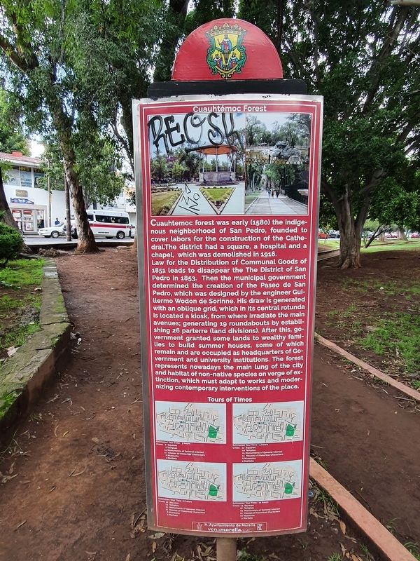
Cuauhtemoc forest was early (1580) the indigenous neighborhood of San Pedro, founded to cover labors for the construction of the Cathedral. The district had a square, a hospital and a chapel, which was demolished in 1916.
Law for the Distribution of Communal Goods of 1851 leads to disappear the The District of San Pedro in 1853. Then the municipal government determined the creation of the Paseo de San Pedro, which was designed by the engineer Guillermo Wodon de Sorinne. His draw is generated with an oblique grid, which in its central rotunda is located a kiosk, from where irradiate the main avenues; generating 19 roundabouts by establishing 26 parterre (land divisions). After this, government granted some lands to wealthy families to build summer houses, some of which remain and are occupied as headquarters of Government and university institutions. The forest represents nowadays the main lung of the city and habitat of non-native species on verge of extinction, which must adapt to works and modernizing contemporary interventions of the place.
Erected by Honorable Ayuntamiento de Morelia.
Topics. This historical marker is listed in these topic lists: Colonial Era • Horticulture & Forestry • Native Americans • Parks & Recreational Areas. A significant historical year for this entry is 1580.
Location. 19° 41.939′ N, 101° 10.7′ W. Marker is in Morelia, Michoacán. Marker is at the intersection of Avenida Aqueducto and Calzada Ventura Puente, on the right when traveling south on Avenida Aqueducto. Touch for map. Marker is in this post office area: Morelia MIC 58260, Mexico. Touch for directions.
Other nearby markers. At least 8 other markers are within walking distance of this marker. José María Morelos y Pavón (about 120 meters away, measured in a direct line); Manuel Martínez Solórzano Natural History Museum (about 150 meters away); Contemporary Art Museum Alfredo Zalce (about 150 meters away); Cuauhtémoc (about 180 meters away); General José María Morelos y Pavón (about 180 meters away); a different marker also named José María Morelos y Pavón (about 180 meters away); The Sanctuary of Our Lady of Guadalupe (about 240 meters away); Michoacán State Forestry Commission Inaugurated (approx. 0.4 kilometers away). Touch for a list and map of all markers in Morelia.
Credits. This page was last revised on October 14, 2021. It was originally submitted on October 14, 2021, by J. Makali Bruton of Accra, Ghana. This page has been viewed 135 times since then and 8 times this year. Photos: 1, 2, 3. submitted on October 14, 2021, by J. Makali Bruton of Accra, Ghana.


